• Hello, please take a minute to check out our awesome content, contributed by the wonderful members of our community. We hope you'll add your own thoughts and opinions by making a free account!

5/4-6 possible severe wx

Agitated low-level cumulus streets becoming more prevalent in upstate SC and the gravity waves are indicative of a low-mid level stable layer/capping inversion that's starting to be progressively mixed out & eroded as the warm front progresses northward.

View attachment 40969
Looks like the warm front is knocking at the door, looks to be closing in on the NC/SC border.
 
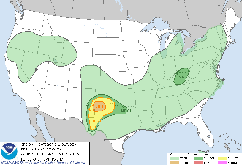
day1otlk_1630.gif

Tornado 5% area decreased significantly
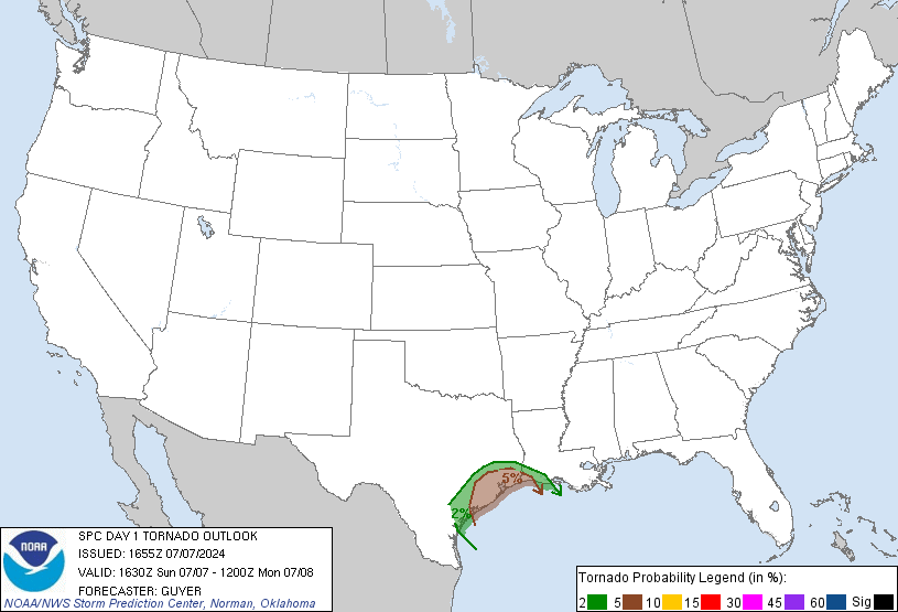
day1probotlk_1630_torn.gif

Wind/hail 15% areas remain the same
 
Given the sun doesn’t go down till like 8..I feel like current temps may not mean much it’s going to change as rain slides East of GSO.
 
Last edited:
The sun is not out here in Southeast Charlotte, does that effect anything? Is this a set up where even without sunshine it’s an elevated threat?
 
I won’t be chasing due to quarantine. But I will share pics and info from family&friends.
 
Yeah that rain got through us in no time flat. I still don't see the warm front getting this far north, but a little bit of sunshine and slightly warmer temps could strengthen the storms we see here later.
 
Boundry still seems to be south of me, (Union County) NC, but winds are increasing, so maybe it's making it's way up here. Still pretty cloudy here though. Edit: Actually it seems temps have fallen some, I can't imagine the wedge getting stronger and holding on down here, but as they say, never bet against the wedge. Actually seeing some thinning in the clouds, mo-nature can't make up her mind!
 
Last edited:
SPC was probably right cutting down on the tornado potential as you get farther north and east. High LCL heights with no way to root storms to the sfc north of the WF means wind/hail are the primary threat.
 
Well what the heck, temp down 3 degrees past 10 minutes lol
 
SPC was probably right cutting down on the tornado potential as you get farther north and east. High LCL heights with no way to root storms to the sfc north of the WF means wind/hail are the primary threat.

Yeah, areas near CLT towards FAY look a bit dicey 1FADC9D0-BB24-418E-8B75-FD2182724F96.pngBF519CEE-0324-4308-B756-0B74B8387B19.png
 
Temp has collapsed 4 degrees and DP is down 6 on my personal weather station 66/60. KSPA is reporting 70/63
 
80 in my location of upstate sc near Pickens airport. Wouldn’t be surprised at all to see a storm or two


Sent from my iPhone using Tapatalk
 
Hot and humid down here. I sure would like some rain for the garden now and it feels like it should storm.
 
Front is almost certainly coming south. Rock Hill has dropped 9 degrees from their high and winds are from the north. Charlotte is down a good bit too. Winds picked up here and it is cooler and a little less humid. The wedge front is probably not finished coming south either and I expect it to get almost through the GSP CWA before it stops. Would not be shocked to see a 25 degree drop in Anderson before 4pm.
 
Front is almost certainly coming south. Rock Hill has dropped 9 degrees from their high and winds are from the north. Charlotte is down a good bit too. Winds picked up here and it is cooler and a little less humid. The wedge front is probably not finished coming south either and I expect it to get almost through the GSP CWA before it stops. Would not be shocked to see a 25 degree drop in Anderson before 4pm.
25? Seems a bit strong to me. KSPA is now reporting 72, 2 degrees up from 15 minutes ago
 
Front is almost certainly coming south. Rock Hill has dropped 9 degrees from their high and winds are from the north. Charlotte is down a good bit too. Winds picked up here and it is cooler and a little less humid. The wedge front is probably not finished coming south either and I expect it to get almost through the GSP CWA before it stops. Would not be shocked to see a 25 degree drop in Anderson before 4pm.

LOL. I can almost guarantee the temp will NOT drop 25 degrees in Anderson... As the cold front approaches the front will come north. There is nothing to keep it locked in...
 
Wow its really cleared up where I am. Temps and dews rising. 64/50 at RDU, 66 at KRWI. I need those dews to rise a lot though if I want any chance at some action which seems unlikely at this point. Even Greensboro has cleared out and is at 61. Funny how all of the norther piedmont and eastern NC posters posted its clearing at same time.
 
Clearing up here, but I am still not expecting much, if anything.
 
Wow its really cleared up where I am. Temps and dews rising. 64/50 at RDU, 66 at KRWI. I need those dews to rise a lot though if I want any chance at some action which seems unlikely at this point. Even Greensboro has cleared out and is at 61. Funny how all of the norther piedmont and eastern NC posters posted its clearing at same time.

Clouds are back here in Greensboro, but temps did rise quite a bit.
 
Looking at the SPC mesoanalysis, the warm front has really started to tick north the past hour or so, MUcape gradient is now over CLT
 
Back
Top