-
Hello, please take a minute to check out our awesome content, contributed by the wonderful members of our community. We hope you'll add your own thoughts and opinions by making a free account!
You are using an out of date browser. It may not display this or other websites correctly.
You should upgrade or use an alternative browser.
You should upgrade or use an alternative browser.
Severe 3/30-4/2 Severe Weather
- Thread starter SD
- Start date
Z
Zander98al
Guest
Z
Zander98al
Guest
Z
Zander98al
Guest
Z
Zander98al
Guest
Z
Zander98al
Guest
Z
Zander98al
Guest
bingcrosbyb
Member
Did the storm fall apart? Or too close to the radar?
Z
Zander98al
Guest
Not sure, it's directly under radar so you won't be able to see much from that radar site.Did the storm fall apart? Or too close to the radar?
Z
Zander98al
Guest
Z
Zander98al
Guest
Bro
Z
Zander98al
Guest
Z
Zander98al
Guest
Wow!!!!!
HSVweather
Member
Heavily populated area
Z
Zander98al
Guest
HSVweather
Member
HSVweather
Member
Z
Zander98al
Guest
Z
Zander98al
Guest
Z
Zander98al
Guest
Z
Zander98al
Guest
That's one of your healthiest cells of the day. Don't be surprised if that one goes ballistics soon
Z
Zander98al
Guest
Z
Zander98al
Guest
Yup
Z
Zander98al
Guest
Z
Zander98al
Guest
Stay safe everybody, worst has finally past my place, time to sign out. ?
Stormsfury
Member
Confirmed damage at the University of Montebello per tweet
bingcrosbyb
Member
68/61, I can’t say I’m expecting much activity today but it certainly has the feel
It was a really scary night for Florida & Alabama, & now we might reach one of the highest Tornado Counts ever recorded so far this year
- Joined
- Jan 23, 2021
- Messages
- 4,596
- Reaction score
- 15,184
- Location
- Lebanon Township, Durham County NC
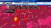
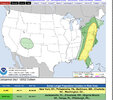
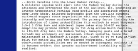
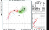
One of the target areas seems to be the Durham/Orange Border around 2-3PM. Significant TOR parameters made it up to 2.5.Interesting .. any increase in surface instability will be crucial .. let’s see how this goes .. models for have tornado and supercell parameters spiking across central NC as we get to 12-3 pm .. the question is if we can get that storm development View attachment 116579View attachment 116580
NBAcentel
Member
Z

