thanksgivingbrown
Member
Storm near Red Bay is riding the boundary. Ramping up quick

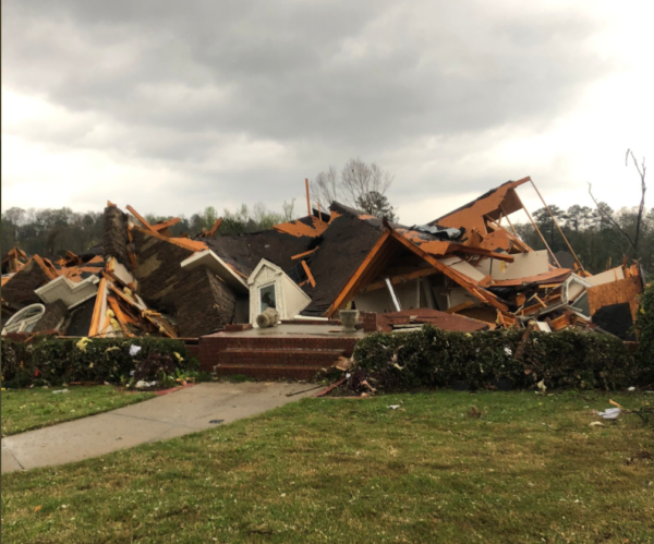
 www.al.com
Do you mind sharing where you found this temp map?

Look how fast it dropped
Lol. You had more info then my post so you can take credit lolAbout to have a violent tornado on the ground near Moundville if it’s not already. This is from BMX!
Edit: Dang beat by a second. Hahah
Strong circulation View attachment 80485
This storm should have a good shot at being seen on tuscaloosa live cameraLarge BWER now visible on reflectivity.


Parameters favor more strengthing. Unless the cell to it's south chokes it.Wow.