• Hello, please take a minute to check out our awesome content, contributed by the wonderful members of our community. We hope you'll add your own thoughts and opinions by making a free account!

Severe 3/21-3/24 Severe Weather

Yup, very messy setup, likely quick into a QLCS. Probably textbook lower MS threat before transition, yatayatayata.
If so there would be a pretty significant wind threat for central Alabama possibly. Screaming winds near the surface and a bowing line
 
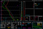
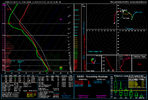
Starting to wonder if this if Gonna be more of a QLCS threat, with how highly forced it is, with great low level kinematics, but weak SRWs past 6km into the anvil level
I think the best tor potential is DFW to the MS/AL line, it really seems like it's going to congeal into a qlcs as time goes on
 
So your typical QCLS with possible supercells ahead of the line lol? Is the mesolow going to put a kink in things?
I wouldn’t say typical. Those are some pretty impressive thermals. The QLCS should bite quite a bit. The mesolow would just add the the helicity.
 
We should take things lightly when saying qcls still about 4 days out so storm mode is still kind've in the air. And alot of the south's tornado days are on messy qcls tornadoes. All it takes is one or two serious tornadoes to be big for our area. With that being said, there is a lot of ingredients and on the high end in some case, for potentially violent long track tornadoes somewhere. Many days were you can have a few tornadoes and one of them be a violent tornado and the rest be spins ups on a line. To early. Obviously spc and nws having taking notice to this possibly being a significant threat. So no need to relax and think it's just a typical squall line. Not the time to get complacent lol.
 
There's a lot of moving pieces in the forecast, and very well could go from thinking a QCLS to a broken line to supercells lined up. Just this last threat yesterday the HRRR was going from line to broken supercells to isolated supercells to line. In All practically know the environment will be conducive for some very bad storms and keep a eye on the weather service forecasts all it takes is one significant storm in your area for it to be significant to you. I've been affected by two tornadoes in 10 years living at this house on days from qcls/messy storm modes.. both ef3s.
 
Could this be just a straight line wind storm? If so, what are the predictions of wind gust here in Al?
 
Could this be just a straight line wind storm? If so, what are the predictions of wind gust here in Al?
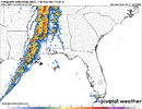
Possibly, still a decent bit out. Depends on the storm mode evolution. The NAM is showing a strong squall line that bows out some will usually indicates see very strong winds nearby. Too early in the game lol
 
That was a really weird 00z NAM run, with pretty notable changes. Not sure what to think of it.
Agreed. It shows isolated convection ahead of the line to about west Alabama. For day 4.

But it goes with what I was saying before, still a ways out storm mode and paremeters are still fluid.
 
Agreed. It shows isolated convection ahead of the line to about west Alabama. For day 4.

But it goes with what I was saying before, still a ways out storm mode and paremeters are still fluid.

It's the synoptic evolution that is weird.

The southern portion of the trough slow down and hang back in New Mexico a bit longer, but then the northern stream wave kicks out ahead of it, which leads to slower phasing and a fairly disorganized surface feature.

Ultimately, the outcome from a severe weather perspective is a less ominous setup with the flow being a bit weaker and bit more veered, although the risk area does end up translating a bit further NW.

I suppose it's a plausible outcome, but until now, it hadn't appeared on any of the model outputs.
 
FROM NWS BIRMINGHAM

.LONG TERM...
/Updated at 0236 PM CDT Sat Mar 19 2022/

Monday through Saturday.

No significant changes to forecast. Models still have the strongest
convection arriving in west Alabama by mid afternoon on Tuesday.
This is a very dynamic system with the short wave trof undergoing
a negative tilt between 18z Tuesday and 06z Wednesday. Models are
not very bullish with surface based instability Tuesday afternoon
across west Alabama with MUCAPE only 400-700 J/kg, but GFS does
have 0-3 EHI values approaching 2. Models are also indicating a
meso-low developing over Mississippi Tuesday afternoon, which
could enhance tornadic potential. Higher threat for severe storms
will be west of I-65 before midnight, but severe threat will
continue through the overnight period and into early Wednesday
morning due to strong forcing and wind shear.
 
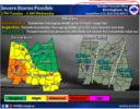
Obviously this forecast is changing with each model run, but Fred Gossage mentioned on Twitter and the Talkweather page that the last day of models make him more concerned about Wednesday from south/east GA into the Carolinas for strong/violent tornado potential. No one has really been covering that far out since how things develop Monday and Tuesday would likely affect that anyways.
 
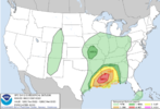
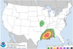
Screenshot 2022-03-20 025248.png

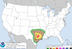
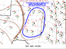
Day 3 Convective Outlook
NWS Storm Prediction Center Norman OK
0230 AM CDT Sun Mar 20 2022

Valid 221200Z - 231200Z

...THERE IS A MODERATE RISK OF SEVERE THUNDERSTORMS FROM PORTIONS OF
SOUTHERN LOUISIANA INTO SOUTHERN MISSISSIPPI...

...SUMMARY...
A substantial severe weather event -- including potential for
significant tornadoes -- remains evident over the Lower Mississippi
Valley/central Gulf Coast region Tuesday
.

...Synopsis...
A upper trough and expansive area of highly amplified cyclonic flow
will shift gradually eastward across the central U.S. Tuesday, as a
closed low likely evolves over the Mid Missouri Valley area with
time.

At the surface, a low is forecast to move across the Missouri
vicinity through the day, with a trailing cold front forecast to
reach the Mississippi Delta region during the afternoon. Late in
the period, the low should reside over the Illinois vicinity, with
the cold front extend southward across Kentucky/Tennessee/Alabama to
the Florida Panhandle.

...Lower Mississippi/central Gulf Coast States...
A regional severe-weather outbreak -- including potential for
several tornadoes (a few potentially significant) remains evident
for Tuesday
. Severe storms -- including tornado risk -- will likely
be ongoing at the start of the period across the Sabine River Valley
area of east Texas/western Louisiana, as a surface cold front moves
steadily eastward.

As southerly flow ahead of the front continues to advect high
theta-e air northward from the Gulf, limited heating will allow
destabilization to occur through the morning and into the afternoon.
At this time, it appears that in addition to storms occurring ahead
of the advancing front, pre-frontal cellular convection will also
evolve through late morning/afternoon. With strong low-level
southerly flow (50 to 70 kt at 850mb) in place, and 70 to 90 kt
mid-level westerlies overspreading the region, shear very favorable
for strong updraft rotation and low-level mesocyclones will exist.
As such, potential for strong tornadoes will exist with the evolving
supercell storms ahead of the front. Additionally, tornadoes (along
with damaging winds and hail) will be likely with storms shifting
eastward in tandem with the cold front.


Into the evening and overnight, severe risk -- including potential
for tornadoes and damaging winds -- will continue. While
diminishing somewhat later in the period, threat will likely spread
across southern Alabama and into the Florida Panhandle.

..Goss.. 03/20/2022
 
Last edited:
Back
Top