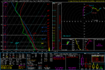
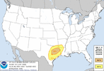
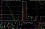
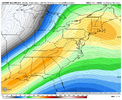
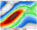
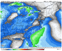
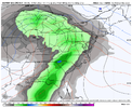
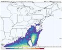
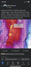
Still some question marks but spc has already outlined parts of the region
-
Hello, please take a minute to check out our awesome content, contributed by the wonderful members of our community. We hope you'll add your own thoughts and opinions by making a free account!
You are using an out of date browser. It may not display this or other websites correctly.
You should upgrade or use an alternative browser.
You should upgrade or use an alternative browser.
Severe 3/21-3/24 Severe Weather
- Thread starter SD
- Start date
Darklordsuperstorm
Member
Yeah. When was the last time we saw a day 8 outlook?
It's been a while. The big question to me is the kinematics. We shouldn't have a problem with moisture return and a large area of dews 60-65+ but I'm interested to see how the main upper energy acts. The 12z icon and 0z euro were more threatening than the 12z gfs imo but the gfs does raise the threat level with the trailing northern stream energy around 200hrs as it digs in and potentially invigorates secondary cyclogenesisYeah. When was the last time we saw a day 8 outlook?
TileDude
Member
Spann mentioned today that it has only occurred 6 times since 2012. Last time was in 2019.Yeah. When was the last time we saw a day 8 outlook?
Psalm 148:8
Member
- Joined
- Dec 25, 2016
- Messages
- 237
- Reaction score
- 422
Out of those 6 times, I wonder how many verified as a true threat several days later?
Marycrowley
Member
It was actually 5 times before now (now making the 6th time) but wondering the same!Out of those 6 times, I wonder how many verified as a true threat several days later?
Z
Zander98al
Guest
The GFS has a pretty legit setup in Mississippi and Alabama. For this event. Lapse rates are pretty steep, ehi is forecast around 4 on a global model, large scale upper air lift, height falls
Z
Zander98al
Guest
Poor lapse rates = heavy rain event incoming here...
DadOfJax
Member
This may be a big one…..rarely see alarms this far out.
NWMSGuy
Member
Any more thoughts regarding this time frame?
BHAMWX
Member
Does this particular set up have a greater potential for a PDS to be issued ?
Depends on how it ejects. The GFS is far more concerning than the Euro for the SE.Does this particular set up have a greater potential for a PDS to be issued ?
Z
Zander98al
Guest
NoSnowJoe
Member
NEW SPC DAY 4
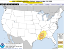
ZCZC SPCSWOD48 ALL
ACUS48 KWNS 190900
SPC AC 190900
Day 4-8 Convective Outlook
NWS Storm Prediction Center Norman OK
0400 AM CDT Sat Mar 19 2022
Valid 221200Z - 271200Z
...SEVERE WEATHER OUTBREAK POSSIBLE ON D4/TUE...
...DISCUSSION...
Latest deterministic and ensemble runs of the medium-range global
models continue to depict likelihood of a continuation of
potentially substantial severe-weather event across the central Gulf
Coast states Tuesday and into Wednesday. This includes a reasonable
probability of a regional-type tornado outbreak centered over
central and southern Mississippi for Tuesday.
As strong upper low/trough over the central and southern Plains
region shifts gradually eastward, a belt of very strong mid- and
upper-level southwesterlies will likely extend from east Texas
across the Tennessee Valley, atop a 60 kt southerly low-level jet.
The resulting/anticipated degree of veering and increasing flow with
height falls within high-end parameter space for significant
tornadoes.
In addition, the strong low-level southerlies will persistently
advect high theta-e Gulf air (dewpoints averaging in the upper 60s)
northward into the pre-frontal warm sector, which -- despite limited
heating due to cloud cover and potentially ongoing convection in
some areas -- will combine with modestly steep mid-level lapse rates
to yield what should prove to be ample CAPE at least as far north as
central Mississippi, and later central Alabama.
Overall, given very strong shear, the strength of the upper system,
and the Gulf warm sector expected inland, a high-end environment
appears likely to exist across a geographically-focused area
centered over the central Gulf Coast states, supporting potential
for a substantial outbreak of severe/supercell storms.
Severe weather potential will likely continue into Wednesday, though
the upper system appears likely to become somewhat sheared/elongated
as the upper low/jet streak shift northeastward across the Ohio
Valley, while secondary energy digs southward across the southern
Rockies and into northern Mexico. Thus, while an amply
moist/unstable environment and still-strong shear will exist across
southeastern Alabama/southwestern Georgia/the Florida Panhandle, and
possibly expanding during the day into parts of South Carolina
supporting continued potential for severe storms, the risk will be
lesser than Tuesday's event, and should diminish with time into the
evening hours. Still, all-hazards severe weather will be a
possibility through the first half of the period across this portion
of the Southeast.
By Thursday, models begin to diverge in terms of pattern evolution;
while the cold front may remain onshore, prior to advancing into the
western Atlantic, prospects for severe weather remain questionable,
and thus no outlook area will be issued at this time. Once the
front moves offshore overnight Thursday, as the upper system shifts
eastward, severe-weather potential should end over the Southeast.
With large-scale ridging to gradually expand across the U.S. into
the weekend, severe weather potential appears minimal a this time.
..Goss.. 03/19/2022

