-
Hello, please take a minute to check out our awesome content, contributed by the wonderful members of our community. We hope you'll add your own thoughts and opinions by making a free account!
You are using an out of date browser. It may not display this or other websites correctly.
You should upgrade or use an alternative browser.
You should upgrade or use an alternative browser.
Severe 3/21-3/24 Severe Weather
- Thread starter SD
- Start date
NBAcentel
Member
HSVweather
Member
accu35
Member
This goona be a wild Tuesday
NBAcentel
Member
This day 3 mod for tors is kinda weenie lol from the SPC all I see on modeling ingredient wise is a QLCS with a mostly wind threat/and it’s attendant tornado threat. wind parameters aloft are favorable for flooding/training convection with the SSW flow aloft and lack of capping/deep moist column/pause in SRWs above 3km to 6km/parallel vectors between 1km and 6km. All this screams upscale/linear/slop and it’s just a bad setup in general for discrete convection, not to say there could be 1 or 2 individual storms out ahead the line, but as it moves east surface based instability decreases a lot into eastern MS/AL
DadOfJax
Member
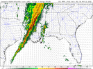
Classic QLCS showing up on the 3k NAM at the end of its run. Good signs for a reduced threat, although not completely, of isolated supercells with 200 mile paths.
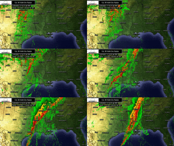
Fv3 hires is probably more concerning than the 3k for SW Al and southern MS when it comes to tornadoes. You can see in the sim radar things get more cellular vs linear and there are some line segments where you could spin up the tail ends. Either way the wind damage threat looks really high with this imo as we are at least very likely to get a large qlcs chasing the higher cape and I wouldn't be terribly shocked to see a wake low develop on the back side of the large storm complex.Classic QLCS showing up on the 3k NAM at the end of its run. Good signs for a reduced threat, although not completely, of isolated supercells with 200 mile paths.
The 12z NAM soundings by the end of the run in the Carolinas and GA were attention grabbing but the timing of overnight into mid morning Thursday (using the icon) may limit the overall areal coverage
Last edited:
Stormsfury
Member
Fv3 hires is probably more concerning than the 3k for SW Al and southern MS when it comes to tornadoes. You can see in the sim rado9u0ar things get more cellular vs linear and there are some line segments where you could spin up the tail ends. Either way the wind damage threat looks really high with this imo as we are at least very likely to get a large qlcs chasing the higher cape and I wouldn't be terribly shocked to see a wake low develop on the back side of the large storm complex.
The 12z NAM soundings by the end of the run in the Carolinas and GA were attention grabbing but the timing of overnight into mid morning Thursday (using the icon) may limit the overall areal coverage
One caveat is referencing the last outbreak on Easter Sunday weekend of 2020 is that ended up producing 130+ tornadoes in a couple days, including over 20+ tornadoes in SC during overnight/early morning hours.
Z
Zander98al
Guest
Something to note but the 15z RAP almost does away with the meso low and also brings the best of the warm sector all the way into central/north Mississippi.
Z
Zander98al
Guest
Actually becoming more concerned for supercells being spit out over the Mississippi Delta, it seems some of the closer range models are picking up on it.
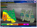
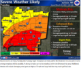
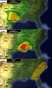
I can see why the significant area was put in this region, you could possibly have a regional type tornado outbreak here like spc says. And then again the threat area may be a bit more higher for wind damage but still high potential for tornado.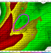
I can see why the significant area was put in this region, you could possibly have a regional type tornado outbreak here like spc says. And then again the threat area may be a bit more higher for wind damage but still high potential for tornado.

That is typical of these setups of high shear, little in the way of an EML and with a SSW or SW wind at 500mb. That area seems to always spit out one or two big supercells before the line overtakes them.Actually becoming more concerned for supercells being spit out over the Mississippi Delta, it seems some of the closer range models are picking up on it.
NBAcentel
Member
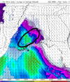
That area circled is actually why this setup is gonna be messy, to much of that divergence aloft and it’s a junk fest/mainly a QLCS threatActually becoming more concerned for supercells being spit out over the Mississippi Delta, it seems some of the closer range models are picking up on it.
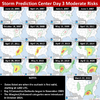
I can see why the significant area was put in this region, you could possibly have a regional type tornado outbreak here like spc says. And then again the threat area may be a bit more higher for wind damage but still high potential for tornado.View attachment 115932
Z
Zander98al
Guest
Junk fest with high end paramters lol. Even if just initially with convection popping you could have some significant tornadoes in that corridor. Apparently spc and nws see something that's ringing bells in there heads, maybe they have private models they use that indicate something we may not see.That area circled is actually why this setup is gonna be messy, to much of that divergence aloft and it’s a junk fest/mainly a QLCS threat
Now that I think about it we had a similar event back int like april 2019 when I first joined it flopped big. Moderate risk into Louisiana and Mississippi. And ended up producing a ef3. But other than that nothing much.. Ineed to check that event I think this one is a bit different but that one was a incredibly bad slopfest that produced on the very southern end.
Z
Zander98al
Guest
Z
Zander98al
Guest
Z
Zander98al
Guest
@Johnkittz @NoSnowATL, either post something of value or quit interacting within this thread on my posts. Y'all are becoming nothing more than annoying.
Bham afternoon disco:
LONG TERM...
/Updated at 0200 PM CDT Sun Mar 20 2022/
Tuesday through Wednesday.
The GFS model continues to be an outlier with regard to arrival
time of the QLCS on Tuesday. Other models are about 6 hours slower
than GFS, including the higher resolution 3km NAM. Giving more
weight to the 3km NAM, delayed arrival of severe threat until 4 pm
on Tuesday, and ended severe threat at 6 am Wednesday. 3km NAM is
also showing some discrete cells developing along the MS/AL state
line ahead of the main QLCS, but that development does not even
get going until 6 PM. A lot of uncertainly still regarding severe
threat timing. Flooding threat has increased for areas along and
north of I-20 with WPC issuing a moderate risk for excessive
rainfall. Storm total rainfall amounts now approaching 2.5 inches
in the far northwest counties, and flash flood watch will likely
be issued Monday morning. Surface based instability still lacking
with this event over central Alabama. Surface dewpoints start out
in the 40s and 50s Tuesday morning. Dewpoints will rise quickly
during the day Tuesday, but models have lowered northward
transport of 60+ dewpoints, which could limit severe potential
north of I-20.
58/rose
accu35
Member
Zander, I learn alot from you and enjoy your input and your knowledge for weather. Don’t be discourage by others, keep doing what you do. Thank you for keeping us alert and ready for any danger headed our way.@Johnkittz @NoSnowATL, either post something of value or quit interacting within this thread on my posts. Y'all are becoming nothing more than annoying.
NWMSGuy
Member
tennessee storm
Member
That’s why they get paid the big bucks… spc does this for living lolJunk fest with high end paramters lol. Even if just initially with convection popping you could have some significant tornadoes in that corridor. Apparently spc and nws see something that's ringing bells in there heads, maybe they have private models they use that indicate something we may not see.
Now that I think about it we had a similar event back int like april 2019 when I first joined it flopped big. Moderate risk into Louisiana and Mississippi. And ended up producing a ef3. But other than that nothing much.. Ineed to check that event I think this one is a bit different but that one was a incredibly bad slopfest that produced on the very southern end.
NBAcentel
Member
SPC has had busted setups a couple times this year in the SE from being to bullish fwiwThat’s why they get paid the big bucks… spc does this for living lol
bigstick10
Member
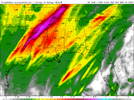
Training is very common in ATL, think this is way under done.Short range NAM dumping loads of rain across a large portion of the Mid South over the next 84 hours. Memphis WFO mentioning training storms. Will issue a Flash Flood watch later tonight early AM Monday.
View attachment 115936
Z
Zander98al
Guest
That Mississippi river is going to have some serious swelling.Short range NAM dumping loads of rain across a large portion of the Mid South over the next 84 hours. Memphis WFO mentioning training storms. Will issue a Flash Flood watch later tonight early AM Monday.
View attachment 115936
Z
Zander98al
Guest
Something stupid that happens on occasion is the northward pull of the warm sector isn't realized as much until you get about a day out, that being said, I think the worst of this event will be in the delta of MS into southwest Alabama. You may even get a clipped back risk area with it moving more southwest than the current SPC risk area. You'll probably see more shifts. If the mesolow becomes less evident you'll have more of a northward pull of that moisture but a tad less shear for rotation.
Z
Zander98al
Guest
Big. Noticed this but didn't want to say anything, still in the long range HRRR runs. Get to about 18 hours and then that'll be pretty concerning. Not sure if your best parameters would be meshed well but still 2 days things will continue to refine.
accu35
Member
Big. Noticed this but didn't want to say anything, still in the long range HRRR runs. Get to about 18 hours and then that'll be pretty concerning. Not sure if your best parameters would be meshed well but still 2 days things will continue to refine.
Kinda scary for my area
Z
Zander98al
Guest
Where do you live? Based off all recent model runs parameters and severity will quickly drop going into Alabama. But again within 18 hours warm sectors can drastically changeKinda scary for my area
Z
Zander98al
Guest
accu35
Member
Southwest AlWhere do you live? Based off all recent model runs parameters and severity will quickly drop going into Alabama. But again within 18 hours warm sectors can drastically change
accu35
Member
I think my area stands a chance at a moderate risk. I’m a hour north of Mobile. I live in Clarke Co. Jackson AlWhere do you live? Based off all recent model runs parameters and severity will quickly drop going into Alabama. But again within 18 hours warm sectors can drastically change
00z HRRR is the most ominous yet for DFW tomorrow evening, including a PDS Tornado sounding.
Z
Zander98al
Guest
Z
Zander98al
Guest
Begging to wonder if this is going to do your typical shift of a more eastern Mississippi into Alabama threat. Seems like it always happens where it will shift more into Alabama the closer it gets. Your best paramters still look like the delta but just something thats bouncing through my head right now. Its a pattern ive noticed.
Z
Zander98al
Guest
Z
Zander98al
Guest
NWMSGuy
Member
RebelBearLandshark
Member
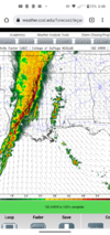
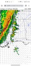
Yeah those caught my eye as well. Could see parts of North Mississippi go under an enhanced risk area. Don't think we'll go moderate+ due to the lack of CAPE.Appears there is some rotating storms with the main line as it crosses the River. Seeing a few swaths close to my region in Northwest MS. Thinking SPC will need to extend their outlooks Northward with the overnight products.
View attachment 115943

