-
Hello, please take a minute to check out our awesome content, contributed by the wonderful members of our community. We hope you'll add your own thoughts and opinions by making a free account!
You are using an out of date browser. It may not display this or other websites correctly.
You should upgrade or use an alternative browser.
You should upgrade or use an alternative browser.
Tropical 2025 Tropical Thread
- Thread starter SD
- Start date
Stormsfury
Member
Although Humberto is now a former shadow of itself, it looks quite likely that Humberto was even stronger than the 160mph operarionally assessed. Pressure probably got into the 910s range or lower during absolute peak. If I were to guess, Humberto peaked at 180mph sustained.We'll never even know how strong Humberto was this weekend because they kept sending recon into Imelda but it was definitely a higher end 5 probably
It's really been historic just a few hundred miles off the east coast. A lot of years never even have one cat 5 and there's been two this year
Brent
Member
Shaggy
Member
And neither will hit the USYeah we may never see this againView attachment 175304
been a tough 2020s so far, don't mind a breatherAnd neither will hit the US
Shaggy
Member
Mjo gets back into p8/1 with some amplitude so this probably tracks
lexxnchloe
Member
NoSnowATL
Member
Even the fantasy runs troll the US.
Shaggy
Member
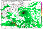
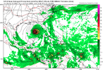
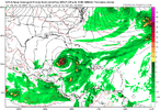
Gfs is just relentless in kicking out fantasy land threats
All season long.Gfs is just relentless in kicking out fantasy land threats
Shaggy
Member
I mean it went from a WSW motion across the gulf into the BoC to a Maine landfall in like 2 runs.All season long.
Brent
Member
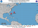
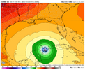
Maybe something near Florida this weekend. GFS tries to spin up a tropical storm that crosses the Peninsula and then goes towards the Panhandle
Southwestern Atlantic:
An area of low pressure may form near the northwestern Bahamas and
southern Florida by Saturday. Any additional development is
expected to be slow to occur as the system moves northwestward
across the Florida Peninsula into the Gulf of America.
* Formation chance through 48 hours...low...10 percent.
* Formation chance through 7 days...low...10 pe
rcent.
lexxnchloe
Member
lexxnchloe
Member
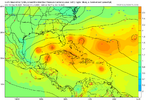
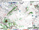
Euro in fantasy land
View attachment 175335
lexxnchloe
Member
MichaelAndrews
Member
Michael 2018 Vibes
Big H over the middle guessing this would turn after shooting the gap and head straight to the panhandle
Hopefully this stays out in fantasy land
Big H over the middle guessing this would turn after shooting the gap and head straight to the panhandle
Hopefully this stays out in fantasy land
There have been two lemons in the last few TWOs. Here’s the 2AM for the one in the MDR:
A tropical wave is expected to move off the coast of Africa over the
next day or two. Thereafter, this wave is forecast to interact with
another disturbance in the eastern tropical Atlantic, and some slow
development of the combined feature is possible as the system moves
westward to west-northwestward at 15 to 20 mph.
* Formation chance through 48 hours...low...near 0 percent.
* Formation chance through 7 days...low...30 percent.
Forecaster Jelsema
——————-
Pertaining to this lemon:
I didn’t post it. But the 12Z UKMET had a TC form from this at 162 hours and it was already recurving/moving NW to 23.7N, 57.2W at 168.
The new UKMET (0Z) forms it 18 hours earlier and it moves WNW instead of NW meaning it ends up much further S than the 12Z run had it at the end of the run (~150 miles NE of the Leewards):
NEW TROPICAL CYCLONE FORECAST TO DEVELOP AFTER 132 HOURS
FORECAST POSITION AT T+132 : 15.7N 53.2W
LEAD CENTRAL MAXIMUM WIND
VERIFYING TIME TIME POSITION PRESSURE (MB) SPEED (KNOTS)
-------------- ---- -------- ------------- -------------
1200UTC 08.10.2025 132 15.7N 53.2W 1009 40
0000UTC 09.10.2025 144 17.5N 56.5W 1009 39
1200UTC 09.10.2025 156 18.8N 59.3W 1009 34
0000UTC 10.10.2025 168 19.7N 61.4W 1008 31
Shaggy
Member
Models went from getting into the Gulf to it riding up east of the Bermuda so I would go with the riding up east of Bermuda just because of the seasonal trend
Last edited:
Models went from getting into the Gulf to it riding up east of the Bermuda so I would go with the writing up east of Bermuda just because of the seasonal trend
It would almost certainly be a miss of the Conus if it were to be a TC E of 55W per history. There hasn’t been on record even one TC existing E of 55W after October 4th that made it all of the way to the Conus! (I’ve checked all of the years.) That doesn’t mean it’s impossible and that it won’t eventually happen. But that does mean the chance is tiny.
OTOH, it is were to be very slow to develop into a TD and wait, say, til near the Lesser Antilles or further W, then there would no longer be the near certainty of a Conus miss. It might then still be a likelihood but not a near certainty looking from this far out.
NoSnowATL
Member
I believe history says the gulf is dead until next year. Just amazing to see a year where even thunderstorms get killed in the peak of the season.
Shaggy
Member
Once again it seems the east coast is dodging a threat because of a low that forms off the coast and breaks the ridge down and allows the early turn. It would likely still miss but be a closer threat if it wasn't for that lead storm popping off SCIt would almost certainly be a miss of the Conus if it were to be a TC E of 55W per history. There hasn’t been on record even one TC existing E of 55W after October 4th that made it all of the way to the Conus! (I’ve checked all of the years.) That doesn’t mean it’s impossible and that it won’t eventually happen. But that does mean the chance is tiny.
OTOH, it is were to be very slow to develop into a TD and wait, say, til near the Lesser Antilles or further W, then there would no longer be the near certainty of a Conus miss. It might then still be a likelihood but not a near certainty looking from this far out.
We are going to do the upper low + hurricane thing again. If there isn't a hurricane to the east time this its going to be much more threatening
Regarding this “pumpkin” (as someone else called it) just coming into the far E MDR that we’re discussing:
12Z UKMET: 3rd in a row with TCG from this; similar TCG to prior run but moves NW instead of WNW and thus ends up further N than prior run although not quite as far N as two runs ago; Also this one has it become declassified at 168:
NEW TROPICAL CYCLONE FORECAST TO DEVELOP AFTER 126 HOURS
FORECAST POSITION AT T+126 : 16.6N 54.6W
LEAD CENTRAL MAXIMUM WIND
VERIFYING TIME TIME POSITION PRESSURE (MB) SPEED (KNOTS)
-------------- ---- -------- ------------- -------------
0000UTC 09.10.2025 132 17.8N 56.3W 1009 36
1200UTC 09.10.2025 144 19.9N 59.3W 1010 30
0000UTC 10.10.2025 156 21.8N 61.2W 1009 29
1200UTC 10.10.2025 168 CEASED TRACKING
Downeastnc
Member
The 12Z Euro for the “pumpkin”:
no TC til ~192 hours when it’s 1005 mb that’s ~125 miles N of PR. But it’s already recurving sharply then and never gets stronger than 1005 mb til it gets to 30N way out in the middle of the ocean.
————
2 PM TWO up to 0/50:
2. Tropical Atlantic:
A tropical wave has just emerged off the coast of Africa. The wave
is forecast to interact with another disturbance over the eastern
tropical Atlantic, and then move westward after that.
Environmental conditions are expected to become conducive for some
slow development of the system in a few days, and a tropical
depression could form near or east of the Lesser Antilles by the end
of next week.
* Formation chance through 48 hours...low...near 0 percent.
* Formation chance through 7 days...medium...50 percent.
Forecaster Berg
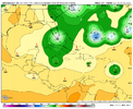
12Z GEFS: one of 30 hits Conus (hits S FL as a hurricane) and that’s because it’s the furthest SW member (at Barbados) as it approaches the Lesser Antilles. The rest are at that time from PR to the Leewards (~50%) with ~50% at that time well NE of the Leewards:
Here’s when that one member hits S FL. The one at the Outer Banks is from a NW Caribbean system:
I don’t think any 12Z EPS are hitting the CONUS. If there are any, I can’t tell.
Here’s when that one member hits S FL. The one at the Outer Banks is from a NW Caribbean system:

I don’t think any 12Z EPS are hitting the CONUS. If there are any, I can’t tell.
Last edited:
Shaggy
Member
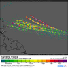
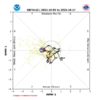
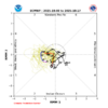
Gfs is staying active and doesn't want to give up on the season.MJO is forecasted to continue to traverse mainly favorable phases meaning a resumption of activity fairly soon wouldn’t be surprising, especially with it being La Niña:
View attachment 175348View attachment 175349
Shaggy
Member
Slight change in the GEFS as it seems a few late bloomers on the E MDR system form in the northeast Carinbean and make it into the GoM
Last edited:
Gfs is staying active and doesn't want to give up on the season.
Yeah, there’s no reason for models to give up this early in the late active season, especially in La Niña:
As of 10/3:
2024 still had 46% of ACE left
2020, 2016 still had 40%
2005 still had 29%
1999 24%
1998 27%
1996 19%
1985 35%
1966 31%
1954 42%
1950 23%
1954 would still have Hazel later in the month and 1985 would still have Kate that hit the Florida panhandle as a strong category 2 just a few days before ThanksgivingYeah, there’s no reason for models to give up this early in the late active season, especially in La Niña:
As of 10/3:
2024 still had 46% of ACE left
2020, 2016 still had 40%
2005 still had 29%
1999 24%
1998 27%
1996 19%
1985 35%
1966 31%
1954 42%
1950 23%
lexxnchloe
Member
Brent
Member
Yeah as much as I want it to be over at this point October still has a bad history
Including the strongest hurricane ever in the Atlantic and yeah Hazel is still one of the worst hurricanes ever on the east coast
And yeah the icon is busy at the end of the run too
Including the strongest hurricane ever in the Atlantic and yeah Hazel is still one of the worst hurricanes ever on the east coast
And yeah the icon is busy at the end of the run too
Yeah as much as I want it to be over at this point October still has a bad history
Including the strongest hurricane ever in the Atlantic and yeah Hazel is still one of the worst hurricanes ever on the east coast
And yeah the icon is busy at the end of the run too
Also Mitch, Michael, King, Sandy, Zeta, Milton, Perfect Storm, Opal and Matthew among others. Hopefully nothing like that will occur in 2025
Best hurricane model around.
BHS1975
Member
It's a great winter model too because it's the most pessimistic.Best hurricane model around.

