• Hello, please take a minute to check out our awesome content, contributed by the wonderful members of our community. We hope you'll add your own thoughts and opinions by making a free account!

Tropical 2025 Tropical Thread

I really think we're gonna have to wait til we get something closer to home. I mean there's a long list of em

Most African waves recurve anyway and especially if we keep up these massive troughs
 
I really think we're gonna have to wait til we get something closer to home. I mean there's a long list of em

Most African waves recurve anyway and especially if we keep up these massive troughs
Late Sept / early Oct, we say it every year and we are right 90% of the time.
 
Just like yesterday’s 12Z and today’s 0Z, the 6Z Euro has the low come off Africa Fri evening (not that far out…that’s why I think it’s worth posts). It becomes a TD Saturday night near the CVs, moves slightly S of due W from there, and ends up near 16N, 30W at 144 still as a TD. If this keeps up a few more runs, it would call for a lemon, especially with the CVs potentially impacted within only 5 days.

Edit: Actually, with rather strong support by the Euro and Icon, some support by the CMC and JMA, and on/off support by the UKMET, I feel that if the Euro/Icon were to hold onto this at 12Z and if the UKMET were to get it back, it would then already be lemon-worthy even if the GFS still doesn’t have it.
 
Last edited:
Just like yesterday’s 12Z and today’s 0Z, the 6Z Euro has the low come off Africa Fri evening (not that far out…that’s why I think it’s worth posts). It becomes a TD Saturday night near the CVs, moves slightly S of due W from there, and ends up near 16N, 30W at 144 still as a TD. If this keeps up a few more runs, it would call for a lemon, especially with the CVs potentially impacted within only 5 days.

Edit: Actually, with rather strong support by the Euro and Icon, some support by the CMC and JMA, and on/off support by the UKMET, I feel that if the Euro/Icon were to hold onto this at 12Z and if the UKMET were to get it back, it would then already be lemon-worthy even if the GFS still doesn’t have it.

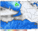
Followup:
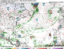
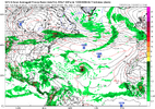
The 12Z Icon is another run with it. It comes off Africa Fri night and is already a TD on Sat/Sat night:
IMG_4452.png
 
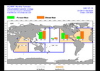
Today’s Euro Weekly run not only has the most active 9/15-21 ACE yet, it is the 1st run with 9/22-8 and that is even more active than 9/15-21! It has the quietest Sep week as the 1st one and the noisiest week as the 4th one. That resembles Sep of 2024 somewhat because then the quietest weeks of ACE in Sep were the 1st (0) and 3rd (0) while the 4th had the noisiest by far with AN ACE (18.1). The 2nd had 6.1.

Today’s EW ACE Sep progs vs very active 20 yr climo
1-7: 4.5 (.3)
8-14: 11.3 (.7)
15-21: 20.4 (1.3)
22-28: 22.4 (1.6)

So, today’s vs climo is despite a very quiet 1st week and still BN 2nd week progging the 1st 4 weeks of Sept at 58.6, which compares to only 24.2 in 2024 and ~the active 30 year climo of ~60.

To compare, look at what I posted on 8/27/24:

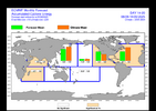
Today’s Euro Weeklies could be nicknamed “A Tale of Two Seasons”:

- Weeks 1-3 (9/2-22): remain only at ~50% of climo overall. These haven’t changed much for days other than a gradual decline.

- Week 4 (9/23-29/new week “on the block”): the first forecast for that week is for 120% of climo and it follows the prior week’s modest 70%. So, it’s seeing some kind of sudden change. If it were a reversion to climo, it would be only at 100%, not 120%. Also, this is the first time there has been any week at 120%+ since the 8/16 run. Will be interesting to follow.


IMG_4453.png

IMG_4454.png

IMG_4455.png

IMG_4456.png
 
Are we above or below climatological average ACE for the date?

Well above but will fall to avg in ~a week barring unexpected activity. If quiet for 2 weeks, it would fall to BN, which is favored by models right now.
 
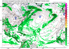
Though support has waned significantly since all but the GFS had it on Monday, the 0Z UKMET brought the E MDR AEW back from the dead (albeit with later TCG) with a minimal TS due to a strong pressure gradient below a rather strong Azores high moving WNW:

NEW TROPICAL CYCLONE FORECAST TO DEVELOP AFTER 156 HOURS
FORECAST POSITION AT T+156 : 15.6N 33.8W

LEAD CENTRAL MAXIMUM WIND
VERIFYING TIME TIME POSITION PRESSURE (MB) SPEED (KNOTS)
-------------- ---- -------- ------------- -------------
1200UTC 03.09.2025 156 15.6N 33.8W 1010 34
0000UTC 04.09.2025 168 16.9N 35.9W 1011 35
——-

But 0Z GFS/Icon and probably CMC have nothing.
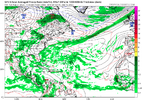
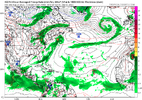
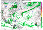
GFS shows the season killing strong blocking trof all the way from the Islands to sw of Ireland


1756379672787.png
 
Though support has waned significantly since all but the GFS had it on Monday, the 0Z UKMET brought the E MDR AEW back from the dead (albeit with later TCG) with a minimal TS due to a strong pressure gradient below a rather strong Azores high moving WNW:

NEW TROPICAL CYCLONE FORECAST TO DEVELOP AFTER 156 HOURS
FORECAST POSITION AT T+156 : 15.6N 33.8W

LEAD CENTRAL MAXIMUM WIND
VERIFYING TIME TIME POSITION PRESSURE (MB) SPEED (KNOTS)
-------------- ---- -------- ------------- -------------
1200UTC 03.09.2025 156 15.6N 33.8W 1010 34
0000UTC 04.09.2025 168 16.9N 35.9W 1011 35
——-

But 0Z GFS/Icon and probably CMC have nothing.

This became a lemon at 2AM fwiw. But only yesterday’s 12Z JMA (TD) and today’s 0Z UKMET (TS) have it as a TC among the operationals. GEFS is also pretty quiet with few members developing this although the 6Z and yesterday’s 12Z EPS/today’s 6Z EPS have somewhat notable activity fwiw.

Based on position similarly high up in the MDR similar to Erin, the odds would strongly favor a safe recurve from the US though those odds could change pending if/where it actually forms a LLC.
 
Last edited:
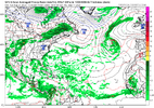
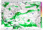
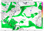
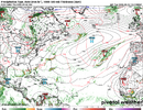
Way too many blue arrows for the foreseeable future. To many brown colors out in the ATL too. Maybe by week 3, the greens show up and we get a relaxation of the height pattern in Canada. We'll see.


Yeah and I mean to be fair it was dead last year right now too and well we remember what happened after September 20th

I don't think the season is over at all but I do question big time if anything from Africa can make it across

But Helene and Milton last year formed much closer to home anyway and well
And Hazel in Oct was pulled inland by a well timed deep trough.
 
This became a lemon at 2AM fwiw. But only yesterday’s 12Z JMA (TD) and today’s 0Z UKMET (TS) have it as a TC among the operationals. GEFS is also pretty quiet with few members developing this although the 6Z and yesterday’s 12Z EPS/today’s 6Z EPS have somewhat notable activity fwiw.

Based on position similarly high up in the MDR similar to Erin, the odds would strongly favor a safe recurve from the US though those odds could change pending if/where it actually forms a LLC.

Followup on AEW coming off Africa as early as tomorrow:

12Z UKMET: has a TS that is already recurving before 40.

NEW TROPICAL CYCLONE FORECAST TO DEVELOP AFTER 138 HOURS
FORECAST POSITION AT T+138 : 15.3N 32.1W

LEAD CENTRAL MAXIMUM WIND
VERIFYING TIME TIME POSITION PRESSURE (MB) SPEED (KNOTS)
-------------- ---- -------- ------------- -------------
1200UTC 03.09.2025 144 16.0N 33.0W 1010 37
0000UTC 04.09.2025 156 16.9N 35.4W 1010 40
1200UTC 04.09.2025 168 18.6N 37.0W 1010 38

————
Edit:
The 12Z Euro has just a weak low.
For the record: after 4 12Z JMA runs in a row with a TC from this, today’s 12Z JMA had no TC.
 
Last edited:
Followup on AEW coming off Africa as early as tomorrow:

12Z UKMET: has a TS that is already recurving before 40.

NEW TROPICAL CYCLONE FORECAST TO DEVELOP AFTER 138 HOURS
FORECAST POSITION AT T+138 : 15.3N 32.1W

LEAD CENTRAL MAXIMUM WIND
VERIFYING TIME TIME POSITION PRESSURE (MB) SPEED (KNOTS)
-------------- ---- -------- ------------- -------------
1200UTC 03.09.2025 144 16.0N 33.0W 1010 37
0000UTC 04.09.2025 156 16.9N 35.4W 1010 40
1200UTC 04.09.2025 168 18.6N 37.0W 1010 38
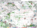
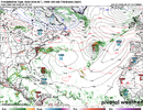
GFS also has a recurver well east of Bermuda

1756400508788.png
 
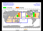
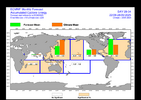
Euro Weeklies update

Tue’s (8/26/25) Euro Weeklies ACE Sep progs vs very active 20 yr climo:
1-7: 4.5 (0.3)
8-14: 11.3 (0.7)
15-21: 20.4 (1.3)
22-28: 22.4 (1.6)

Today’s (8/28/25) EW ACE progs are less active weeks 2-4 vs the Tue run but still show the same pattern of a relatively quiet first half of Sept and a much more active 2nd half somewhat similar to Sept of 2024:
1-7: 4.5 (0.3)
8-14: 8 (0.5)
15-21: 17 (1.1)
22-28: 20 (1.4)
 
Followup on AEW coming off Africa as early as tomorrow:

12Z UKMET: has a TS that is already recurving before 40.

NEW TROPICAL CYCLONE FORECAST TO DEVELOP AFTER 138 HOURS
FORECAST POSITION AT T+138 : 15.3N 32.1W

LEAD CENTRAL MAXIMUM WIND
VERIFYING TIME TIME POSITION PRESSURE (MB) SPEED (KNOTS)
-------------- ---- -------- ------------- -------------
1200UTC 03.09.2025 144 16.0N 33.0W 1010 37
0000UTC 04.09.2025 156 16.9N 35.4W 1010 40
1200UTC 04.09.2025 168 18.6N 37.0W 1010 38

————
Edit:
The 12Z Euro has just a weak low.
For the record: after 4 12Z JMA runs in a row with a TC from this, today’s 12Z JMA had no TC.

0Z UKMET for E MDR lemon:

NEW TROPICAL CYCLONE FORECAST TO DEVELOP AFTER 108 HOURS
FORECAST POSITION AT T+108 : 13.5N 28.4W

LEAD CENTRAL MAXIMUM WIND
VERIFYING TIME TIME POSITION PRESSURE (MB) SPEED (KNOTS)
-------------- ---- -------- ------------- -------------
1200UTC 02.09.2025 108 13.5N 28.4W 1010 31
0000UTC 03.09.2025 120 14.0N 30.9W 1011 33
1200UTC 03.09.2025 132 15.9N 31.8W 1010 34
0000UTC 04.09.2025 144 16.4N 34.6W 1012 28
1200UTC 04.09.2025 156 17.2N 35.4W 1013 26
0000UTC 05.09.2025 168 18.4N 36.8W 1013 24
 
Back
Top