-
Hello, please take a minute to check out our awesome content, contributed by the wonderful members of our community. We hope you'll add your own thoughts and opinions by making a free account!
You are using an out of date browser. It may not display this or other websites correctly.
You should upgrade or use an alternative browser.
You should upgrade or use an alternative browser.
Tropical 2025 Tropical Thread
- Thread starter SD
- Start date
lexxnchloe
Member
lexxnchloe
Member
The 12Z EPS has a notable signal near midmonth for a TC formation (~25%) in the S Gulf with them moving mainly N to WNW and then hitting or threatening to hit from NE MX through TX/LA. But this could be mainly gone on the 0Z for all we know since this run looks much different vs earlier runs and its way out in the unreliable late week 2.
Followup:
Not surprisingly after a sudden uptick on yesterday’s 12Z EPS late in week 2 for the W Gulf, the 0Z backed down notably, especially for TX threats although it still has a couple of W Gulf TCs with a 955 into LA and a 990 mb into MX. The 12Z had had ~8 TS+ including a 927 into LA, 968 into TX, and 961 into MX along with 3 hurricanes threatening at the end still in the Gulf.
Shaggy
Member
Not sure if it's from the same system but it looks like the gefs has a few land falling members I just didn't dig deep enough to see if it's from the Eastern MDR system or something different
Not sure if it's from the same system but it looks like the gefs has a few land falling members I just didn't dig deep enough to see if it's from the Eastern MDR system or something different
In what part of the US? Do you mean the 6Z GEFS?
Shaggy
Member
Looks like one threat is from something that forms down around Cuba and landfalls over GA/SC border and then a few members seem to break off to the west woth the E MDR system and landfalls over NC.
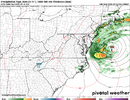
System moving onshore is new development the one just off the Bahamas is the E Mdr system that eventually hits NC.
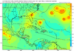
System moving onshore is new development the one just off the Bahamas is the E Mdr system that eventually hits NC.

Shaggy
Member
Good things it's the 280+ had opWell that’s different
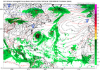
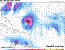
View attachment 174697
Downeastnc
Member
lexxnchloe
Member
Slight shift west.
Downeastnc
Member
Slight shift west.
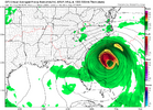
Ends up hooking hard west at the end rips SC a new one though...
GeorgiaGirl
Member
Yeah, I wouldn't be on the east side of this one, but I think I'll pass on this run, no thanks.
Good thing it's in kicks and giggles land, though I wonder if whether the pattern setup to potentially mean this causes trouble happens more within day 10.
Of course, I say I'll pass on this and the next frame puts the decaying core over ME.
Good thing it's in kicks and giggles land, though I wonder if whether the pattern setup to potentially mean this causes trouble happens more within day 10.
Of course, I say I'll pass on this and the next frame puts the decaying core over ME.
Downeastnc
Member
Would be very bad for the mts on this track...
Shaggy
Member
It's an op run we still need to be focused on the ensembles at this range
snowc
Member
Florence repeat???
snowc
Member
If this is Florence like, I'm moving... Residents in NC/SC beware.Slight shift west.
lexxnchloe
Member
If the EURO goes west then its time to track at least.
That was a Hugo Track off 12z GFS fantasy op run
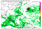
12Z UKMET: N of 0Z…aiming for just N of Leewards
NEW TROPICAL CYCLONE FORECAST TO DEVELOP AFTER 96 HOURS
FORECAST POSITION AT T+ 96 : 13.8N 43.4W
LEAD CENTRAL MAXIMUM WIND
VERIFYING TIME TIME POSITION PRESSURE (MB) SPEED (KNOTS)
-------------- ---- -------- ------------- -------------
1200UTC 07.09.2025 96 13.8N 43.4W 1012 25
0000UTC 08.09.2025 108 13.9N 46.1W 1011 28
1200UTC 08.09.2025 120 13.9N 48.8W 1010 28
0000UTC 09.09.2025 132 14.3N 51.3W 1009 31
1200UTC 09.09.2025 144 15.6N 53.6W 1010 32
0000UTC 10.09.2025 156 16.8N 56.0W 1010 32
1200UTC 10.09.2025 168 17.8N 58.6W 1010 34
lexxnchloe
Member
Henry2326
Member
GeorgiaGirl
Member
Might take a break for a min, but the Euro is positioned south of the leeward islands and if it doesn't start lifting nnw fast, could see the shredder here...
lexxnchloe
Member
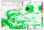
EURO kills it in the carib and has nothingMight take a break for a min, but the Euro is positioned south of the leeward islands and if it doesn't start lifting nnw fast, could see the shredder here...
I  the GFS
Henry2326
Member
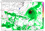
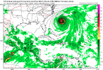
Yeah, something has changed in the modeling.....don't have that warm fuzzy feeling of North and away anymore. Actually was prepared to ignore the whole thing.....10,000ft mtns is what kills it. Fact its there and that far south before hitting the shredder, pours more fuel on the fire for the potential / still 10 days out.
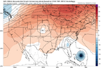
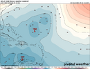
View attachment 174706
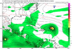
View attachment 174707
lexxnchloe
Member
GFS slightly south so far
lexxnchloe
Member
Yep trough in the Canadian maritimes/NE with s system approaching is going to go OTS 90% of the time.recurve
lexxnchloe
Member
Still not locked in yet. Turning back west at 300. See what happens at 0Z.Yep trough in the Canadian maritimes/NE with s system approaching is going to go OTS 90% of the time.
lexxnchloe
Member
GeorgiaGirl
Member
Yeah, it looked as if it was going to exit stage right, but then the ridging builds back in and it might shift this storm into the coast.
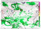
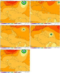
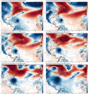
GEFS looks interesting to start off. Split idea. Most seem north of the OP runs, but there's a cluster to the south.
GEFS looks interesting to start off. Split idea. Most seem north of the OP runs, but there's a cluster to the south.

