-
Hello, please take a minute to check out our awesome content, contributed by the wonderful members of our community. We hope you'll add your own thoughts and opinions by making a free account!
You are using an out of date browser. It may not display this or other websites correctly.
You should upgrade or use an alternative browser.
You should upgrade or use an alternative browser.
Tropical 2024 Tropical Thread Reboot
- Thread starter SD
- Start date
Henry2326
Member
Henry2326
Member
I'd settle for a little rain tbh
lexxnchloe
Member
I think the odds are pretty good that that may happen. This has been an unusual year in the tropics and conditions are still favorable for the development of tropical systems. We may even see a December tropical threat this year at the rate things are going.
Wonder if we can break the record for the latest hurricane to hit the continental US, which is November 22.
I think the odds are pretty good that that may happen. This has been an unusual year in the tropics and conditions are still favorable for the development of tropical systems. We may even see a December tropical threat this year at the rate things are going.
lexxnchloe
Member
lexxnchloe
Member
Brent
Member
lexxnchloe
Member
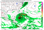
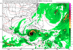
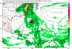
What in the world is this GFS View attachment 154016
lexxnchloe
Member
lexxnchloe
Member
Brent
Member
lexxnchloe
Member
accu35
Member
Don’t want a storm but damn I need rain
I don't know guys. This season seems to keep going through the new year at this rate.
And to think it was cancelled back in early July.
And to think it was cancelled back in early July.
Brent
Member
AJ1013
Member
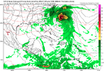
Can we get this version instead of the version that has a major hurricane slamming into Miami? Thanks!


Brent
Member
GolfishardIknowit70
Member
Euro has a pretty big system getting close to Florida
lexxnchloe
Member
Brent
Member
lexxnchloe
Member
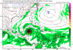
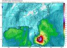
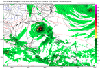
Huge hurricane on the GFS in the Caribbean View attachment 154114
Brent
Member
lexxnchloe
Member
Brent
Member
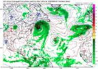
I don't like this one because there looks to be a cutoff around the vicinity again.
Shaggy
Member
Helene like with the cutoff over the mid southI don't like this one because there looks to be a cutoff around the vicinity again.
Shaggy
Member
Small village on the south end of a bay that took the western eyewall and about to get into the eye. Bet they took a devastating surge based on angle of winds

Downeastnc
Member
Small village on the south end of a bay that took the western eyewall and about to get into the eye. Bet they took a devastating surge based on angle of winds

lexxnchloe
Member
Downeastnc
Member
GolfishardIknowit70
Member
Phillipines have been hit 5 time by typhoons already
lexxnchloe
Member
Shaggy
Member
Not sure if this tiny island is inhabited at all but it took a direct hit from an overachiever

Shaggy
Member
So cyclone Chido is only on his 5th advisory and is now up to 120kts. I'd call that RINot sure if this tiny island is inhabited at all but it took a direct hit from an overachiever

Shaggy
Member
135kts so basically an invest to cat 5 in 48 hours


