Not sure but I know @BirdManDoomW always has success when he speaks to the MNGR NOW.Who do I need to speak with about this
-
Hello, please take a minute to check out our awesome content, contributed by the wonderful members of our community. We hope you'll add your own thoughts and opinions by making a free account!
You are using an out of date browser. It may not display this or other websites correctly.
You should upgrade or use an alternative browser.
You should upgrade or use an alternative browser.
Misc 2021-22 Fall/Winter Whamby Thread
- Thread starter jackendrickwx
- Start date
smast16
Member
I've seen enough. It's happening. I'll drink my own piss if I don't get an inch of snow by end of month.
I remember how that turned out last time.Quoting this for later I mean you do live in Charlotte right? ? ? ?
NBAcentel
Member
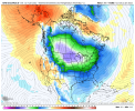
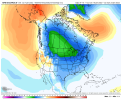
would you look at that, models look solid inside the day 10 window, the hype train begins, cho mf cho mfers
I’m gonna whine like a lil kid if it snows a lot more in Spartanburg than at NCSUwould you look at that, models look solid inside the day 10 window, the hype train begins, cho mf cho mfers
whatalife
Moderator
smast16
Member
D
Deleted member 609
Guest
Think I may sign up for a month of weather bell. Is that the best one?
Screenshot your login/password for meThink I may sign up for a month of weather bell. Is that the best one?
D
Deleted member 609
Guest
10-4Screenshot your login/password for me
- Joined
- Jan 5, 2017
- Messages
- 3,779
- Reaction score
- 5,990
It looks good for parts of North Carolina…
In many ways this is directly related to the last two systems we saw, just upstream and they are expecting at-least one more in the next 1-3 days.

 www.cnn.com

Evacuations ordered due to imminent flooding from heavy rain and snow in Washington state | CNN
Record rain and snow will cause floods, possible landslides, and higher avalanche risks across western Washington state, with more forecast to fall through the weekend.
Street name: small skinny weinerWhat’s his handle on here
Oh I bet we could
Mock ing biird yeahhhh
- Joined
- Jan 5, 2017
- Messages
- 3,779
- Reaction score
- 5,990
Cold rains for everyone! Happy January from "the little girl" in the Pacific.
NBAcentel
Member
everything was going good until the 12z EPS imo
- Joined
- Jan 5, 2017
- Messages
- 3,779
- Reaction score
- 5,990
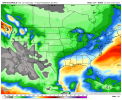
Sailing through prime climo for winter weather with a snow mean of less than .5" over the next 10 days is really pathetic. Sticking with my winter cancel call back in December. It's looking real good right now.
Just for Atlanta and south, though!
Just for Atlanta and south, though!
Last edited:
NoSnowATL
Member
And another one
Avalanche
Member
Dude, cmon man, you know this aint Brick. He would've got it, lost it, and refound it for verification time.Y’all seen brick lately ?
Rates will overcome all.6z was meh. It will not snow at 50°.
Sent from my iPhone using Tapatalk
I’ve kind of given up on seeing a major winter storm IMBY ever again (I missed a few major ones while I was away living in FL). I haven’t seen one in seven years despite hours of model watching. It’s kind of depressing. This hobby isn’t for the faint of heart. We can’t even get consistent fantasy storms on the LR models anymore.
NBAcentel
Member
Can’t even get a snow mean past 1 inch for 2 runs in a rowI’ve kind of given up on seeing a major winter storm IMBY ever again (I missed a few major ones while I was away living in FL). I haven’t seen one in seven years despite hours of model watching. It’s kind of depressing. This hobby isn’t for the faint of heart. We can’t even get consistent fantasy storms on the LR models anymore.
NoSnowATL
Member
We should go ask Nashville about snow means. They are never right. We could add Boston as well.
smast16
Member
People we love … GRITThink we just stay the course here in the medium-extended range (Jan 15-30). GEFS is probably too amplified out west and EPS not amplified enough. GEFS is more of a -EPO pattern with episodic cold highs dropping down (colder, better chances farther south and/or Miller B, as has been stated), while EPS is more of a split flow / weak +PNA look (not as cold, but could have some good chances if timing is there). I still think a quick retraction of the jet back to the WPac (back to -PNA) is the least likely scenario. AAM charts are trending up, so, more evidence of westerly momentum getting charged into the Pac jet and keeping it from doing a quick retreat. GEFS is probably overdone on the -NAO, but still think we may have an opportunity there. AAM charts from @MattHugo81 on Twitter
Keeping it simple, on a scale of 1 to 5 with 3 being avg and 5 being excellent, I'd view the 2nd half of Jan as a 4 (better than average).


SimeonNC
Member
Man after tracking that January 2-4 storm system, I'm impatient. I wanna get in on tracking another one asap lol.
NBAcentel
Member
Yeah I have never been this impatient before, considering we both haven’t seen a legit winter (3+ inches of snow) storm since 2018 when our average is 3-4 inches of snow per winterMan after tracking that January 2-4 storm system, I'm impatient. I wanna get in on tracking another one asap lol.
Brent
Member
Man after tracking that January 2-4 storm system, I'm impatient. I wanna get in on tracking another one asap lol.
It's funny here because December was so warm I honestly wasn't concerned about winter but yeah those flurries on Saturday my mood has totally changed ???
And I know I was in Texas for February but we have a better snow climo up here
NBAcentel
Member
I can feel it in my bones, a weenie 18z GFS run
packfan98
Moderator
I keep feeling like there will be a run where we get two good SE hits. We almost had that yesterday.I can feel it in my bones, a weenie 18z GFS run
D
Deleted member 609
Guest
Nicky, that you?I can feel it in my bones, a weenie 18z GFS run
I feel it too not even kidding I was thinking this earlierI can feel it in my bones, a weenie 18z GFS run
Assuming we don’t bust high on our low, which we probably will, tomorrow morning RDU should post the coldest low temperature in a couple years or so. Which is sad and a demonstration of how little true cold we’ve had recently. Our lowest temperature last winter was a pathetic 22…it’s like I never moved away from Florida.
I’ve kind of given up on seeing a major winter storm IMBY ever again (I missed a few major ones while I was away living in FL). I haven’t seen one in seven years despite hours of model watching. It’s kind of depressing. This hobby isn’t for the faint of heart. We can’t even get consistent fantasy storms on the LR models anymore.
I came to this understanding after we moved to Greenville in 2006, never looked back. Granted, 6” IMBY is better than 18” in theirs, but to see heavy snow I have to travel and the Mid-Atlantic and even SE NE do tease out benchmarks.
I grew up on the space coast by the way, 1980-2000
Last edited:
Threat level 1/6I can feel it in my bones, a weenie 18z GFS run
It's always good when you seem confident! Hopefully, you didn't jinx us.18z GFS going to show a big fantasy storm here in a bit. Buckle up.

