• Hello, please take a minute to check out our awesome content, contributed by the wonderful members of our community. We hope you'll add your own thoughts and opinions by making a free account!

Misc 2021-22 Fall/Winter Whamby Thread

bd2089339adda3c833791398dc0c331b.jpg

Weather Channel app showing a bit of freezing rain Sunday night into Monday up in the “boro”, (Roxboro), aka The Snow Capital of the Triangle area. As always with these apps will it hold to be true? Probably not or probably so. Maybe, maybe not, then maybe again...


Sent from my iPad using Tapatalk
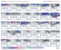
Pattern has generally been there for something like this. Chance isn’t great (yet) but it’s certainly real imo
 
If it snows the literal day after I leave for a visit to family in Alabama I will be inconsolable
That’s why I don’t go on vacation in the winter.

I was on vacation December 7th 2017. Almost missed the snow by a day. Even then, I spent the entire time tracking it on the models.
 
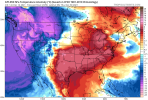
Meh. Each day losing faith in this -NAO pattern. I just don't think it's cold enough. :confused: It looks like that Pacific Ridge keeps moving further and further west. The cold is on our side of the world, but locked up out of reach.

gfs-ens_T2ma_nhem_65.png
It is absolutely not going to get very cold here as long as that big bright red anomaly to the NW is over the Aleutians or west of there.

We can have every numerical value of almost every index in our favor, but the shape and placement of the anomaly matters as much, if not more, than just the value.

There's a lot of excitement for a seasonable pattern. But I guess that's because we've moved away from a full on torch. Until we see the big block in the NW Pacific move, it's going to be mild with the occasional chilly rain for most.
 
I really don’t know how to copy and paste on a phone? How do I get a pic off aFB and post in my comment here? I really can’t figure it out
 
I really don’t know how to copy and paste on a phone? How do I get a pic off aFB and post in my comment here? I really can’t figure it out
Can you tap and hold on the image? When I do that, I get the option to save the image to my device.

For example:

Screenshot_20211214-112827_Samsung Internet.jpg
 
It is absolutely not going to get very cold here as long as that big bright red anomaly to the NW is over the Aleutians or west of there.

We can have every numerical value of almost every index in our favor, but the shape and placement of the anomaly matters as much, if not more, than just the value.

There's a lot of excitement for a seasonable pattern. But I guess that's because we've moved away from a full on torch. Until we see the big block in the NW Pacific move, it's going to be mild with the occasional chilly rain for most.
Yeah that ridge is getting really annoying. The SER is a direct result of that ridge. The NAO is doing all it can and keeping us from burning, but it can only do so much considering what it's up against. Average doesn't get us winter weather around here. Looks great from NYC north so I suppose we could luck out with CAD. But definitely not a real exciting look.
 
Yeah that ridge is getting really annoying. The SER is a direct result of that ridge. The NAO is doing all it can and keeping us from burning, but it can only do so much considering what it's up against. Average doesn't get us winter weather around here. Looks great from NYC north so I suppose we could luck out with CAD. But definitely not a real exciting look.
Literally a mirror image of last year haha
 
I really don’t know how to copy and paste on a phone? How do I get a pic off aFB and post in my comment here? I really can’t figure it out
Just click/tap on the share button, more options and then there should be an option to copy the URL of that particular post/image.
 
So now I’m hearing mid to late January for a pattern change? Was supposed to be late to early January. Delayed but not denied? I guess lol. In the meantime I’m going to really enjoy above average temps ?
 
Yeah that ridge is getting really annoying. The SER is a direct result of that ridge. The NAO is doing all it can and keeping us from burning, but it can only do so much considering what it's up against. Average doesn't get us winter weather around here. Looks great from NYC north so I suppose we could luck out with CAD. But definitely not a real exciting look.

Yes, that's essentially where I'm at. Unless the -NAO get's really west based and traps a lobe of the PV beneath it, I don't think we get cold enough for snow. CAD will get us to seasonal, normal winter temps. I don't think it gives us what we need for a board wide winter event, but we'll see.

Hopefully the Aleutian ridge shifts east to Alaska and we get at least a full conus trough. I'd agree that the NE and the mid-atlantic may score as is, but I just don't think it's enough for the SE.
Have a feeling we’re gonna be chasing more tornado setups with that monstrous -PNA vs wintry wx
 
Which is worse? The never ending heat and false hope down the road or inflation and the struggling stock market? Not good but health and family are what it’s all about. So enjoy the good things
F that! All anybody wants is a good snow/ice storm to track!
 
Back
Top