Webberweather53
Meteorologist
We officially have invest 97L off the SE US

So far, in one form or another.So its gonna move east?


If that trough behind it were digging harder or getting left behind we could have some funI'd be much more excited if this was gonna get east of Florida stall out then develop on a NNW headings. Most skirters like this rarely give me anything of interest.

There's a chance we could get Fay this week with Invest 98L.With Edouard probably being named tonight we are ahead of the infamous 2005 season
Now granted 2005 had a major hurricane by now but still
Just wait until September. At this rate, we will probably have 4 active storms in 1 basin. I just expect and fear that because of this year being this year we will see a cat 5 just shred some coastal city or do damage on the level of one.With Edouard probably being named tonight we are ahead of the infamous 2005 season
Now granted 2005 had a major hurricane by now but still
Just wait until September. At this rate, we will probably have 4 active storms in 1 basin. I just expect and fear that because of this year being this year we will see a cat 5 just shred some coastal city or do damage on the level of one.
Still looks decent this morningWeak SLP making landfall around Port St Joe FL


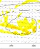
We are starting to get into the front end of that windowEPS ready to wake up the MDR. This gif is from hr 120-240
View attachment 44255
View attachment 44256
View attachment 44257
View attachment 44258
View attachment 44259
View attachment 44260
We are starting to get into the front end of that window


I seen that in the models, icon has it tooHave a couple areas to possibly watch nothing is imminent but for closer to home there are signs of something in the Gulf by the end of the week headed for Texas (I'll be in Galveston Monday-Friday) so I'll definitely be watching that
View attachment 44449


Three now...And then there were two...
View attachment 44581
Disorganized showers and thunderstorms over the central Bahamas,
central Cuba, and adjacent Atlantic waters are associated with a
tropical wave. Environmental conditions could become a little more
conducive for development of this system over the Gulf of Mexico.
This system is expected to move west-northwestward through the
Straits of Florida today, over the southeastern Gulf of Mexico by
Tuesday, across the central Gulf on Wednesday, and reach the
northwestern Gulf on Thursday.
* Formation chance through 48 hours...low...near 0 percent.
* Formation chance through 5 days...low...20 percent.
View attachment 44580
A tropical wave located more than 900 miles west-southwest of the
Cabo Verde Islands is producing a small area of disorganized showers
and thunderstorms. Environmental conditions are expected to be
marginally conducive for development of this system during the next
few days while it moves westward at 10 to 15 mph over the tropical
Atlantic. By Friday and over the weekend, conditions are forecast to
become less favorable for tropical cyclone formation.
* Formation chance through 48 hours...low...10 percent.
* Formation chance through 5 days...low...20 percent.View attachment 44579


 earthobservatory.nasa.gov
Is it just me or did the euro show the first real cape Verde potential in the long range?
12z EPS was really interesting...A convectively enhanced Kelvin Wave is going to move overhead next week, I can definitely see this.