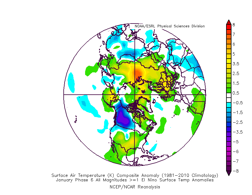
Haha been that way for years now.Too late! Snow hole for you!
-
Hello, please take a minute to check out our awesome content, contributed by the wonderful members of our community. We hope you'll add your own thoughts and opinions by making a free account!
You are using an out of date browser. It may not display this or other websites correctly.
You should upgrade or use an alternative browser.
You should upgrade or use an alternative browser.
Misc 2019 Banter & Friendly Conservation
- Thread starter whatalife
- Start date
B
Brick Tamland
Guest
And now for today's jammin January jam.
packfan98
Moderator
THIS IS THE MOST CUTTERY, CUTTEST, CUTTER, CUT PATTERN I HAVE EVER SEEN. I HATE IT! WOE IS ME!!!
Lies, all lies????
How much is brick paying you????
Yes, Brick can be a great poster. But he doesnt like to listen to the professionals meteorologist in here and learn. If he did listen to them and learn what they are saying. He could be one of the top 5 or 10 poster in here. ?
Snowflowxxl
Member
Your getting the hang of this!!THIS IS THE MOST CUTTERY, CUTTEST, CUTTER, CUT PATTERN I HAVE EVER SEEN. I HATE IT! WOE IS ME!!!
GeorgiaGirl
Member
Another interesting nugget I uncorked is 1949-1957 wasn't really all that cold in January. (I do have the GFS up now though, as I'm gullible)
I hate weather
Kylo
Member
“It’s ok guys most of our big winter storms don’t show up unti were inside 40 hours” SMDH
ForsythSnow
Moderator
You know what I hate? I hate hating of weather. Weather hates us. The hate created computers generate hatred towards us with runs that create hate of weather and hate of models in particular out of hate. That hate is translated to more hate from the hatred of hated people in the weather board world and said hate creates the hatred cycle we all know as this thread. I hate this thread.I hate weather
If I was the owner of the site it would've been in real jeopardy with that offer. LolI have a 50$ gift card to Steak & Shake.
Sent from my iPhone using Tapatalk
Kylo
Member
Alright, who is going to create the Feb thread. Brick is forever banner from creating a thread unless it’s tracking summer heat. I can criticize because I have terrible mojo too and will never create a winter/snow thread.
“wAiT fOr ThE eNsEmBlEs GuYs”I hate weather
packfan98
Moderator
I created the December thread...Historic SE storm...Alright, who is going to create the Feb thread. Brick is forever banner from creating a thread unless it’s tracking summer heat. I can criticize because I have terrible mojo too and will never create a winter/snow thread.
B
Brick Tamland
Guest
Let me do it. I’ll put this winter in the trash can once and for allAlright, who is going to create the Feb thread. Brick is forever banner from creating a thread unless it’s tracking summer heat. I can criticize because I have terrible mojo too and will never create a winter/snow thread.
ForsythSnow
Moderator
I'm going to stop you right there on the first sentence. I think we should wait a week.Alright, who is going to create the Feb thread. Brick is forever banner from creating a thread unless it’s tracking summer heat. I can criticize because I have terrible mojo too and will never create a winter/snow thread.
Let's have someone from AL or GA fire this one up and bring that down here this time.I created the December thread...Historic SE storm...
packfan98
Moderator
I’ll name it “Flip Flopping February” and we will get annihilated
GeorgiaGirl
Member
Kylo
Member
I'm going to stop you right there on the first sentence. I think we should wait a week.
Let's have someone from AL or GA fire this one up and bring that down here this time.
Definitely! I think we need another 10 days to elect someone. This has to be handled just right.
Agree on AL/GA person. The Carolinas have been sucking wind on thread creation.
Yes we do. I love a good crap salad*fp* hopefully the general idea on the GEFS looks different as I don't think any of us want to see this look a week from now heading into February:
View attachment 11359
Kylo
Member
That’s is the funniest thing I have ever seen. What the heck!Here's the cold we've been waiting for...
View attachment 11358
*fp* hopefully the general idea on the GEFS looks different as I don't think any of us want to see this look a week from now heading into February:
View attachment 11359
It’s ok, it’s a step down process! Seattle and Portland get snow first, then we get our rain
Late in the run on the ensembles the trough will be even further east than yesterday’s run. We are losing this thing no doubt about it
Kylo
Member
*fp* hopefully the general idea on the GEFS looks different as I don't think any of us want to see this look a week from now heading into February:
View attachment 11359
Matches up with MJO path. Painful.

Speak for yourself. I hate snow. This is a fantastic look. Crappie should be on the bed soonMatches up with MJO path. Painful.

Kylo
Member
Speak for yourself. I hate snow. This is a fantastic look. Crappie should be on the bed soon
I just want the weekly deluge to stop. Give me seasonal and it will feel good come Feb. Nightmare winter almost over...tick tock
Here are the issues with our lack of winter (in no particular order ...):
Latitude: How can it actually snow here when you look at our latitude?
Global Warming
Hole in the Ozone
Alabama not winning the football national championship.
Super Wolf Blood Moon Lunar Eclipse
Joe Bastardi
James Spann
Last and probably the main reason, sun angle.
Hang in there everyone ... one day we will get there!
Yeah some people forget most of the south is at the same latitude is North Africa.Here are the issueswith our lack of winter (in no particular order ...):
Latitude: How can it actually snow here when you look at our latitude?
Global Warming
Hole in the Ozone
Alabama not winning the football national championship.
Super Wolf Blood Moon Lunar Eclipse
Joe Bastardi
James Spann
Last and probably the main reason, sun angle.
Hang in there everyone ... one day we will get there!
Storm5
Member
If I was the owner of the site it would've been in real jeopardy with that offer. Lol
Well you can buy it then turn around and sell it for the gift card
Sent from my iPhone using Tapatalk
I will start it and it will snow. That is a Cold Rain guarantee.Alright, who is going to create the Feb thread. Brick is forever banner from creating a thread unless it’s tracking summer heat. I can criticize because I have terrible mojo too and will never create a winter/snow thread.
Can we just put a "Closed For Model Repairs" sign up on this place and reopen 2/1?!
“Don’t worry guys it’s just one operational run not taking into account all of the variables.”
Smh I’m starting to think our 2 shots to actually score, our one teeny tiny window, is coming in the form of two big cutters. We missed the mark. Snowpack to our north will be gone in the next 2 weeks. This winter is shot all to hell. I hate to see you go but love to watch you leave
Smh I’m starting to think our 2 shots to actually score, our one teeny tiny window, is coming in the form of two big cutters. We missed the mark. Snowpack to our north will be gone in the next 2 weeks. This winter is shot all to hell. I hate to see you go but love to watch you leave

Not for me! I got 1”!I created the December thread...Historic SE storm...
Yeah gonna,be a huge snowpack to the north the next week. Would be nice to score before that melts.“Don’t worry guys it’s just one operational run not taking into account all of the variables.”
Smh I’m starting to think our 2 shots to actually score, our one teeny tiny window, is coming in the form of to big cutters. We missed the mark. Snowpack to our north will be gone in the next 2 weeks. This winter is shot all to hell. I hate to see you go but love to watch you leave View attachment 11363
In winters like this, I say, if the snow doesn't come to you, go to the snow. Sometimes, that's just a simple drive. I may have to fly this time. I have a butt load of Skymiles so that's good.
....and yeah, I hate to say it but that solution at the end of the GFS run is always more believable than when it shows us Minnesota cold. Just the way it is..........
....and yeah, I hate to say it but that solution at the end of the GFS run is always more believable than when it shows us Minnesota cold. Just the way it is..........


