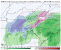
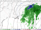
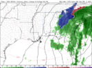
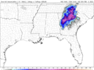
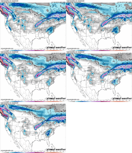
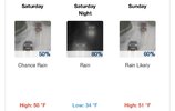
Cold air doesn’t even exist on the euro .. pack your bags and enjoy your cold rain .. I’ll definitely be enjoying it
-
Hello, please take a minute to check out our awesome content, contributed by the wonderful members of our community. We hope you'll add your own thoughts and opinions by making a free account!
You are using an out of date browser. It may not display this or other websites correctly.
You should upgrade or use an alternative browser.
You should upgrade or use an alternative browser.
If things continue .. give it another 24 or so hours and you’ll be in the same boat as us. This thing isn’t trending colder and that’s not what you wanna see at this rangeFor non mountain NC - yes
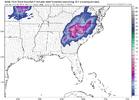
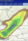
Different story for Tennessee/North Georgia/ North Alabama. Very much in play View attachment 132672


thru 14z Sunday.. 4km followed by 1km.
Haha, IDK man.. something tells me not to believe over a foot of snow in my back yard on the above model. In fact, I am betting on none currently.
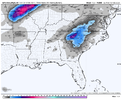
Good thing it's not going to be 25 with all that snow! Atlanta would absolutely implode!Holy smokes! with snow still falling on many spots..
View attachment 132675
I honestly feel that maybe Central Midlands might do good with this one. If 6z Nam continued snow was moving in.
Fwiw AccuWeather has a coating to an inch for Concord
HurricaneSolomon
Member
- Joined
- Dec 6, 2021
- Messages
- 154
- Reaction score
- 276
Fwiw AccuWeather has a coating to an inch for Concord
It shows the same for Durham too. I actually like that feature. I will definitely be monitoring that throughout the day for any changes. For Durham they raised the 1-3 inches possibility to 34 percent. It was a lot less than that earlier. I know we’re still in hopeful mode but we shall see.
Sent from my iPad using Tapatalk
Cad Wedge NC
Member
Just curious as to why the Nam/Gfs solution is so different from the Euro/Uk camp. This thing is 72 hours out and we don't have a clue as to what will happen. That 06z GEFS snow mean is the highest I have had all winter, but I got a bad feeling that this one still might get away from us.
I honestly feel that maybe Central Midlands might do good with this one. If 6z Nam continued snow was moving in.
Do not fall for these American model's bait for Central SC. They are putting down massive totals when the area probably will not see anything frozen at all.
I hate to be that guy but those things have proven useless. Especially the GEFS. I'm sure pros may strongly disagree but I feel we're in the range where the higher resolution ops are more reliable. We'll test that theory for sure now because that looks like a 3 inch mean over me and the Euro op says I don't see a flake.
The NAM is horrible man. Don't bite on that.I honestly feel that maybe Central Midlands might do good with this one. If 6z Nam continued snow was moving in.
D
Deleted member 609
Guest
10:1 ratio isn't happening outside the mountains me no thinks, regardless.
Here's the latest; Ensembles/Ops/Short Ranges: keep in mind Nam and GDPS are only out to 84: Gonna use 10;1 instead of kuchera , cause pivotal want give me free access to some:
6Z GEFS

6z GFS

0z Euro Op

0Z canadian Op

0Z Ukmet

0Z CMCE

0Z EPS

6Z NAM

6Z RDPS

6Z GEFS

6z GFS

0z Euro Op

0Z canadian Op

0Z Ukmet

0Z CMCE

0Z EPS

6Z NAM

6Z RDPS

ICON looking rather NAMish this AM.

More than likely not. But I can bet that someone crashes the column East of the mountains and at least switches to some fat flakes for a time.10:1 ratio isn't happening outside the mountains me no thinks, regardless.
WSNC
Member
Great discussion from GSP this morning.
LONG TERM /SATURDAY NIGHT THROUGH WEDNESDAY/...
As of 305 am Thursday: The forecast in the early part of the medium
range becomes increasingly wet and complex as cyclone deepens/
matures near the eastern Gulf Coast, with strong upper low moving
over the Deep South. Strong forcing and associated precipitation is
expected to begin overspreading the CWA late Sat, continuing through
Sat night into Sunday. Meanwhile, elongated surface high pressure
spilling over the central Appalachians into the Mid-Atlantic will
nose cooler air down the eastern Seaboard...helped along by the
increasing pressure gradient north of the intensifying cyclone. This
effect combined with plunging freezing levels associated with the
mid-level cold core/dynamic cooling will support increasing chances
for a changeover to wintry precipitation...mainly across the mtns
Sat night. Precip type that far north and west of the cyclone will
be primarily a rain/snow concern, with liquid equivalent precip
amounts supporting potential significant accums.
East of the mtns, the p-type forecast is much trickier at this
juncture, mainly due to the cold air not being in place when the
cold air arrives, and the absence of classical cold air damming...as
the placement of the synoptic surface high would argue more for an
in-situ cold pool. These are two rules of thumb that are typically
limiting factors for significant accums of wintry precip for the
Piedmont/foothills. However, this event offers a plethora of
pitfalls for said rules of thumb: namely the potential for dynamical
cooling within the strongly forced environment north of the upper
low, and also for the potential for banded precip (strong
frontogenesis along with some hints of the presence of symmetric
instability) producing heavy precip rates that could force the
profiles to cool from a marginal cold rain sounding to a marginal
snow sounding from time to time. Additionally, higher resolution
models are beginning to depict a warm nose pushing into the Piedmont
on strong easterly/warm advection flow above the surface, further
complicating the p-type forecast. For now, the most likely p-type
for the vast majority of the Piedmont and foothills is a cold rain.
However, considering the complexity of the situation, this forecast
has high potential to go sideways...probably right up until the time
the event starts. "Upper low, weather man`s woe" as the cliche goes.
(As a complete "gee whiz" aside, this pattern will be quite
favorable for gravity wave development over the region, with the
shrinking wavelength between the increasingly neg tilt of the trough
axis associated with the upper low and the downstream ridge.
Inversion associated with the in-situ CAD could duct some of these
waves to the surface to produce a mesoscale strong-to-damaging wind
event.)
Precip chances linger through Sunday morning, with continued
potential for accumulating mountain snowfall as the deformation zone
wraps across the region. Temps will remain below normal through Sun
night, but warm quickly again to above-normal levels early in the
work week, as heights rise quickly and flow turns westerly in the
wake of the cyclone. Shower chances increase late Tue into early Wed
as the next frontal zone approaches.
Robert (WxSouth) facebook post. I'm not a memeber of fb anymore but I could still see his post. Copy and pasted. There is also a map/model to see. I was waiting for him to say it was a roof crusher. LOL
New data coming in looks like a stronger case for major Georgia Snowfall by Sunday morning. I dissect the technical analysis and lay it all out in laymens terms at my blog site. Basically, an upper low, similar to March 2009, rolls across southern Mississippi and Alabama and then turns into Georgia, maturing rapidly as it grows. The system aloft deepens, gets colder and draws down cold air in front of it in the Piedmont of the Carolinas quickly, especially along and west of I-85 pre dawn Sunday (a heavy rain to sleet to snow situation using the 925 mb layer). Meanwhile underneath the Upper Low itself in Alabama and Georgia, rain will flip straight to snow as the system gets wrapped up with heavy precip rates. By Sunday morning, all the western Carolinas, eastern Tennessee , northeast Alabama and much of central and northern Georgia will be snowing or rain/sleet, changing to snow. In some cases, probably very hard. The Maples at my place have swelling buds last few days, which will act as a magnet for the falling goose feathers. A possible powerline problem could emerge in some spots of GA, SC, NC, TN, VA due to heavy accretion of the large dendrites clumping to trees and powerlines in the heaviest snow axis. The blog members will continue to get updates and I'll post some info here on FB as this system develops. This upper low is trending stronger and more dynamic overall in all the model runs tonight.
New data coming in looks like a stronger case for major Georgia Snowfall by Sunday morning. I dissect the technical analysis and lay it all out in laymens terms at my blog site. Basically, an upper low, similar to March 2009, rolls across southern Mississippi and Alabama and then turns into Georgia, maturing rapidly as it grows. The system aloft deepens, gets colder and draws down cold air in front of it in the Piedmont of the Carolinas quickly, especially along and west of I-85 pre dawn Sunday (a heavy rain to sleet to snow situation using the 925 mb layer). Meanwhile underneath the Upper Low itself in Alabama and Georgia, rain will flip straight to snow as the system gets wrapped up with heavy precip rates. By Sunday morning, all the western Carolinas, eastern Tennessee , northeast Alabama and much of central and northern Georgia will be snowing or rain/sleet, changing to snow. In some cases, probably very hard. The Maples at my place have swelling buds last few days, which will act as a magnet for the falling goose feathers. A possible powerline problem could emerge in some spots of GA, SC, NC, TN, VA due to heavy accretion of the large dendrites clumping to trees and powerlines in the heaviest snow axis. The blog members will continue to get updates and I'll post some info here on FB as this system develops. This upper low is trending stronger and more dynamic overall in all the model runs tonight.
NBAcentel
Member
Euro finally stopped the amped/NW trend and was less amped, need to see it go the other way today
I would have thought the NWS would have at least a mention for my area but no. TWC finally has the ol some snow may mix in jingo in the details.
iGRXY
Member
Hopefully we see the CMC/UK/Euro slide the ULL at least further southeast some today.
rburrel2
Member
NoSnowATL
Member
It’s a ULL, it will be a last minute headache for the local Mets. Not a easy one to predict.I would have thought the NWS would have at least a mention for my area but no. TWC finally has the ol some snow may mix in jingo in the details.
NCHighCountryWX
Member
- Joined
- Dec 28, 2016
- Messages
- 699
- Reaction score
- 1,918
iGRXY
Member

First thing is the EURO has this going neutral around New Orleans. We need that to take place around Mobile or even Pensacola to keep it from cutting over us in the Western Carolinas and NE GA.

NAM is a perfect illustration of this. It goes Neutral tilt over the western panhandle of Florida and that makes all the difference in the track taking it about another 100 miles to the southeast.
rburrel2
Member
One thing that makes me think we have a chance here is the deviation in the 5h low evolution happens less than 48hrs from now. The GFS/NAM keep the low center east of the ark/la/tex region... the CMC/Euro cut it off in east texas... prettty clear what we need to happen in that regard.
The forecaster probably thought, ugh, let the afternoon crew deal with this one lol.I would have thought the NWS would have at least a mention for my area but no. TWC finally has the ol some snow may mix in jingo in the details.
I mean, you don't really put +sn in a forecast in non climo areas with no true cold source in place this far out... Especially dealing with an ULL....
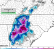
The 15 incher line is only a few miles from me in Hart County. Can I say I've been nam'd pleaseeeeee. ??Feels good to finally get NAm'ed this winter. Where's Stevo at? 15 inch bullseye over his house.View attachment 132683
Something tells me we’re playing with fools gold but let’s see how we trend todayIf things continue .. give it another 24 or so hours and you’ll be in the same boat as us. This thing isn’t trending colder and that’s not what you wanna see at this range
iGRXY
Member
Simple, keep the N/S interaction going until we get this thing at least into Arkansas and Louisiana before seeing it slow down and separation starts happening. That being the key detail is why I haven't thrown in the towel because it's going to be extremely difficult for models to pick up on that until it's almost at go time. There's really not much of anything separating the GFS/NAM from the foreign models other than where it goes neutral tilt.One thing that makes me think we have a chance here is the deviation in the 5h low evolution happens less than 48hrs from now. The GFS/NAM keep the low center east of the ark/la/tex region... the CMC/Euro cut it off in east texas... prettty clear what we need to happen in that regard.
I’m here. I’m always here.Feels good to finally get NAm'ed this winter. Where's Stevo at? 15 inch bullseye over his house.View attachment 132683
I get fringed with a foot of melting snow on contact so I’m tossing..what a sight that would be though..Feels good to finally get NAm'ed this winter. Where's Stevo at? 15 inch bullseye over his house.View attachment 132683

