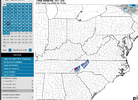
This could be a big one regardless of wintry precip
-
Hello, please take a minute to check out our awesome content, contributed by the wonderful members of our community. We hope you'll add your own thoughts and opinions by making a free account!
You are using an out of date browser. It may not display this or other websites correctly.
You should upgrade or use an alternative browser.
You should upgrade or use an alternative browser.
Pattern 12/15-19 Coastal!!!!!
- Thread starter SD
- Start date
- Joined
- Jan 5, 2017
- Messages
- 3,769
- Reaction score
- 5,965
It looks like major threats will be flooding rains in coastal areas and possible prolonged high wind threat, even well inland. Minor concerns around cool temperatures creating hazards, especially if power is lost. Need to keep an eye on where temps go after the storm. Quickly dropping temps below freezing at night with no power is undesirable. Severe looks to be confined to Florida, depending on how far north the surface low tracks.
Coastal Erosion would be very problematic. Have to see how this pup tracks. It actually moves at a snails pace starting tommorow OK/TX panhandles before finally making it to the Gulf by Saturday. Probably get some good snow off to Brett's west.
- Joined
- Jan 23, 2021
- Messages
- 4,590
- Reaction score
- 15,178
- Location
- Lebanon Township, Durham County NC
Some poor DOT employees holiday on the obx is gonna be ruined by this thing.
Shaggy
Member
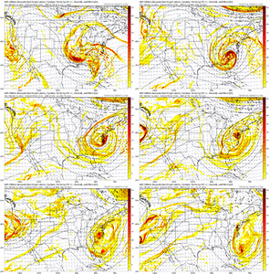
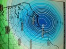
The consensus at this stage is impressive. Ukie, cmc are the strongest sub 975mb but even gfs and euro are down 990ishThis could be a big one regardless of wintry precip
With a high pressure moving off the northeast coast, the pressure gradient is set up to bring some very strong on shore winds… quite possibly 60mph+. Coastal flooding is going to definitely be a concernThe consensus at this stage is impressive. Ukie, cmc are the strongest sub 975mb but even gfs and euro are down 990ish
Downeastnc
Member
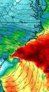
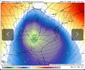
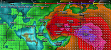
Heck the Ukie is more or less a cane lol...wind maps are ridiculous, gust 60-80 well inland over NC....
Shaggy
Member
Gonna hit johnnie mercer pier Sunday morning to watch the surf roll inWith a high pressure moving off the northeast coast, the pressure gradient is set up to bring some very strong on shore winds… quite possibly 60mph+. Coastal flooding is going to definitely be a concern
Shaggy
Member
PixHeck the Ukie is more or less a cane lol...wind maps are ridiculous, gust 60-80 well inland over NC....
And @Shaggy post the full image man! ?
LickWx
Member
Yes and you can see exactly the track it probably takes… right along the coast where there
Is a natural baroclinic zone
Shaggy
Member
This still has tons of potential to be a big storm regardless of ptypesLol go off gfsView attachment 138551
Downeastnc
Member
accu35
Member
accu35
Member
That upper low core coming from the west collided with the gulf low can make some magic for the mountains.
Why can't we get this when it's cold enough for snow?
If you got this when it was cold enough for snow, it would be rain for most.Why can't we get this when it's cold enough for snow?
Looks like maybe a classic feedback issue with GFS. we shall see.
- Joined
- Jan 23, 2021
- Messages
- 4,590
- Reaction score
- 15,178
- Location
- Lebanon Township, Durham County NC
Glad we’ll be in Alabama and miss this thing
Stormsfury
Member
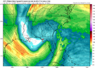
If this potential cyclone ends up taking a more inland track, the severe weather potential would be through the roof given that kind of wind energy....
Irregardless, quite a potential of a major storm system... probably need to monitor for potential sting jets or gravity wave formation within the dry slot.
Irregardless, quite a potential of a major storm system... probably need to monitor for potential sting jets or gravity wave formation within the dry slot.
- Joined
- Jan 23, 2021
- Messages
- 4,590
- Reaction score
- 15,178
- Location
- Lebanon Township, Durham County NC
ICON seemingly backed way off
This one has major mountain potential at highest highest elevations
Shaggy
Member
All the 0z runs seem to have backed off and are now above 990 for strength.ICON seemingly backed way off
Hot off the World Famous 6z GFS: Stalls our storm, then once it starts moving a 1047 is able to supply come CAD and whala. GETS Cutoff for days


Canadian is the strongest, takes inland track and is deepening. Prolific rainmaker Far eatern NC around the sounds and gives the high mtns some snow.All the 0z runs seem to have backed off and are now above 990 for strength.


Shaggy
Member
Icon came back a bit stronger at 6z so I think we will continue to see some intensity changes but the crazy deep runs seem to have abated
Blue_Ridge_Escarpment
Member
UK takes a 981 into Asheville
JHS
Member
12z GFS is a little to the west with this and the 12z Euro came way west. It has a 982MB low over GSO at hour 114 and it still there at 984MB 6 hours later. This gives me a little more confidence that this is going to be a major system for most of NC and SC along with parts of GA.
JHS
Member
Yeah, it looks as if most models are shifting west. If things work out right, the mountains will get pounded with snow. The Euro shows 70 mph gusts in the higher elevations in western NC too.UK takes a 981 into Asheville
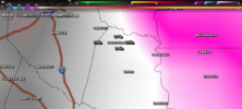
12z Euro adding biggly to the 3 inches mby just got this past Sunday


12z Euro goes from 990 around MYR to 982 in between RDU and GSO in 6 hours
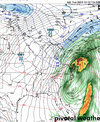
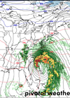
Looks like a fairly mature comma head, of course we get slotted and there is no cold air anywhere in the eastern US.
Looks like a fairly mature comma head, of course we get slotted and there is no cold air anywhere in the eastern US.

