Tokenfreak
Member
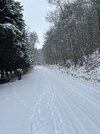
Back to sleet here again!
Yeah, that's way wrongIts also ridiculously wrong.
You may have to ride up 178 towards Rosman.All Snow here around Sunset in upstate But nothing just real heavy. Again no way I see this laying down 3-4"
I don't understand why they would show it on tv if it's wrong ?Its also ridiculously wrong.
Any snow at all is more than I got over here. We have not got anything at all yet. A few sleet pellets is all.Say what you want but this storm in NW Upstate is a Bust. CJ Bumped his totals to 4-8" across here And that's a Laughing stock!

Moisture fetched west to east mostly...that doesn't happen often. It'll pivot northward and then yall get dumped on..hopefully twmps cooperate for yaIt's crazy you got 2" but Sunset near the Reserve don't even have an inch!
You think we flip to snow down this way?Starting to see signs of heavier
precip crashing the column around gaffney moving east. The actual warm nose that likely shuts off snow for good it’s still pretty far south View attachment 162487
I’m in Rutherfordton under those same sounds and yes has picked up in both rates and size, Hold on.Starting to see signs of heavier
precip crashing the column around gaffney moving east. The actual warm nose that likely shuts off snow for good it’s still pretty far south View attachment 162487
 ️
️Been sitting at 30° For quite awhile. If we can't fight off that WAA we're doneMoisture fetched west to east mostly...that doesn't happen often. It'll pivot northward and then yall get dumped on..hopefully twmps cooperate for ya
Same lolSleet here …
Might be all we see here. Maybe Brad P was right. Sure looks like we are going to need heavy rates to get snow, we may end up with just a glaze of sleet or ice.Same lol
There are two things are giving me hope we see more than expected here in the Triangle: One is the timing, the other is the higher rates that will likely occur closer or near the changeover, since we will be riding that pony. We will see.The low level jet is really cranking now. Diurnal timing is screwing parts of the Carolinas.

 webcam.wfu.edu
It could put central NC in a good spot if this radar trend continues.. would be great to saturate the column by 4pSeems to saturate the column fairly quickly, wasn't expecting all these mPING reports so quick after returns started showing on radar. Also coming quickly too, precip arriving sooner than model projections, shocked I tell ya
It’s possible but we need to hurry and get some rates otherwise we are ------. Hoping these increasing returns west of CLT start putting in some work. We are on limited timeYou think we flip to snow down this way?

We might get blanked here? Looks pretty bleak at the moment in our area.It’s possible but we need to hurry and get some rates otherwise we are ------. Hoping these increasing returns west of CLT start putting in some work. We are on limited time View attachment 162497
I'm not surprised actually. These spots are legit cold islands in SC. I was concerned when the RGEM was firing warning shots the last day or so. Even have icing problems into upper parts of Summerville, SC.Major icing ongoing at I-26/I-95 interchange in South Carolina. Roads are slushy and trees are bending. Took me completely by surprise.