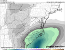
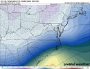
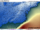
You’ll get yours at some point. Hell I was there in April last year and it snowed.It's tough because us foothill folks have to root for a slightly stronger solution that may put many of you south and east out of play. We're all so snow-starved, I was hoping this pattern would have found a way to deliver for all of us.
-
Hello, please take a minute to check out our awesome content, contributed by the wonderful members of our community. We hope you'll add your own thoughts and opinions by making a free account!
You are using an out of date browser. It may not display this or other websites correctly.
You should upgrade or use an alternative browser.
You should upgrade or use an alternative browser.
Wintry 1/9-12 Winter Potential Great Dane or Yorkie
- Thread starter SD
- Start date
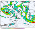
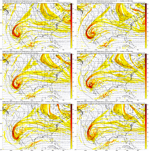
The trailing N/S shortwave track on the 6z GFS...Juneau-Edmonton-Rapid City-Amarillo-Houston-Wilmington. 6z ICON same track (it's at Houston at hr120 end of the run). It's doesn't show on the surface maps yet, but that track is plenty favorable for backside action for the I-20 corridor.
ITUSETOSNOW
Member
Look at my name... Not anymore.
Sam Sparks
Member
Just off the water, I can hear the boats, but can't see them lol! I'm close to Trident MarinaDo you live on Smith Lake? My inlaws have a place there and we come down quite a bit. Beautiful lake
As RAH discussed below, our one big issue is no big high pressure to the north. So again, I think we really need to keep hoping for the flatter/weaker miller A storm.
.LONG TERM /WEDNESDAY THROUGH SUNDAY/...
As of 425 AM Monday...
* Cold temperatures dominate the forecast through midweek with
attention turning to our next potential winter system Friday into
Saturday.
A reinforcing shot of Arctic high pressure is expected to progress
across the area Wed night into Thurs as the center of high pressure
over the southern Plains shifts eastward and into the Ohio Valley by
Thurs morning. Although the weather will be particularly quiet from
a precipitation perspective, the cold and dry Arctic airmass
deposited over our area and the northerly winds traversing the
expected snowpack over VA will combine to result in well below
normal temperatures Wed into Fri. Highs in the 30s to around 40
degrees and lows in the teens to low 20s will be common areawide.
This cold and dry air will set the stage for our next system Fri
into Sat.
A complicated system pattern will be driving this next system as
several shortwaves interact with an anchored parent low over
Newfoundland as well as northern-stream closed low near the Baja
Peninsula to start the period. Ensemble guidance suggest generally a
positive tilt trough axis to develop as the low over the Baja merges
with several waves and migrates eastward, extending from the Great
Lakes through the Ohio Valley and into the southern Plains by 12z
Sat. Ensemble member MSLP pressure centers from the GEFS, EPS, GEPS,
generally show a single low developing over the northern GOM states
and lifting ENE in a classic Miller A track through the Southeast
and off the Carolina coast through 00z Sun. This configuration would
favor a more rain/snow event with a relatively narrow transition
zone, but with a very large question remaining on where that is
expected to set up. The important missing ingredient from this
pattern is a dominant Arctic high positioned over the Northeast to
lock in the cold/dry air ahead of this system, which will have to
rely on locking in an insitu CAD regime as precipitation begins to
diabatically cool the dry preceding airmass.
Current forecast guidance suggests a chance for initially snow late
Fri into early Sat with the rain/snow line shifting northward
towards the climatologically favored I-85 corridor by Sat morning
with precipitation coming to an end through the afternoon hours.
Timing and amounts will likely change as models narrow in on how
important synoptic features develop and interact with one another.
&&
NBAcentel
Member
rburrel2
Member
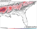
06z euro ai looks about the same on total precip for the upstate but maybe a tick cooler at 850mb
NBAcentel
Member
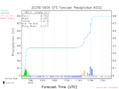
Savannah River warm nose in full effect.Ice off 06 EPS.
View attachment 160255
I hear you. It's better in the mountains/foothills for sure but until earlier this week, my last snow was March of 2022.You’ll get yours at some point. Hell I was there in April last year and it snowed.
rburrel2
Member
I’m expecting about an inch of snow/sleet accumulation on Friday and then capped off with a glaze of ice Friday night with temps in the upper 20s. Probably light snow most of the day Friday but struggles to accumulate, then when we finally get decent rates and temp drops in to the 20’s, it flips to sleet.
I’m hoping this is a reasonable “low” expectation and hi-res models will take us to glory.
I’m hoping this is a reasonable “low” expectation and hi-res models will take us to glory.
NBAcentel
Member
Snowflowxxl
Member
ATL folks - at this point we need to cheer for some flakes on the backside. I think it’s possible and probably our best shot. Flizzard action
NBAcentel
Member
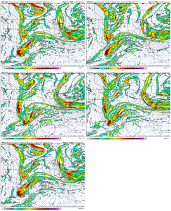
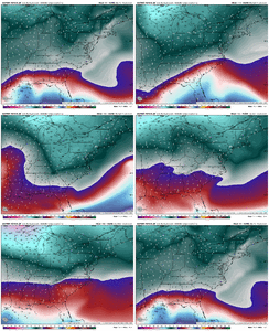
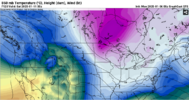
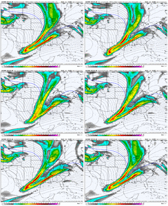
Same can be said for the storm itself especially track wise and the overall type of storm it is, and somewhat with the energy, comparing it to other modelsFWIW the EC AI has been way more stable now with the energy around the four corners View attachment 160257View attachment 160256
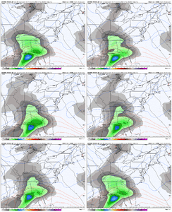
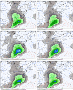
rburrel2
Member
That was actually an awesome run of the Euro AI... a little more qpf and a little colder... those are the exact trends we need!
@Fro for sure.. The Euro AI did so good with this storm, imo. It's been showing this solution the most consistently even going back a couple/3 days ago.
@Fro for sure.. The Euro AI did so good with this storm, imo. It's been showing this solution the most consistently even going back a couple/3 days ago.
At this point a few hours of snow would be a major win here in clt after getting blanked the last clipper. A front end surprise is what we prob should be praying for similar to the upstate a few years ago, but won’t be evident until we get into short range model range late week.I’m expecting about an inch of snow/sleet accumulation on Friday and then capped off with a glaze of ice Friday night with temps in the upper 20s. Probably light snow most of the day Friday but struggles to accumulate, then when we finally get decent rates and temp drops in to the 20’s, it flips to sleet.
I’m hoping this is a reasonable “low” expectation and hi-res models will take us to glory.
Dude, your area is soooo close. Why throw in the towel now?ATL folks - at this point we need to cheer for some flakes on the backside. I think it’s possible and probably our best shot. Flizzard action
Not expecting a big storm, but could be some mixing again in the same areas as yesterday event minus that snow burst in the northern foothills. Could see another glaze again with this new storm esp tree tops
CltNative90
Member
I'll be spending the second half of the week and weekend at about 3,500 feet in Little Switzerland (plans arranged long before this storm was on the radar). I've been pulling for the mountains/ foothills with this event, as well as back home to break the streak. Unfortunately, as is almost always the case, when the mountains score there will be at the very least mixing issues in the southern and eastern areas. I think the best scenario to get everyone involved is the weaker flatter solution. It may mean sacrificing a big time snowstorm where I'm going to be, but I feel somewhat confident the precip shield will expand further north and west than modeled as is typically the case.It's tough because us foothill folks have to root for a slightly stronger solution that may put many of you south and east out of play. We're all so snow-starved, I was hoping this pattern would have found a way to deliver for all of us.
rburrel2
Member
GFS and regular Euro keep the upstate all snow on Friday too... the issues here is how much qpf actually falls. GFS and Euro say 1 maybe 2/10th's if we're lucky. (Euro verbatim says surface is 34 friday afternoon b/c we don't get heavy enough precip to wetbulb), Euro AI says more like 4/10ths. The precip just hits a wall and dies on the GFS/Euro, awful.
That's something that can trend the other way quick though...
That's something that can trend the other way quick though...
Snowflowxxl
Member
We really are not that close and it’s still has more days to trend northDude, your area is soooo close. Why throw in the towel now?
rburrel2
Member
I definitely think part of the reason for the muted qpf over NC/SC is b/c all the models have convection in the gulf moving west/east and blocking moisture transport. The issue is it's probably accurate since they're all showing it???
That's news to me, especially for Friday night.We really are not that close and it’s still has more days to trend north
Get under some heavy rates and maybe just maybe...GFS and regular Euro keep the upstate all snow on Friday too... the issues here is how much qpf actually falls. GFS and Euro say 1 maybe 2/10th's if we're lucky. (Euro verbatim says surface is 34 friday afternoon b/c we don't get heavy enough precip to wetbulb), Euro AI says more like 4/10ths. The precip just hits a wall and dies on the GFS/Euro, awful.
That's something that can trend the other way quick though...
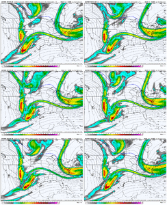
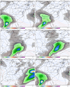
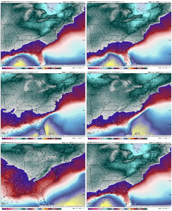
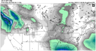
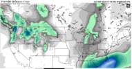
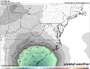
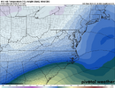
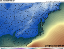
Looks like all the indicators hold well over mby for this run tooGood winter storm on the AI this run. Slightly colder in the mid levels View attachment 160258View attachment 160259View attachment 160260
The moisture is certainly heavy over Florida up to about Savannah Georgia and then it explodes over the Atlantic east of South Carolina. It’s not so much moisture robbing it’s just seems to be favoring New England last minute I could see it coming back for them.I definitely think part of the reason for the muted qpf over NC/SC is b/c all the models have convection in the gulf moving west/east and blocking moisture transport. The issue is it's probably accurate since they're all showing it???
Ward Cleaver
Member
I have to fly from GSO to DFW early Saturday morning, but southern travel is looking a bit precarious for the second half of this week. Rebooking for a Thursday or Friday arrival into DFW might not be a good idea because of the weather forecast in TX, but waiting until Saturday morning could spell trouble in NC.
My gut says to stick with the early Saturday flight I have even though it’s likely to be delayed or cancelled out of GSO. Surely the airline can get me to DFW by late Saturday evening. Conditions would have improved at DFW by then and the airline would likely have equipment available at GSO since that’s the first flight of the day for that route.
I love snow, but it stinks when you have to travel in the middle of it.
MichaelJ
Member
ITUSETOSNOW
Member
January 8, 1973, ATL had the "Mother" of all ice storms.Ice off 06 EPS.
View attachment 160255
Not having a feed of cold air into the system is becoming a concern for me.
Snowflowxxl
Member
The LR NAM is over hated at this point. It’s not that bad and I’ve seen it sniff things out many times over the last decade.
rburrel2
Member
rburrel2
Member
This would be good for SC too looks like.
- Joined
- Jan 2, 2017
- Messages
- 1,566
- Reaction score
- 4,279
Sort of AI ish so to speak initially. Be interesting what it does with the energy from here and with thermals down the roadView attachment 160267
say what you want about long term nam but this is remarkable consistency that i was surprised to see
Forevertothee
Member
Does frozen precip make it south of 85 into the Clinton area on the AI?06z euro ai looks about the same on total precip for the upstate but maybe a tick cooler at 850mb
NBAcentel
Member
i agree with this take and do think it can be a precursor to trends that the globals shows later. not always, but i keep it in the back of my mindThe LR NAM is over hated at this point. It’s not that bad and I’ve seen it sniff things out many times over the last decade.

