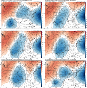
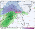
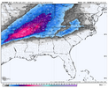
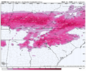
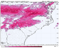
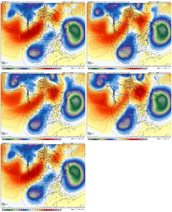
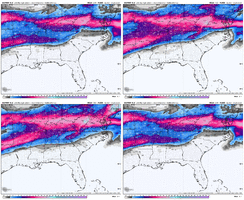
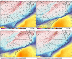
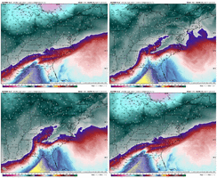
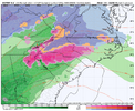
With UK on board Euro should look pretty good.UKMET send ice further south here in Alabama then the gfs
-
Hello, please take a minute to check out our awesome content, contributed by the wonderful members of our community. We hope you'll add your own thoughts and opinions by making a free account!
You are using an out of date browser. It may not display this or other websites correctly.
You should upgrade or use an alternative browser.
You should upgrade or use an alternative browser.
Wintry 1/9-12 Winter Potential Great Dane or Yorkie
- Thread starter SD
- Start date
Power of positivity, a bunch of snow starved weenies might just pull off the wishcaste of all timesView attachment 159722
profile is all westerlies because this storm is running on no synoptics and all vibes
kind of funny to have a snowstorm with everyone having a wind from the west
Use 540 thickness line as a general ballpark, but you have to dig into the details to see what is going on thru the full atmosphere temperature-wise. But in addition, the rain and snow shown there is for precip that has occurred over the previous 6 hours it looks like, whereas the thickness lines are showing the thickness (temperature profile) at that timestamp (not over the previous 6 hours)Question for those that know. So the 540 line here shows rain on both sides of it in SC. I thought the 540 line meant it was cold to snow if it was below it? Is this just displayed wrong and that rain is really snow or is it really rain and I just don't understand lol?
NBAcentel
Member
Worth noting though the GEFS still had a handful of to amped members
NBAcentel
Member
This is easily the messiest looking setup at H5 I’ve ever tracked. Just awfulGFS OP looked a lot like it’s 18z run from yesterday. Only much better. View attachment 159741
Tsappfrog20
Member
I like the way things are looking come on KING
Sent from my iPhone using Tapatalk
Sent from my iPhone using Tapatalk
The consistency in the Atlantic is crazy though. Imagine if that was jumping around too.This is easily the messiest looking setup at H5 I’ve ever tracked. Just awful
accu35
Member
Jimmy, you think we can see colder runs?GFS OP looked a lot like it’s 18z run from yesterday. Only much better. View attachment 159741
I remember those 2 gulf lows,That would indeed be a trip Jimmy if the baja wave came out as storm 2 lol. Would harken back to the double barrel storms in Jan 1982 (1st one was the OG Atlanta Snowjam storm)
Miller A's.
I couldn't remember the year but it seems like it was only a couple of days maybe 3 at the most that separated it!
Both were around 6 inches if memory serves.
That's not the only time that's happened in my life either.
Maybe wrong but seems as if this wasn't that uncommon in the 70's either!
I’m probably not the smartest guy to ask that but I would never bet on any run being colder than the last.Jimmy, you think we can see colder runs?
GEFS kinda meh, storm still there so there's that I suppose. Lot's to work out still
Jan 1982 - back to back winter stormsI remember those 2 gulf lows,
Miller A's.
I couldn't remember the year but it seems like it was only a couple of days maybe 3 at the most that separated it!
Both were around 6 inches if memory serves.
That's not the only time that's happened in my life either.
Maybe wrong but seems as if this wasn't that uncommon in the 70's either!


NBAcentel
Member
euro looks worse then 18z but better then 12z
There is a hand full of us that live in the Ga mountains and I am a bit more interested than normal. Even when the models have trended to almost nothing, we have been really close. So close, it didn't seem worth mentioning. I really think Jasper north is really close to seeing something out of this storm (other than rain, hopefully). I really think this works out for areas further south too, at least to the northern burbs. ATL south is the usual crap shoot too.
Looks like some FROPA snow showers too. This area rocks on NW flow events.
The only model to really hate us seems to be the CMC.
Looks like some FROPA snow showers too. This area rocks on NW flow events.
The only model to really hate us seems to be the CMC.
It wants to drop the early short wave piece into the baja low and raise the heights thru Missourieuro looks worse then 18z but better then 12z

SnowwxAtl
Member
euro looks worse then 18z but better then
It is app cutter?A little colder at 850 maybe? View attachment 159746
NBAcentel
Member
Stronger Atlantic Canada confluence but amped storm. Gonna be a CAD lights out. Interesting
iGRXY
Member
Ice storm for CAD regions on this run
iGRXY
Member
Euro is diving the C Plains wave sharply into Oklahoma like the GFS, but it's not as positive tilt as the GFS (so it's warmer aloft out front)


Are you seeing the soundings?Ice storm for CAD regions on this run
Igry is the primary up at wolf laurel? Looks it on your map above. Guess this miller Bs
iGRXY
Member
NBAcentel
Member
Curious if some of that is sleet and the gui algorithm may be over playing the ZR?
most likely. i've never seen model output accurately reflect zr, it's always inflatedCurious if some of that is sleet there and the gui algorithm may be over playing the ZR?
Snowflowxxl
Member
Cut ZR totals in half always
NBAcentel
Member
I am running an AI ensemble based on Pangu-Weather, initialized at 00z. This is highly experimental, but did very well during hurricane season. Seems to have a miller A/B hybrid, similar to GFS. So far am at 9 members out of 30, but it takes quite a while to get all of those done.
In testing, Pangu-Weather scores similarly to the operational ECMWF, but theoretically an ensemble approach should bring those scores up significantly.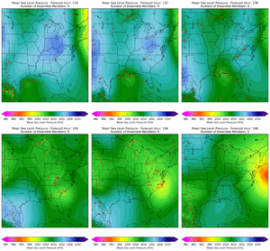
In testing, Pangu-Weather scores similarly to the operational ECMWF, but theoretically an ensemble approach should bring those scores up significantly.

Clear takeaways tonight for me are....1) we are trending toward digging the CPlains wave sharper south into Oklahoma, and 2) biggest question is does the C Plains diving trough get out ahead of the baja wave - I'd say that is a big question mark when you consider all of the latest op and ensemble runs
iGRXY
Member
FRAM is still 0.5” of ice along the 85 corridor with 2-4” snow also
NBAcentel
Member
NBAcentel
Member
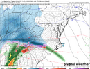
That’s a hell of a finger fgen band on the euro. Sheesh. No wonder it drops that amount of snow on the front end. Gotta like the trend though snow wise…. It’s been improving as much as we still don’t like its solution. This solution kinda gives me the vibes of the storm Ollie brung up a couple days ago back in mid Jan 2022 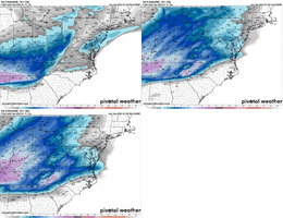


iGRXY
Member
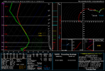
looking at the soundings this isn’t your usual ZR but it’s really sleet on the panels. It’s legit ZR.
It could be legit mixed precip.looking at the soundings this isn’t your usual ZR but it’s really sleet on the panels. It’s legit ZR.

