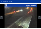
Freezing rain coming down here
-
Hello, please take a minute to check out our awesome content, contributed by the wonderful members of our community. We hope you'll add your own thoughts and opinions by making a free account!
You are using an out of date browser. It may not display this or other websites correctly.
You should upgrade or use an alternative browser.
You should upgrade or use an alternative browser.
Wintry 1/9-12 Winter Potential Great Dane or Yorkie
- Thread starter SD
- Start date
iGRXY
Member
Unless we switch back I'm sitting at 26 degrees with showers right now. I fully expect every bit of it to stick
Sleeting pretty good here in Linden (north of Fayetteville). Below freezing @ 31F
ForsythSnow
Moderator
Don't see much left but we'll seeWhere is the NWS and Brad nitz finding that much moisture left? @ForsythSnow
rburrel2
Member
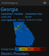
Ice is getting thick here, and winds picking up. Gonna be a long night if power goes outMan I’m getting worried about ZR. power outages have jumped 40,000 in the last 20 minutes View attachment 162605
Mostly snow right now west Raleigh!
Ryan87NC
Member
 [emoji[emoji6
 ]
] [emoji6
 ]][emoji
 [emoji[emoji6
 ]
]
 ][emoji[emoji6
 ]
]
 ]]]
]]] [emoji[emoji6
 ]
] [emoji6
 ]][emoji
 [emoji[emoji6
 ]
]
 ][emoji[emoji6
 ]
] [emoji6
 ]]]][emoji[emoji
 [emoji[emoji6
 ]
] [emoji6
 ]][emoji
 [emoji[emoji6
 ]
]
 ][emoji[emoji6
 ]
]
 ]]][emoji[emoji
 [emoji[emoji6
 ]
] [emoji6
 ]][emoji
 [emoji[emoji6
 ]
]
 ][emoji[emoji6
 ]
]
 ]]]
]]] [emoji[emoji6
 ]
] [emoji6
 ]][emoji
 [emoji[emoji6
 ]
]
 ][emoji[emoji6
 ]
] [emoji6
 ]]]][emoji[emoji6
 ]
] [emoji6
 ]][emoji[emoji
 [emoji[emoji6
 ]
] [emoji6
 ]][emoji
 [emoji[emoji6
 ]
]
 ][emoji[emoji6
 ]
]
 ]]]
]]] [emoji[emoji6
 ]
] [emoji6
 ]][emoji
 [emoji[emoji6
 ]
]
 ][emoji[emoji6
 ]
] [emoji6
 ]]]]][emoji[emoji
 [emoji[emoji6
 ]
] [emoji6
 ]][emoji
 [emoji[emoji6
 ]
]
 ][emoji[emoji6
 ]
]
 ]]][emoji[emoji
 [emoji[emoji6
 ]
] [emoji6
 ]][emoji
 [emoji[emoji6
 ]
]
 ][emoji[emoji6
 ]
]
 ]]]
]]] [emoji[emoji6
 ]
] [emoji6
 ]][emoji
 [emoji[emoji6
 ]
]
 ][emoji[emoji6
 ]
] [emoji6
 ]]]][emoji[emoji6
 ]
] [emoji6
 ]][emoji[emoji
 [emoji[emoji6
 ]
] [emoji6
 ]][emoji
 [emoji[emoji6
 ]
]
 ][emoji[emoji6
 ]
]
 ]]][emoji[emoji
 [emoji[emoji6
 ]
] [emoji6
 ]][emoji
 [emoji[emoji6
 ]
]
 ][emoji[emoji6
 ]
]
 ]]]
]]] [emoji[emoji6
 ]
] [emoji6
 ]][emoji
 [emoji[emoji6
 ]
]
 ][emoji[emoji6
 ]
] [emoji6
 ]]]][emoji[emoji6
 ]
] [emoji6
 ]][emoji
 [emoji[emoji6
 ]
] [emoji6
 ]][emoji
 [emoji[emoji6
 ]
]
 ][emoji[emoji6
 ]
]
 ]]]]]" data-quote="Webberweather[emoji[emoji
 [emoji[emoji6
 ]
] [emoji6
 ]][emoji
 [emoji[emoji6
 ]
]
 ][emoji[emoji6
 ]
]
 ]]][emoji[emoji
 [emoji[emoji6
 ]
] [emoji6
 ]][emoji
 [emoji[emoji6
 ]
]
 ][emoji[emoji6
 ]
]
 ]]]
]]] [emoji[emoji6
 ]
] [emoji6
 ]][emoji
 [emoji[emoji6
 ]
]
 ][emoji[emoji6
 ]
] [emoji6
 ]]]][emoji[emoji6
 ]
] [emoji6
 ]][emoji[emoji
 [emoji[emoji6
 ]
] [emoji6
 ]][emoji
 [emoji[emoji6
 ]
]
 ][emoji[emoji6
 ]
]
 ]]]
]]] [emoji[emoji6
 ]
] [emoji6
 ]][emoji
 [emoji[emoji6
 ]
]
 ][emoji[emoji6
 ]
] [emoji6
 ]]]]][emoji[emoji
 [emoji[emoji6
 ]
] [emoji6
 ]][emoji
 [emoji[emoji6
 ]
]
 ][emoji[emoji6
 ]
]
 ]]]
]]] [emoji[emoji6
 ]
] [emoji6
 ]][emoji
 [emoji[emoji6
 ]
]
 ][emoji[emoji6
 ]
] [emoji6
 ]]]]" data-source="post: 0"
class="bbCodeBlock bbCodeBlock--expandable bbCodeBlock--quote js-expandWatch">
Correlation coefficient line. It usually delineates snow from sleet in winter storms. The CC line is created by snow flakes melting aloft before they reach the ground, causing the CC to drop because you’re getting a different wide array of hydrometeor reflectors in the radar beam
Thank you!
Sent from my iPhone using Tapatalk
SnowNiner
Member
Slowed to a stop in Troutman. Where's my chicken feathers?
That’s what I have been trying to figure out. I don’t see that much left to come through. It’s 29 and there is a light glaze (maybe tenth of an inch) but that’s about itWhere is the NWS and Brad nitz finding that much moisture left? @ForsythSnow
Webberweather53
Meteorologist
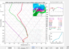
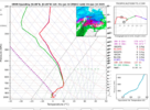
Because the HRRR model forecast is wrong, as it often is during these warm advection regimes. If you’re going to look at model forecast soundings for these things, it’s best to use the 3km NAM
SimeonNC
Member
Now I'm worried, if we get ZR and continue to wetbulb this could be problematic
rburrel2
Member
I mean that's hour 1. I assumed that's close enough to initial conditions. but maybe i'm wrong.Because the HRRR model forecast is wrong, as it often is during these warm advection regimes. If you’re going to look at model forecast soundings for these things, it’s best to use the 3km NAM
Yeah the EWebb NAM warm advection warm nose bites again. It’s like a copperheadDo something about these grit sized flakes. We need the cottonballs to quit rotating in an out
puking snow in Wilkes Co. 27 over 27.
Ron Burgundy
Member
Power flashing here and just heard first transformer blow 
Cary_Snow95
Member
Back to sleet in Cary
JimBobs
Member
Anybody getting heavy snow shouldn't expect it to continue long at all; you should be on the lookout for a quick switch to sleet and ZR. Happened just like that in CLT.
All snow for the last 5min for the first time. Gosh I’ve been looking at webcams for years it’s finally on my street
Did for about 10 minutes after my post. All sleet nowYou still getting some snow mixed in there?
WolfpackHomer91
Member
That’s. Wrap Mooresville…. ALL Sleet now. Watch, NE Nc / SE VA will get hammered as usual
Sent from my iPhone using Tapatalk
Sent from my iPhone using Tapatalk
Just measured 1.5 inches been snowing since 1:15 rates just now picking up right before the back edge gets here. lol. NWS says 4-6 tonight.
SnowNiner
Member
Yeah the EWebb NAM warm advection warm nose bites again. It’s like a copperhead
Missing a real CAD here, nothing to stop it.
RDUHeatIsland
Member
Still can't quite get free of the sleet here. Got a nice crust on the deck and the shady parts of the street are white.
sn/ip mix changed to all snow here around Lake Lynn. Neighborhood pavement is covered in shady spots. Ground has light dusting. Rates are light but picking up to heavier light ( or light moderate??).
I am now in the core of what's considered North Raleigh (as opposed to living on the Wake/Durham line previously) so my obs may not be as relevant since there's quite a few already reported around me. Shoot--I'm literally a few miles from the airport so I could just send a screenshot of their obs.
I am now in the core of what's considered North Raleigh (as opposed to living on the Wake/Durham line previously) so my obs may not be as relevant since there's quite a few already reported around me. Shoot--I'm literally a few miles from the airport so I could just send a screenshot of their obs.
Me too! Got up to 31I've stayed at 30 degrees this entire event. wish it wasn't being wasted on frz rain lol
Makeitsnow
Member
About 2 inches of snow and 0.25 to 0.50 of sleet. A decent amount of ice on everything now. High has been 31.5...now 31.3. Based on my sensor readings it's probably 30 or so at tree top level. Feel like the athens area had a small screwjob as there was a huge hole in the precip for a few hours. Also there was this odd time for a good hour late this morning where despite heavy db's...35 to even 40dbz...there was only light sleet. Later with far less impressive returns there was moderate sleet.
Glad the back edge of rain is near atlanta...but still a couple hours of rain to go. this amount of freezing rain is fine....don't want damaging ice or power issues.
Glad the back edge of rain is near atlanta...but still a couple hours of rain to go. this amount of freezing rain is fine....don't want damaging ice or power issues.
The flakes are not huge but man is it coming down. Everything is white. 29.6 degrees.
- Joined
- Jan 23, 2021
- Messages
- 4,601
- Reaction score
- 15,196
- Location
- Lebanon Township, Durham County NC
All snow
28/24
WB 26.7 it seems
28/24
WB 26.7 it seems
Will easily achieve 4” here but if meso-banding occurs after 9pm per NWS, someone gonna get 8”+ somewhere along NC/VA within 2 counties of state line. Could even be an eastern county outside of the mountains.
All snow in New Hill. Wake County
Triplephase93
Member
Do something about these grit sized flakes. We need the cottonballs to quit rotating in an out
Was a problem here as well.
JP152
Member
SnowNiner
Member
That’s. Wrap Mooresville…. ALL Sleet now. Watch, NE Nc / SE VA will get hammered as usual
Sent from my iPhone using Tapatalk
Yeah switched in Troutman just now. Nam 3k shows us going back over to snow tonight but I think precip will be gone by then honestly. Kids are bummed, we got like a half inch of snow out of this. I include me in the kids description.
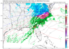
SnowwxAtl
Member
It is done here at that the airportDon't see much left but we'll see

