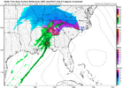
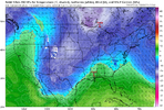
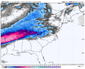
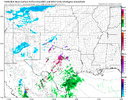
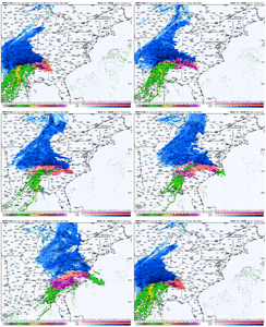
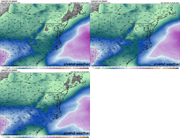
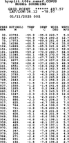
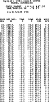
-
Hello, please take a minute to check out our awesome content, contributed by the wonderful members of our community. We hope you'll add your own thoughts and opinions by making a free account!
You are using an out of date browser. It may not display this or other websites correctly.
You should upgrade or use an alternative browser.
You should upgrade or use an alternative browser.
Wintry 1/9-12 Winter Potential Great Dane or Yorkie
- Thread starter SD
- Start date
Does anyone know if the FV3 and GRAF are run off the same parameters/ are similar? Because they are in lockstep this run .
Webberweather53
Meteorologist
This is one of those storms where I can see the front end thump over performing, especially down in GA, but the warm nose on the back end also over performs as well.
NAM 12 km is too dry while the HRRR is just right now.Is the snow is Texas over preforming or is it as modeled so far?
Webberweather53
Meteorologist
Out to hour 36 on the NAM and it at least appears that the low is not going to run up the Apps as it moves east just north of I-10 and then it looks like it tries to transfer to a new low in eastern SC along what I’m guessing is the wedge boundary. Looking at the soundings, that 700mb warm nose is there obviously but looks quite shallow
ForsythSnow
Moderator
Basically Fgen will overperform but also gives us more warmth. Will have to see how that goes but seems logicalThis is one of those storms where I can see the front end thump over performing, especially down in GA, but the warm nose on the back end also over performs as well.
Webberweather53
Meteorologist
This was the nam yesterday for right now in Texas, take a look at the ping reports for verification (spoiler: lots of snow)
View attachment 161775
Heavier precipitation helps a lot there as you need sufficient lift in the snow growth zone to generate snow. Even a fully below freezing sounding, but with little-no lift there can generate light ZR/IP.
Psalm 148:8
Member
- Joined
- Dec 25, 2016
- Messages
- 344
- Reaction score
- 789
So question.. I’ve been told about the 540 line and it being a marker for where the general idea for snow precipitation is located.. have seen many maps in the feed where precipitation type is snow, but 540 is much farther north??Fv3 to 33 and front band looks great
View attachment 161765
Question 2… unless the crazy NAM is right with a much further north track, we are less than 24 hours from when the start of precipitation.. will be frozen.. likely causing hazardous driving conditions..BMX has a winter wx advisory already issued down to Lee county.. FFC still has no winter wx advisory below their watch counties.. again.. we are less than 24 hours for the start of the event! What gives?? You would think the offices would coordinate better than that!! They have done this for years!! Why??
Because it’s going full tilt. This would be the equivalent of a coastal showing up on the models here days in advance only to go full tilt at the last minute and annihilate the 85 corridor with a foot+This was the nam yesterday for right now in Texas, take a look at the ping reports for verification (spoiler: lots of snow)
View attachment 161775
View attachment 161776
NAM isn't unreasonable...snow NW of 85...lot of sleet in a transition zone. It's probably more right than wrong...
View attachment 161767View attachment 161768
It also basically completely blanks AL/MS/GA which is not in line with any other non-related model. Not impossible, but I’d certainly put the odds against it.
This is one of those storms where I can see the front end thump over performing, especially down in GA, but the warm nose on the back end also over performs as well.
Was thinking the same…like February 2014 and some other storms. There, we changed over to IP quicker than expected, but the front end thump was stronger than expected and we still met our snowfall predictions.
Stormsfury
Member
Massive change up North with the bundled northern energy in the UP of Michigan versus SE Wisconsin. That's a quite a 300mile shift NE in just a 6 hr window for the HRRRReally respectable run. Seems like the more positive tilt S/W trend is helping us out further east in NC to flatten it out last minute and have a more W -> E orientation instead of SW -> NE View attachment 161740View attachment 161741
Just woke up, so metro Atlanta ice to rain yet or more freezing rain?
Icy wet slop fest. FFC covers pretty well in AFD
Code:
SHORT TERM...
(Today through Friday)
Issued at 421 AM EST Thu Jan 9 2025

No changes to the Winter Storm Watch were made.

High pressure across the central part of the county will push
eastward today. Meanwhile, a low pressure system will develop in the
western Gulf of Mexico and move northeast. As the low pressure moves
onshore early Friday, a wedge will begin to build down across the
eastern portion of the CWA.

High pressure and dry conditions will prevail today. Temperatures
will remain 5 to 15 degrees below normal for this time of year. Most
of the overnight period will remain dry, but the isentropic lift
over the wedge will be increasing. Mid and high level cloudiness
will thicken.

From run to run, the models have trended towards more freezing rain
and less snowfall. The warm nose aloft around 700mb to 750mb looks
to move in earlier and and stronger than previous models runs. This
means a messy precip-type forecast for much of north and central GA.

Temperatures within the wedge will hover at or below freezing. As
always, there is some question of how much the wedge will erode
from the south side on Friday. BL winds do support the most
erosion from CSG to MCN southward. One of the forecast problems of
the day will how much erosion of the wedge will occur between the
MCN-CSG line to the Interstate 20 corridor. Do think that some
warming through the day is possible, but not confident on how
much. The NAM is the most aggressive with the cold air and usually
does the best with the wedge. However, the overall evolution of
the low pressure system looks suspect. The GFS seems to handle the
synoptic pattern better. So, have taken a blend of temps that are
slightly warmer than the NAM at the surface. The wedge will
likely hold firm north of the Interstate 20 corridor, even
including metro ATL.

Precip chances will begin to increase from the west after 2AM Friday
morning. At onset, it should be cold enough aloft for some light
snow. The snow may mix with rain in the far south where temperatures
will be closer to above freezing. As the day progresses,
temperatures should hold at or below freezing within the wedge.
During the late afternoon into the evening, the warm nose aloft
moves overhead and the p-types will get a lot more messy. A mixture
of snow, sleet and freezing rain will be likely where temperatures
are below freezing. Where temperatures hover just near freezing a
mixture of rain/freezing rain will be likely. Further north
across the mountains, more sleet and freezing rain will mix with
the snow, cutting the snowfall amounts.

NListemaaIt doesn't blank them...it's a huge sleet storm 2-3". Would be like an ice skating rink..would be kind of cool. Maybe they get 1-2" and then a hammering of sleet. Would be awesome.It also basically completely blanks AL/MS/GA which is not in line with any other non-related model. Not impossible, but I’d certainly put the odds against it.
Was thinking the same…like February 2014 and some other storms. There, we changed over to IP quicker than expected, but the front end thump was stronger than expected and we still met our snowfall predictions.
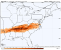
i keep on seeing “Apps Runner” thrown around, but has any model actually shown that? Seems like there’s been some Miller B-type systems, but I thought even the worst HRRR runs would’ve transferred to a secondary low off the coast eventually (granted, perhaps too late for any of us to benefit)?
It doesn't blank them...it's a huge sleet storm 2-3". Would be like an ice skating rink..would be kind of cool. Maybe they get 1-2" and then a hammering of sleet. Would be awesome.
View attachment 161780
Sorry, I mean for snow specifically.
At least there’s virtually no way for any of us to get rained on here which is booking a win in my book3km looks reasonable...front end snow/sleet then flip to ice. Hopefully we stay sleet.
View attachment 161778
I’ve often noticed that in the south that the 540 line often doesn’t match up with the snow line. I’m sure one of the mets on here can probably give an explanation as to why. As for the coordination between neighboring field offices, I’ve noticed also at times here in the Carolinas that RDU and GSP often don’t look coordinated with advisories… I guess it’s something I noticed more because I’m close to the eastern edge of the GSP CWA. As for the NAM low truck, it does look like it is much closer to other modeling now with that 12z run, but obviously as has been pointed out, it still has that strong 700mb warm nose.So question.. I’ve been told about the 540 line and it being a marker for where the general idea for snow precipitation is located.. have seen many maps in the feed where precipitation type is snow, but 540 is much farther north??
Question 2… unless the crazy NAM is right with a much further north track, we are less than 24 hours from when the start of precipitation.. will be frozen.. likely causing hazardous driving conditions..BMX has a winter wx advisory already issued down to Lee county.. FFC still has no winter wx advisory below their watch counties.. again.. we are less than 24 hours for the start of the event! What gives?? You would think the offices would coordinate better than that!! They have done this for years!! Why??
RTRwx
Member
I would not love being a Met at MRX today. Where I'm at (1800' feet up just northwest of Chattanooga) - I've got Globals showing mostly snow and the Meso's showing:
HRRR - 6" snow and half inch of sleet
Fv3 - 9 inches of snow - all snow
NAM - Disaster - Trace to inch of snow and sleet storm of 2+ inches.
My question for you guys is this: At this range, which models do you put the most stock in on the ~700MB warm nose?
HRRR - 6" snow and half inch of sleet
Fv3 - 9 inches of snow - all snow
NAM - Disaster - Trace to inch of snow and sleet storm of 2+ inches.
My question for you guys is this: At this range, which models do you put the most stock in on the ~700MB warm nose?
An area that hasn't been talked about a lot is SE VA & NE NC. That area could end up getting a significant Winter storm from this if that low deepens as it pulls away.
SnowwxAtl
Member
The NAMI would not love being a Met at MRX today. Where I'm at (1800' feet up just northwest of Chattanooga) - I've got Globals showing mostly snow and the Meso's showing:
HRRR - 6" snow and half inch of sleet
Fv3 - 9 inches of snow - all snow
NAM - Disaster - Trace to inch of snow and sleet storm of 2+ inches.
My question for you guys is this: At this range, which models do you put the most stock in on the ~700MB warm nose?
it's out of respect for the rest of the board tbhAn area that hasn't been talked about a lot is SE VA & NE NC. That area could end up getting a significant Winter storm from this if that low deepens as it pulls away.
Psalm 148:8
Member
- Joined
- Dec 25, 2016
- Messages
- 344
- Reaction score
- 789
After we see 12z globals today, I’m keeping my bets on the HRRR and how it actually is verifying at the surface vs its future cast.The NAM
What are looking at? I have hour 33 up right now and it’s show the low just north of Pensacola12z Nam at Hour 33 has the Low in Johnson City TN
ahhh come on lol let's hear it!it's out of respect for the rest of the board tbh
- Joined
- Jan 23, 2021
- Messages
- 4,602
- Reaction score
- 15,197
- Location
- Lebanon Township, Durham County NC
rburrel2
Member
Pretty absurd that NWS GSP has "1 inch" total for the I-85 corridor. Worst case scenario, we're getting 2+ inches of sleet.
Or maybe they don't add sleet totals to their snowfall map? Which would be idiotic since the public would be affected the same way.
Or maybe they don't add sleet totals to their snowfall map? Which would be idiotic since the public would be affected the same way.
Roads treated. 30F with a sunny high of 38 expected. Frost heaving everywhere. Winter storm watch. Been way too long boys
I was looking on a phone. Saw L. You are right see lines nowWhat are looking at? I have hour 33 up right now and it’s show the low just north of Pensacola
Fascinated to see how far south FFC goes with the Winter Storm Warning here in a bit in Georgia. You could argue they don’t even need to go down to I-20 anymore
This would be wild for N AL. This would be more sleet than the historic sleet storm that we received last January. The temperatures were much colder last year for a week after the event, so that sleet stuck around a lot longer than this likely would.It doesn't blank them...it's a huge sleet storm 2-3". Would be like an ice skating rink..would be kind of cool. Maybe they get 1-2" and then a hammering of sleet. Would be awesome.
View attachment 161780
I think that is what we are in for locally. Maybe a couple inches tops and then a sleet stormIt doesn't blank them...it's a huge sleet storm 2-3". Would be like an ice skating rink..would be kind of cool. Maybe they get 1-2" and then a hammering of sleet. Would be awesome.
View attachment 161780
That would be a lot for us...I am thinking 0.5-1" of snow and 1" of sleet would be our best case.I think that is what we are in for locally. Maybe a couple inches tops and then a sleet storm
12z Nam at Hour 33 has the Low in Johnson City TN
Edit I stand corrected Its in SE AL, surface low
View attachment 161783
Low we are tracking is actually over south AL/GA on that image. The low over TN is more or less a reflection of the northern stream wave.

