• Hello, please take a minute to check out our awesome content, contributed by the wonderful members of our community. We hope you'll add your own thoughts and opinions by making a free account!

Wintry 1/9-12 Winter Potential Great Dane or Yorkie

yeah NAM’s prolly a little off with track but I think mix it’s warmer profile with rgem situation and you get something fairly realistic. Hrrrrrrr prolly best for front end thump.
 
An area that hasn't been talked about a lot is SE VA & NE NC. That area could end up getting a significant Winter storm from this if that low deepens as it pulls away.
Idk, I like the idea of it deepening just off the NE NC coast but not sure it's enough to help out much
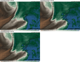
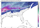
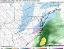
Although I will watch trends, for instance, the ICON shows a 997 with the slightest hint of a deform band on the backside, I do like it's trends at 700mb rh
1736435816725.png
1736435852635.gif
 
Idk, I like the idea of it deepening just off the NE NC coast but not sure it's enough to help out much
Although I will watch trends, for instance, the ICON shows a 997 with the slightest hint of a deform band on the backside, I do like it's trends at 700mb rh
View attachment 161800
View attachment 161802
Yeah I noticed the upper level energy diving in on the RGEM a little faster. There's just a little wiggle room that could beef up the moisture just a bit but not amp up the track enough to cause further mixing issues.
 
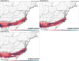
Ice totals creeping up on the RGEM:

View attachment 161803
I hate to say it but I think this axis of ice shifts about a row of counties or 2 NW. You can cut some of those totals but with temps below freezing, very cold antecedent conditions and very little runoff due to light/moderate rain, there could easily be pockets of .25. That's warning criteria I believe and could cause issues
 
Iv said it once and I’ll say it again. The Euro AI has blown the doors off every other model. It’s been rock solid and hasn’t budged.
This statement can only be made if it verifies, right now it hasn't happened so let's wait to see actual verification before we make that determination
 
RGEM is locked in...we don't fight it

View attachment 161796
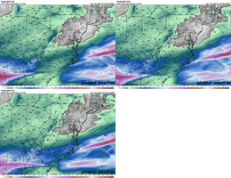
That band south of I20 is really interesting. That is where the RGEM is really consistent on that band of 0.5-0.75 band of ZR and sleet. If you overwhelm the column that could easily be a smash of 3-5” of snow.
 
Here is Nashville NWS thoughts on the NAM/Warm Nose....

As we head into Friday we will be in for some big changes as a
trough comes out of the West and a surface low develops over the
Gulf of Mexico and tracks to our south. This will put us in a
good spot for impactful snow across Middle TN. Warm air advection
will start over the area early Friday morning and light snow will
start to push into our southwest towards daybreak. Light snow will
continue to work northeast through the morning. A trough digging
into the Great Lakes will bring frontogenesis and increase warm
air advection with the system and bring light to moderate snow to
the area for the late morning and afternoon. As the low deepens
Friday morning into the afternoon a low level jet will amp up and
that will push a nose of warm air north. Ensembles and the HREF
support keeping that warm nose to our south with only a 10-30%
chance of 850 mb temps going above 0C mainly in our southern
counties. The latest NAM is much stronger with that jet over us
which pushes the warm nose much further north into our area and
would bring more rain than snow in the afternoon, at this time
that does seem to be an outlier and an unlikely solution. The most
likely solution is all snow for much of the area with some rain
mixing in at times in the afternoon for our far southern counties.
 
That’s important to remember. I’m not sure what FFC’s warning criteria is for sleet, but I know that GSP’s is .5”. With ground temperatures as cold as they are, .5” of sleet will absolutely have the impact of a major winter storm

Yeah, let’s not forget a single inch of snow/sleet/ZR led to chaos (“Snowmaggedon”) in Atlanta in 2014. A similar thing happened in Raleigh in 2005.

 
I was an advocate for this thing to be more amped, and now with the sleet line on my doorstep on the NAM I guess I got my wish?

Generally I was hoping for more amplitude in our iteration of the trough in the eastern 2/3s. Early runs had it, then lost it, as the Baja low stretched the energy into some ugly positively tilted fold and we lost some northern stream support. Good enough for some, but my chief concern was qpf, and when you have low qpf that's when you can light snow/34/no sticking conditions, which isn't a complete L but still very frustrating.

What i didn't see coming was both the Baja low deepening more and this dumb shortwave appendage rotating around it and going negative tilt over Mexico. Generally this doesn't happen. This is already a highly anomalous event. The Cali fires and the winds that fanned them are directly related to the unusual position of this wound up low and the associated impacts.

Anticipating this little move on Monday would be impossible
View attachment 161784
So we got our amplitude but not by my desired method, this little move is what causes the WAA surge and pumps up heights ahead of the system. Broadly, this storm will feature a lot of P-types for the south. I noticed a lot of ill-will towards people rooting for a more amped solution, which I get, I think if you're in Huntsville and tenuously on the right side of the snow line it may seem punitive if the eastern folks want to amp things up so they get there's. I thought generally a more amped solution would be a tide that lifted more ships, as evidenced by model runs earlier in the week, but because it happened at the Baja low we're at risk for less pleasant solutions. So it goes.
Good post. Yeah we’ve been paying attention to a lot of different things over the past week, but probably not anticipating that the eastern ridging ahead of the big baja wave was going to explode. NAM seems to be on it’s on for the most part this morning, but we’ve been burned by some of its successes in the past
 
Damn! I had to finally see where the hell Huntersville was. From Charlotte to Hunterville? Dude, that's a 5 minute drive or a 30 minute walk from what I can tell. :D :D

Nah that’s legit 20 miles lol …. Hwy 73 is the cutoff Most Storms around here For CAD.

Huntersville- 20 Miles
Davidson - 25
Mooresville - 30
Troutman - 35
Statesville - 40 miles away from Uptown


Sent from my iPhone using Tapatalk
 
Good to see the QPF beef up. I kind of expected that, but was frankly getting a little nervous yesterday. FV3 is probably best case scenario, and the NAM is the worst. I like the RGEM's overall consistency.

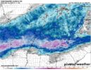
Probably a good 1-3" inches within the main corridor with at least some mixing throughout much of the area.

Travel is going to be a big time mess, given the cold antecedent conditions and the cold after. We're a couple of more plus-ups in QPF away from a fairly major storm, like @Metwannabe said above, if we're not there already.

rgem_asnow_seus_50.png
 
We have Hi-Res models SCREAMING IN OUR FACES that the warm nose is not going to be an issue for many, and yall still hugging the stanky cousin NAM.....yall are wild!
The warm nose is definitely going to be an issue. How big of an issue is TBD.
 
The warm nose is definitely going to be an issue. How big of an issue is TBD.

Right. I mean we can see it with Dallas right now. They're still struggling with mixing. I was looking at their TWC forecast and the snow amounts have downgraded over the last hour. They just haven't been able to make the transition to all snow.
 
Be prepared for major shifts southward with snow line and a pretty major increase in totals. QPF almost ALWAYS trends up in these scenarios, and that trend is already ongoing. Dynamic cooling will show up for some people and bring some big surprises (see RGEM - south of Birmingham for this starting to get picked up). I understand the pessimism amongst the board, but I'm telling you now, this is a board wide major storm.....24 hours away. Enjoy it!
 
Right. I mean we can see it with Dallas right now. They're still struggling with mixing. I was looking at their TWC forecast and the snow amounts have downgraded over the last hour. They just haven't been able to make the transition to all snow.
Dallas is accumulating snow as we speak....all snow falling across the metro.
 
Nah that’s legit 20 miles lol …. Hwy 73 is the cutoff Most Storms around here For CAD.

Huntersville- 20 Miles
Davidson - 25
Mooresville - 30
Troutman - 35
Statesville - 40 miles away from Uptown


Sent from my iPhone using Tapatalk
I am always intrigued by the micro climates of given areas so this is helpful. The CAD thing haunts us here because of 4K+ foot mountains just to our east and north in Gilmer County. We love NW flows though.
 
Back
Top