-
Hello, please take a minute to check out our awesome content, contributed by the wonderful members of our community. We hope you'll add your own thoughts and opinions by making a free account!
You are using an out of date browser. It may not display this or other websites correctly.
You should upgrade or use an alternative browser.
You should upgrade or use an alternative browser.
Wintry 1/9-12 Winter Potential Great Dane or Yorkie
- Thread starter SD
- Start date
It will be interesting to see if Athens makes it to its projected high of 47 today
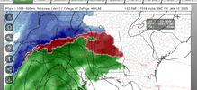
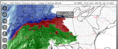
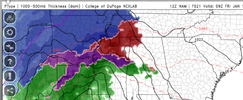
If that’s right, then the evening rush hour in CLT metro is gonna be a mess.Always nice to have the RAP on your side *NSFW*
View attachment 161825
- Joined
- Jan 5, 2017
- Messages
- 3,774
- Reaction score
- 5,985
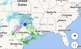
It's snowing in Dallas at a good rate now. It's pretty much all snow.
rusrius
Member
Happy Birthday and thanks for all the hard work. It is greatly appreciated.Starting to snow again here in southern NM underneath the upstream upper low.
Hard to complain about having snow on my birthday
View attachment 161808
There's going to be that narrow transition line going through our area (as normal). The latest RAP had ~2" of snow/sleet and over a quarter inch of freezing rain at RDU. That qualifies for winter storm criteria. That's going to be the unknown even right up to this event starting. Where are the transition line???I kinda think that there will be some kind of 3-4” lollipop somewhere east of 77 along 85.
I well say this if you compare the model runs of the NAM on precip type alone on the majority of runs yesterday compared to ground truth... It missed pretty bad in the 8am to 12pm window so far much more snow/sleet then freezing rain
ITUSETOSNOW
Member
And they are right at 32It's snowing in Dallas at a good rate now. It's pretty much all snow.
NBAcentel
Member
Probably right over downtown honestly. I think north hills could totally end up getting 2” while Garner gets 0.5” and iceThere's going to be that narrow transition line going through our area (as normal). The latest RAP had ~2" of snow/sleet and over a quarter inch of freezing rain at RDU. That qualifies for winter storm criteria. That's going to be the unknown even right up to this event starting. Where are the transition line???
Tsappfrog20
Member
There's going to be that narrow transition line going through our area (as normal). The latest RAP had ~2" of snow/sleet and over a quarter inch of freezing rain at RDU. That qualifies for winter storm criteria. That's going to be the unknown even right up to this event starting. Where are the transition line???
Yea I definitely thinks RDU pulls the trigger on Winter Storm Warning
Sent from my iPhone using Tapatalk
LovingGulfLows
Member
- Joined
- Jan 5, 2017
- Messages
- 1,499
- Reaction score
- 4,100
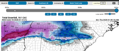
Man... Avert your eyes now ALOT of this is Sleet totals I presume especially south of I-20 but man RAP made a big jump toward GFS/FV-3/RGEM
View attachment 161827
Kind of looks like the Euro AI....hmmm. If that model ends up nailing this event, we may have a new king in town.
ITUSETOSNOW
Member
The same thing will happen in ATL< plus it has been colder here.
WolfpackHomer91
Member
Important to know that the GFS has fallen in line with keeping the SFC low south aligned with the wedge line, so less to transfer to the coast/more consolidated low ... Less transfer, more moisture (less is lost due to transfer energy).
With 30hrs to play with here in NC, Is there a Cap to that? Or is there any possibility we could sneak that .5 - .75” QPF line further to Western Piedmont atleast 77 Corridor
Sent from my iPhone using Tapatalk
Drizzle Snizzle
Member
And Atlanta is higher in elevation ! Elevation has to help right ?The same thing will happen in ATL< plus it has been colder here.
ITUSETOSNOW
Member
Usually,,, DFW was in the 70s a few days ago.And Atlanta is higher in elevation ! Elevation has to help right ?
I can confirm. I have a terminal there and we just shut down our drivers from leaving due to deteriorating road conditions.It's snowing in Dallas at a good rate now. It's pretty much all snow.
I don't know if I will concur 100% yet that same thing will happen in ATL because the WAA elements later on are a little different especially as storm continues on but we definitely are in a war of models and ground truths now and I do think the initial wave will be much more punchy on the snow/sleet front into parts of ATL compared to some guidance has showed... I think the RGEM/RAP/FV-3 are picking up on that I do still see a hard transition in afternoonThe same thing will happen in ATL< plus it has been colder here.
Pilotwx
Member
RAP is a big hit:
Could be convective feedback problems with T'storms and heavy rains to the south that could be what a lot of models could be seeing so this would cut number down farther North . If RAP has no convective feedback issues I could see why NW NC , Northern NC into much of VA numbers have increase on the RAP. This maybe what the RAP is seeing . But it is the RAP
Could be convective feedback problems with T'storms and heavy rains to the south that could be what a lot of models could be seeing so this would cut number down farther North . If RAP has no convective feedback issues I could see why NW NC , Northern NC into much of VA numbers have increase on the RAP. This maybe what the RAP is seeing . But it is the RAP
The situation in Dallas does send positive vibes - and I want a big snow. The trends here have been disappointing and maybe, just maybe, we still can get that big snow. However, I do not think Dallas equates to us in terms of the GOM and I fear that as this low develops and taps the gulf, that warm nose will rear its ugly head more. I am hoping that the storm does not cut quite as much as it is showing and that will help keep the WAA at bay some. Really do not want to be out of power for a few days with an ice storm!
But isn't it fun to have something to be excited about?!? Hoping we all can avoid pain from a missed opportunity. I still have not gotten over Groundhogzilla from a few years ago!! Good luck to all of us!! May we all get some type of win!!
But isn't it fun to have something to be excited about?!? Hoping we all can avoid pain from a missed opportunity. I still have not gotten over Groundhogzilla from a few years ago!! Good luck to all of us!! May we all get some type of win!!
NBAcentel
Member
Downeastnc
Member
Sure in fact it's probably likely....also the more consolidated and south the low is the more deep farther south cold you have typically.With 30hrs to play with here in NC, Is there a Cap to that? Or is there any possibility we could sneak that .5 - .75” QPF line further to Western Piedmont atleast 77 Corridor
Sent from my iPhone using Tapatalk
ForsythSnow
Moderator
Anyone with ease of access know how the 500 vort energy is verifying currently? If DFW is colder I have to wonder if we did go less amped and how we may translate this east.
Storm5
Member
Good seeing the hrrr trend alot colder vs previous runs
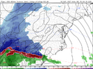
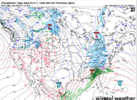
I just looked and even across the upstate over to just south of CLT, that’s still a snow sounding where it’s showing a mixThis is the hope of getting a surprise/something more then expected View attachment 161835
Latest GRAF
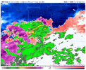
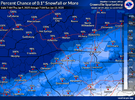
Only 43% in CLT!Y’all would have taken this look a month ago but now y’all mad smhhhhView attachment 161842
WolfpackHomer91
Member
ChattaVOL
Member
Including the cities of Powells Crossroads, Murphy, Cartwright, Signal Mountain, Hayesville, Andrews, Archville, Hiawasse Dam, Martin Springs, Topton, Whitwell, Unaka, Monteagle, Reliance, Benton, Chattanooga, Conasauga, Violet, Brasstown, Cagle,
Tusquitee, Turtletown, Parksville, Cleveland, South Pittsburg, Big Frog Mountain, Marble, Haletown (Guild), Dunlap, Ducktown, Shooting Creek, Jasper, Lone Oak, Lookout Mountain, and Tasso
1146 AM EST Thu Jan 9 2025 /1046 AM CST Thu Jan 9 2025/
...WINTER STORM WARNING IN EFFECT FROM 7 AM EST /6 AM CST/ FRIDAY TO
7 AM EST /6 AM CST/ SATURDAY...
* WHAT...Heavy snow and mixed precipitation expected. Total snow accumulations between 2 and 5 inches and ice accumulations up to one tenth of an inch.
* WHERE...Portions of southwest North Carolina and east Tennessee.
* WHEN...From 7 AM EST /6 AM CST/ Friday to 7 AM EST /6 AM CST/
Saturday.
* IMPACTS...Roads, and especially bridges and overpasses, will likely become slick and hazardous. Plan on slippery road conditions. The hazardous conditions could impact the Friday morning and evening commutes, and the Saturday morning commute.
PRECAUTIONARY/PREPAREDNESS ACTIONS...
If you must travel, keep an extra flashlight, food, and water in your vehicle in case of an emergency. The latest road conditions for the state you are calling from can be obtained by calling 5 1 1.
Persons should consider delaying all travel. Motorists should use extreme caution if travel is absolutely necessary.
&&
Sent from my iPhone using Tapatalk
Through 7am SundayTimestamp 7AM
Sent from my iPhone using Tapatalk
NBAcentel
Member
7AM Thursday - 7AM Sunday, no?Timestamp 7AM
Sent from my iPhone using Tapatalk
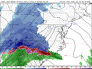
it’s juicy for sure where are you staying for this storm I know concord will mix do you need a cabin further north I have bunk bedPosting this just for fun given it’s unlikely. But the RAP is really juicy View attachment 161844

