Sunday we will all be back in Jan thread looking for the next one. If it ever does snow a 6-12 incher again, its never enough, just makes you crave more.The amount of effort and time spent over two weeks to track what will end up being an inch of snow, maybe, is honestly astonishing.
It really should not be this hard or uncommon to get an inch of snow.
-
Hello, please take a minute to check out our awesome content, contributed by the wonderful members of our community. We hope you'll add your own thoughts and opinions by making a free account!
You are using an out of date browser. It may not display this or other websites correctly.
You should upgrade or use an alternative browser.
You should upgrade or use an alternative browser.
Wintry 1/9-12 Winter Potential Great Dane or Yorkie
- Thread starter SD
- Start date
MichaelJ
Member
00zGFS is a tick east and south of the 18Z to my eyes and goes over Wilmington which is not good news for the Raleigh folks for snow, more of a mix
I'm already looking for the next one lolSunday we will all be back in Jan thread looking for the next one. If it ever does snow a 6-12 incher again, its never enough, just makes you crave more.
NAM and the other short range must be struggling with the energy/convective deal. Globals holding serve, albeit small noise differences at 500mb. The short range are over playing something that my pea brain isn't going to figure out.
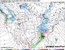
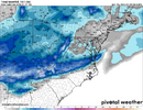
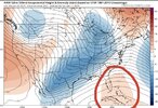
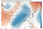
NAM does this whereas GFS does not. Is that just the NAM trying to over amplify at the last minute? If not we will be battling an SER by 12z tomorrow lolNAM and GFS at 48 hrs are just slightly different at H5.
View attachment 161616View attachment 161617
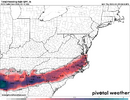
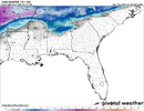
Just some slight differences with the surface low.
View attachment 161618View attachment 161619
NEGaweather
Member


Sent from my iPhone using Tapatalk
ForsythSnow
Moderator
If you check the 509 vort maps on the NAM it's struggling to find what to do with the energy coming down currently but it's leaning with the data it has into amping it up way more. Whether the European and UK do the same will be seen. We need a verification before we declare over I think.NAM and the other short range must be struggling with the energy/convective deal. Globals holding serve, albeit small noise differences at 500mb. The short range are over playing something that my pea brain isn't going to figure out.
I was just going to say that. I really hate the NAM. I know it has its uses. But good lord. How many times have we seen HUGE bouncing around within 48 hours? Like, a whole bunch.NAM and the other short range must be struggling with the energy/convective deal. Globals holding serve, albeit small noise differences at 500mb. The short range are over playing something that my pea brain isn't going to figure out.
Ron Burgundy
Member
So 1.5” SN, 1” IP and 0.30” ZR

Sent from my iPhone using Tapatalk
Quite the winter sandwich for ATL on GFS
NorthGaWinter4
Member
Are you saying lights out bc of ice? Bc I think thats our worst case scenarioIf you check the 509 vort maps on the NAM it's struggling to find what to do with the energy coming down currently but it's leaning with the data it has into amping it up way more. Whether the European and UK do the same will be seen. We need a verification before we declare over I think.
MichaelJ
Member
Yes, it only has us with .3 totalGfs has almost come full circle from its previous day tracks. Still needs some work. Paultry with qpf across NC, compared to other guidance.
View attachment 161620
lusting4Adusting
Member
I know this is banter, but I ain't gonna spam y'all with it, so I'm just gonna share this here. This thread is amazing, it 1000% feels like an old talk weather thread from 10 years ago. Storm5 is heading to Marshall County, Brick has stopped in, although he should be here cliff jumping this last NAM run, Dsaur may get to break out his sled, stormlover is all hyped, jll is all worried, the insane 10+ inch runs, the sudden NAMed northwest express. This storm has it all. All that's left is for Brad Travis to drop back in and give us his personal forecast again. lol. Absolutely love reading all of y'all's thoughts and appreciate the hell out of this place that I found years ago wondering if it might snow. Been fun quietly tracking along with you guys and gals. Hopefully most of us get to enjoy some Snow .
ForsythSnow
Moderator
Depends on the warm nose intensity and rain intensity. A further north nose would definitely bring rates up and temp up, so sleet may not have time to freeze. We already are riding in very cold.Are you saying lights out bc of ice? Bc I think thats our worst case scenario
beanskip
Member
Canadian also quite similar to its prior runs. Got colder in N. Ga. No NAM buffoonery.
BufordWX
Member
In regards to N GA I said before that I was worried about ice accumulation with this system and most high res models still show this as a threat. Even if its not a lot of snow there is still good chance of IP and ZR and hopefully its more of the former than the latter.
Definitely lights out here on the WRFs and RDPS. Over half an inch of ice, an inch or two of snow and probably some sleet to boot. Fun.
I really hate to say this but the next hour will tell us what is up. If the EURO and
yep bigger storms are fun to see but not fun to work in.Sunday we will all be back in Jan thread looking for the next one. If it ever does snow a 6-12 incher again, its never enough, just makes you crave more.
I think TTs shading is pretty sensitive. If you look at the height contours, they are only slightly different down there haha. It's slightly more ridging in the NAM, but within the noise IMO.NAM does this whereas GFS does not. Is that just the NAM trying to over amplify at the last minute? If not we will be battling an SER by 12z tomorrow lolView attachment 161622View attachment 161623
Glad to be here in bama for this thing
Sent from my iPhone using Tapatalk
Pops
Member
Gfs make people feel a little better..on to euro
MichaelJ
Member
Canadian 00Z holds serve. Actually increase a little over 18Z
generally for the nam i think the energy in cabo san lucas rounded the base of the trough in a more efficient manner than the gfs which caused slightly more deepening and a slightly stronger vort max racing NE, which in response kicked up more waa and raised heights downstream. it's a hairline difference that has downstream consequences.NAM does this whereas GFS does not. Is that just the NAM trying to over amplify at the last minute? If not we will be battling an SER by 12z tomorrow lolView attachment 161622View attachment 161623
i never want to reference cabo can lucas in a thread again unless it's because i'm traveling there
EmilyWx
Member
It's important to remember computer models are just generating one *possible* solution to a forecast. It’s more important to interpret the models correctly and not get too hung up on a specific solution. Focusing on trends, historical/past events, climatology, and other tools is usually key. Everyone here knows winter weather forecasting, particularly in the south, is extremely tedious and things change quickly. Thank You to all the hard working meteorologists who have been working to try and figure this one out. A lot remains unknown so it's best to continue using your local NWS office for updates. Hope everyone stays warm (or for snow the opposite lol) and safe! Have a good one!
accu35
Member
EmilyWx
Member
From past experiences for many areas this may be a "track the storm as you go" kind of event
Starts around 12:15 ESTNew to this discussion despite lurking for a while. When does the Euro run actually come out?
11:30 central timeNew to this discussion despite lurking for a while. When does the Euro run actually come out?
ChattaVOL
Member
I vaguely remember the NAM doing this to storm in 2014 (?) or 2015… and it corrected the next run.
Date may be off on that.
Sent from my iPhone using Tapatalk
Date may be off on that.
Sent from my iPhone using Tapatalk
The UKmet at 18z was the best run for Rah, dumping 3.5. See if it can hold that finger band that all models show across NC in the same spot, without edging it north toward Va state line. Someone east of Apps will be inside that and hang a 3-4.5 lollipop, just barely avoiding the sleet by the skin of their teeth. Its been there for days on all the AI,physics and ens models.
I vaguely remember the NAM doing this to storm in 2014 (?) or 2015… and it corrected the next run.
Date may be off on that.
Sent from my iPhone using Tapatalk
Wasn’t 2015. It burnt all the other models so bad they couldn’t show their face for a week.
i think the ceiling on this storm, especially east of the savannah river, is much lower than any of the landmark events in 2014/2015I vaguely remember the NAM doing this to storm in 2014 (?) or 2015… and it corrected the next run.
Date may be off on that.
Sent from my iPhone using Tapatalk
Im riding the euro AI,Crass,Can,Rgem,Euro op,Ukmet,ICon . They all stay lined up on top of each other, consistently for the most part.
That’s exactly what it’s going to be and that mix line is going to be racing north quickly once the finger band stuff pushes through. Correlation coefficient is going to be wild Friday evening.From past experiences for many areas this may be a "track the storm as you go" kind of event
WolfpackHomer91
Member

Not the big amounts of course in the mountains …. But this doesn’t look unrealistic, 2-3” , 1/10 -1/4” ICE and Sleet. Anyone have H5 Charts for this ?
Sent from my iPhone using Tapatalk
SimeonNC
Member
Doing some early now-casting, if you look at the radar, precip over Texas is a lot more robust than modelling had at this point.

