-
Hello, please take a minute to check out our awesome content, contributed by the wonderful members of our community. We hope you'll add your own thoughts and opinions by making a free account!
You are using an out of date browser. It may not display this or other websites correctly.
You should upgrade or use an alternative browser.
You should upgrade or use an alternative browser.
Wintry 1/9-12 Winter Potential Great Dane or Yorkie
- Thread starter SD
- Start date
albertwilsonjr
Member

Sent from my iPhone using Tapatalk
buckinbronco
Member
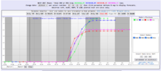
Very minor increase in N AL. Also, your mean is double mine!SREF Plumes increased for us here in the Mid-South:
View attachment 161539
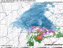
Why is everyone taking so much stock in the NAM. This model hasn’t been reliable for a long time.
Because NAM isn't on our side this run lolWhy is everyone taking so much stock in the NAM. This model hasn’t been reliable for a long time.
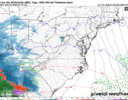
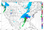
This NAM run ain’t worth a velvet painting of a whale and a dolphin getting it on. Look at that radar depiction lolol next
Six Mile Wx
Member
Put your stock in the Euro Operational until it lines up with the NAM and then look at the NAM precipitation type and rates!
The NAM has done really well up my way the last 2-3 years, a lot of times it will be the first to show snow for me and the GFS and Euro have to catch up! We can’t just toss the NAMWhy is everyone taking so much stock in the NAM. This model hasn’t been reliable for a long time.
BlueRidgeFolklore
Member
With all due respect, and remember I'm saying with all due respect……. I agree with you.This NAM run ain’t worth a velvet painting of a whale and a dolphin getting it on. Look at that radar depiction lolol next
I do agree about the HRRR. It’s purpose is strictly for near term now-casting. The one thing it’s useful for beyond that is picking up on WAA driven FGEN forced bands. It absolutely nailed the front end band that set up with the first January 2022 storm that set up over the SC Upstate and NC southern Foothills and Piedmont from about 24 hours out.I used to always say, “Friends don’t let friends get HRRR’d / RAP’d.” Unless there’s been improvements I’m unaware of, neither of these models are particularly useful on the periphery of their range, IMO, and since they run so often you’ll get plenty of solutions you like and plenty you hate. IIRC, the HRRR in particular had a strange tendency to both overamp systems and at the same time also be too cold (at the surface, at least), though that may be out of date at this point.
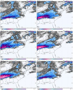
Man, the 18z AI Euro is amazing looking for the NC Piedmont.
NWMSGuy
Member
One thing I’m wondering about is how was the NAM handling the last system at this juncture compared to the EURO AI?
Cad Wedge NC
Member
Old EE rule .... I didn't think that still worked.Put your stock in the Euro Operational until it lines up with the NAM and then look at the NAM precipitation type and rates!
This really isn't true. Just back before Christmas, the NAM outperformed all other NWP guidance in Boston with a light snow event (for them) as it usually does in WAA / frontogenesis situations. It did seem to overdo the warm nose with the VA snow last weekend, so it, like everything else, isn't infallible. The NAM isn't as bad as it's made out to be in the short range, though. Truth be told, I use it basically every day for my operational forecastingWhy is everyone taking so much stock in the NAM. This model hasn’t been reliable for a long time.
Bottom line: when the NAM says thermals are an issue, I still listen. Especially when I've been concerned about it the whole time.
Snowflowxxl
Member
The NAM is a solid model. Toss it if you want but I wouldnt recommend
at what range(s) though?This really isn't true. Just back before Christmas, the NAM outperformed all other NWP guidance in Boston as it usually does in WAA / frontogenesis situations. It did seem to overdo the warm nose with the VA snow last weekend, so it, like everything else, isn't infallible. The NAM isn't as bad as it's made out to be in the short range, though. Truth be told, I use it basically every day for my operational forecasting.
Bottom line: when the NAM says thermals are an issue, I still listen. Especially when I've been concerned about it the whole time.
It did much better with the storm to our north on Sunday/Monday than any of the hi res models. It nailed down everything about 6 days before.I don’t see how it could verify when all the hi res models say different.
OHnoSnow
Member
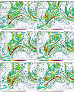
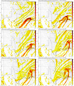
the NAM and the HRRR have the LP ticking north and intensifying. Look for that trend to continue. I think far north MS, extreme north AL and some of the NE AL foothills will get crushed. Southern TN extreme N GA and mountains will also do well. The rest of us in the mid-south will likely be cold rain with all the WAA.
Yeap and everyone just told you 36 HR hrrr is like 384 GFS so NAM honestly if this waa strickly a WAA conversation sure maybe give it soms grace but what it does with actually system seems completely wonkyNAM and HRR with similar LP track and placement? oy
RDUHeatIsland
Member
If that’s the case idk why we are even looking at anything else until it failsIt did much better with the storm to our north on Sunday/Monday than any of the hi res models. It nailed down everything about 6 days before.
Until the Euro and GFS push the low up into Alabama, I am not putting stock into the Ñam.
So we think the NAM and hr 48 HRRR has a better handle on the lp track than the gfs and euro? K.
Seriously its like the model stroked out and said ohh hey random thought how bout we make it a cutter up to CincinniatiUntil the Euro and GFS push the low up into Alabama, I am not putting stock into the Ñam.
It is hilarious… we probably should guessed this would happen. DohThis is pretty wild.
View attachment 161559
I understand the NAM has for the most done a good job of finding issues in thermals, but do you really think we can give this track of the low that the NAM and HRRR any real weight when other modeling has not come close to showing anything like it. A NW trend is one thing, but these two models look like there trying to turn a southern slider into a cutter or Apps runner when nothing we’ve seen in the H5 set up supports it.This really isn't true. Just back before Christmas, the NAM outperformed all other NWP guidance in Boston with a light snow event (for them) as it usually does in WAA / frontogenesis situations. It did seem to overdo the warm nose with the VA snow last weekend, so it, like everything else, isn't infallible. The NAM isn't as bad as it's made out to be in the short range, though. Truth be told, I use it basically every day for my operational forecasting.
Bottom line: when the NAM says thermals are an issue, I still listen. Especially when I've been concerned about it the whole time.
NCWeatherGeek
Member
One thing I have noticed is that the hi res models suffer from something we deal with a lot in the software engineering world. They get into the weeds and lose sight of the bigger pattern sometimes. Just an opinion but maybe it is why the AI model has done a better job. It is looking at the bigger picture for influences.So we think the NAM and hr 48 HRRR has a better handle on the lp track than the gfs and euro? K.
this is nutsBro this might be the biggest NW trend I've ever seenView attachment 161560

