-
Hello, please take a minute to check out our awesome content, contributed by the wonderful members of our community. We hope you'll add your own thoughts and opinions by making a free account!
You are using an out of date browser. It may not display this or other websites correctly.
You should upgrade or use an alternative browser.
You should upgrade or use an alternative browser.
Wintry 1/9-12 Winter Potential Great Dane or Yorkie
- Thread starter SD
- Start date
RTRwx
Member
Lol - HRRR has the LP headed to Tuscaloosa.
bud006
Member
Watching CBS affiliate out of Atlanta live stream on YouTube. Said they are using the GRAF model, calling 3-5 inches north of city with some mixing for my backyard late in the event (more icing threat along I-20 and through downtown). Still some adjustments to come, but (not sure who this meteorologist is) said he feels good about the amounts as of now.
—30—
—30—
Triplephase93
Member
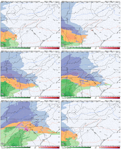
Hrrr @40.
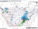
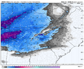
View attachment 161536
That rain snow line around the west Tn boarder doesn’t bode well for us further east On the state line.
NWMSGuy
Member
SimeonNC
Member
Is it safe to say that the HRRR is out to lunch here with the cutter solution?
thanksgivingbrown
Member
I hope soIs it safe to say that the HRRR is out to lunch here with the cutter solution?
wow
Member
The HRRR always draws you in then disappoints in the end
Pops
Member
Man that hrr is amped up..great snow for a while but that warm nose is crazy !believable?
NWMSGuy
Member
32.5F rainI've seen maps showing .50-1" of QPF, and only 1/2" of snow and 0.05" ice ? What's the rest of the precip ? Rain ?
NoSnowATL
Member
LP is off.I hope so
Cad Wedge NC
Member
Yeah, right now that is not the consensus. Huge outlier...Is it safe to say that the HRRR is out to lunch here with the cutter solution?
NWMSGuy
Member
Wonder if there will be any thunder/lightning in area’s with higher rates locally?
NBAcentel
Member
Has nonexistent in situ cad either va other guidance. lol. Probably a sign of a sucky 00z hrrr. But not concerned about this solution at all
I wouldn't say it's safe to say that. NAM3 has also been trending north with the low & CAD erosion.Is it safe to say that the HRRR is out to lunch here with the cutter solution?
It is very typical to see a NW trend in this range.
way off for sure. WowLP is off.
Triplephase93
Member
That warm nose and WAA is no joke.
I understand the sentiment. I’d rather look at everything and look for trends and consensus while weighting different models more at certain lead times. We are on a weather forum. That’s what we do.
Some of yall say not to look at models more than 5 days out, and then we are not supposed to look at globals less than 2 days out. You miss out on all of this fun tracking that way.
I always love the sentiment that we should just throw out all the models at zero hour, too, as if right before the storm isn’t when they should be the most accurate. I understand the sentiment about ground truth and OBS at that point, but modeling has a role to play all the way through the storm.
beanskip
Member
Reminder -- the HRRR's effective range is about the length of a baseball game. Looking at it beyond 5-10 hours (much less 30) is a colossal waste of time.
Tsappfrog20
Member
Let’s see if the nam follows the euro and rgem
Sent from my iPhone using Tapatalk
Sent from my iPhone using Tapatalk
rburrel2
Member
I'm digging the fact that the overheated Hrrr is still dropping 3 inches Clemson. If that's my floor... then somebody pinch me.
ChattaVOL
Member
Sent from my iPhone using Tapatalk
rburrel2
Member
The Hrrr is fizzling out the fronto death band over an area from Spartanburg to Columbia. It never makes it east of there and that's why the snow totals crash off.
- Joined
- Jan 23, 2021
- Messages
- 4,602
- Reaction score
- 15,197
- Location
- Lebanon Township, Durham County NC
Taking a 48 hour HRRR run seriously is like taking the 384 GFS seriously
Yeah, well, everyone starts the laser like focus about their own backyard. Whatever model fits their narrative, that's the model of all models. Same thing every winter threat.I always love the sentiment that we should just throw out all the models at zero hour, too, as if right before the storm isn’t when they should be the most accurate. I understand the sentiment about ground truth and OBS at that point, but modeling has a role to play all the way through the storm.
I used to always say, “Friends don’t let friends get HRRR’d / RAP’d.” Unless there’s been improvements I’m unaware of, neither of these models are particularly useful on the periphery of their range, IMO, and since they run so often you’ll get plenty of solutions you like and plenty you hate. IIRC, the HRRR in particular had a strange tendency to both overamp systems and at the same time also be too cold (at the surface, at least), though that may be out of date at this point.
Man, the 18z AI Euro is amazing looking for the NC Piedmont.
Man, the 18z AI Euro is amazing looking for the NC Piedmont.
My latest forecast thoughts, now with snow totals:


NWMSGuy
Member
Yep definitely an up tic in QPF. Nice to see this going back up on models today.I used to always say, “Friends don’t let friends get HRRR’d / RAP’d.” Unless there’s been improvements I’m unaware of, neither of these models are particularly useful on the periphery of their range, IMO, and since they run so often you’ll get plenty of solutions you like and plenty you hate. IIRC, the HRRR in particular had a strange tendency to both overamp systems and at the same time also be too cold (at the surface, at least), though that may be out of date at this point.
Man, the 18z AI Euro is amazing looking for the NC Piedmont.
NBAcentel
Member
um this nam run looks more closer to - tilt…. Might be a disaster
iGRXY
Member
NAM is also more amped thru 30
Yuck. Don’t like the way the NAM looks early on
beanskip
Member
NAM amp-y; heights rising in mid-South. Hmmmm.
Cad Wedge NC
Member
Folks, I am very surprised at how steady the Euro AI has been leading up to this event. It has had the same general idea for days now and is locked in. If this storm verifies, as this model has shown, this will be our go-to guidance for the remainder of the winter.I used to always say, “Friends don’t let friends get HRRR’d / RAP’d.” Unless there’s been improvements I’m unaware of, neither of these models are particularly useful on the periphery of their range, IMO, and since they run so often you’ll get plenty of solutions you like and plenty you hate. IIRC, the HRRR in particular had a strange tendency to both overamp systems and at the same time also be too cold (at the surface, at least), though that may be out of date at this point.
Man, the 18z AI Euro is amazing looking for the NC Piedmont.
Snowflowxxl
Member
Here’s comes the north trend, but hey, atleast some will get the QPF they were asking for! Lovely 33 rain
albertwilsonjr
Member
Graf not budging
Sent from my iPhone using Tapatalk
I don’t see how it could verify when all the hi res models say different.Folks, I am very surprised at how steady the Euro AI has been leading up to this event. It has had the same general idea for days now and is locked in. If this storm verifies, as this model has shown, this will be our go-to guidance for the remainder of the winter.

