-
Hello, please take a minute to check out our awesome content, contributed by the wonderful members of our community. We hope you'll add your own thoughts and opinions by making a free account!
You are using an out of date browser. It may not display this or other websites correctly.
You should upgrade or use an alternative browser.
You should upgrade or use an alternative browser.
Wintry 1/9-12 Winter Potential Great Dane or Yorkie
- Thread starter SD
- Start date
Blue_Ridge_Escarpment
Member
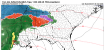
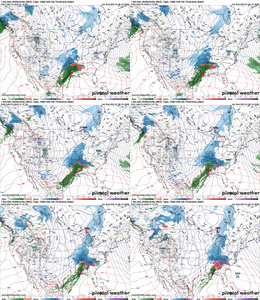
Hour 36 on NAM, pretty substantial shift in the tilt
BHS1975
Member
The 3k NAM will nail that warm nose.The main Baja SW is further ahead the kicker on the NAM. Likely means more WAA introduced quicker into the SE
I generally find with these maps it’s best not to look at the predicted totals outside their region of interest. He’s a NC weatherman and I wouldn’t look at it outside the state as he’s probably just drawing the lines to look “pretty” outside NC as much as anything and isn’t studying them as closely as their forecast area. Same with -------- or any other TV met, IMO. Maybe I’m wrong.I hate to nitpick but If Gainesville to Hartwell to anderson only gets a dusting to 1 inch this system would be a major bust. No guidance shows so little so not sure where he's getting that from
iGRXY
Member
Yeah the NAM is definitely less positively tilted
- Joined
- Jan 23, 2021
- Messages
- 4,602
- Reaction score
- 15,197
- Location
- Lebanon Township, Durham County NC
Yeah it well. If it agrees with the RGEM, it isnt a lock but it is as close as you can get.The 3k NAM will nail that warm nose.
beanskip
Member
Yeah, really pushing up heights in Tenn. valley vs. prior runs.Hour 36 on NAM, pretty substantial shift in the tilt
ForsythSnow
Moderator
Not the surface I'm worried for. Need the upper levels to chill off fast. The window is still open this run for that.
packfan98
Moderator
hr 45 has a stronger surface low than 6z.
Bet we get more qpf though lol.The main Baja SW is further ahead the kicker on the NAM. Likely means more WAA introduced quicker into the SE
nam appears stronger in the northern stream at hour 42
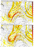
Fairly typical overrunning event here in the SE US on Friday.
Mid-level warm advection and isentropic upglide are the main forcing mechanisms for generating precip here.
Both are staples of southern slider events like this.
View attachment 161208
View attachment 161209
Generally, these types of events favor a general 1-3” / 2-4” broad swath of snow accumulation without as many winners and losers (i.e. situations where someone gets banded on and gets 6” while their neighbors get 1.5”) as a more amped system, right? Or am I remembering wrong? Been a while since we had one of these, haha!
Also, I want to say that in the past modeling had a tendency to underpredict QPF on overrunning events. Is there any truth in that still (or was there ever)?
Thanks to the third shift guys for staying up all night with the models and analysis. How much coffee did you drink? This thing is still looking like a go for N. Miss, Ala, and GA. Let's see if we can reel this bad boy in today! Hopefully the NAM will back off on the ICE.
NBAcentel
Member
Prob gonna result in a snowier finger band further eastBet we get more qpf though lol.
Blue_Ridge_Escarpment
Member
The tilt piece is not just a one run thing. If you toggle the past 3 runs it’s pretty clear.
Absolutely, although I’d personally expect it to underdo IP versus ZR oftentimes. So would expect some of that ZR to verify as IP (hopefully).It’s not necessarily the freezing rain maps, but the thermals. I haven’t paid attention recently, but Ive watched the RGEM school the other short range models in the past.
Last edited:
- Joined
- Jan 23, 2021
- Messages
- 4,602
- Reaction score
- 15,197
- Location
- Lebanon Township, Durham County NC
Atlanta might benefit this run. Also a thinner band of ZR at 48.Prob gonna result in a snowier finger band further east
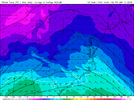
I don’t even know what we want…we want it both slightly more amped but colder. How does that even work.NAM might grant some wishes here. This is what y’all wantedlet’s see if it can meet the compromise and tie that fine line View attachment 161251
DAWG4LIFE
Member
Oh man! I would say those were the days but that was the day! Lol…I remember telling my son, please enjoy this one. This could be a once in a lifetime for you here in Georgia especially living in Dallas Georgia.Yep, my part of Georgia we haven’t seen a trace of snow since the surprise foot in Dec 2017
Absolutely, although I’d personally expect it to underdo IP versus ZR oftentimes. So wouldn’t expect some of that ZR to verify as IP (hopefully).
Yeah, I’m definitely thinking more IP than ZR. The models are notorious for underestimating cold at and around the 925mb
Blue_Ridge_Escarpment
Member
I’ll take my chances on more qpf, if temps aren’t quite there I’ll enjoy my sleet. Rather have a lot of something than a little of nothing.I don’t even know what we want…we want it both slightly more amped but colder. How does that even work.
here's a phrase from the archive- rates will matter- there could be a place like asheboro that gets maybe nothing because their precip is light at 34 and nothing sticks, whereas pittsboro gets a band and gets a sloppy 3-4 (all arbitrary examples)Generally, these types of events favor a general 1-3” / 2-4” broad swath of snow accumulation without as many winners and losers (i.e. situations where someone gets banded on and gets 6” while their neighbors get 1.5”) as a more amped system, right? Or am I remembering wrong? Been a while since we had one of these, haha!
of course, all of this may be null with how much deeper the NAM has the trough in texas right now
we wish for more precip which tugs our low inland, bombs it, and rains on us. So we get what we wanted but also don’t. It’s a lot of fun this placeI don’t even know what we want…we want it both slightly more amped but colder. How does that even work.
Didn’t see this posted, but FFC saying there’s a chance parts of N GA to overperform on snowfall totals before transitioning over to a mix. (6 inches or higher)
LONG TERM...
(Thursday night through Tuesday)
Issued at 344 AM EST Wed Jan 8 2025
Key Messages:
- A Winter Storm Watch is now in effect from 7 AM Friday to 7 AM
Saturday.
- Significant and impactful accumulations of snow, sleet, and
freezing rain are expected from Friday into early Saturday,
particularly near and north of the I-20 corridor.
A significant and impactful winter storm will be on our doorstep
at the start of the long term period, and a Winter Storm Watch is
now in effect for much of north Georgia from 12Z Friday to 12Z
Saturday.
Initial light precipitation will begin to overspread the area from
west to east Friday morning as a surface low progresses eastward
along the northern coastline of the Gulf of Mexico. Models have
continued to come into focus on a more suppressed southerly low
track, which brings higher impacts locally, particularly across
north Georgia through the day on Friday into Friday night.
Confidence remains high that far north Georgia, including the north
Georgia mountains, will see a snow event given profiles remaining
below freezing throughout the column in the area removed from
significant WAA aloft. Several inches of snowfall are thus expected
for these areas, with probabilities of seeing over 4" of snowfall
trending above 50-70% across the northern counties. A heavy, wet
snow typical of southern US snow events is expected given snowfall
ratios on the order of 7:1. There is also concern for snow total
overperformance within this favored area just north of the
transition zone, leading to a higher probability of totals for
some areas reaching or exceeding 6".
Farther southward toward the I-20 corridor, including the bulk of
the Atlanta metro, a mixed bag of precipitation remains likely given
the impact of the increasing warm nose aloft by Friday afternoon.
Given the trend of a more southerly storm track, forecast snowfall
totals and associated snowfall probabilities have inched upward near
and along the I-20 corridor, representing an expected period of
snowfall during the early portion of the winter storm before a ptype
changeover occurs through the latter half of the day. The current
forecast represents a gradual mix of ptype to occur from late
afternoon into Friday evening across this zone, with areas of
freezing rain becoming more likely. Thus, ice accretion is likely
on top of any earlier snowfall that occurs. Note that if freezing
rain becomes the dominant ptype for a more extended period, more
substantial ice accumulations would lead to increased power
outage concerns. Keep in mind as well that this exact transition
area is still uncertain and will likely fluctuate through future
forecasts.
To the south of this mixed precipitation area (generally points near
and south of the southern tier of the Atlanta metro), more
substantial warm air advection will limit winter precipitation
extent and accumulation. Any initial frozen precipitation will
more quickly transition over to liquid rainfall by afternoon.
Precipitation will gradually end from west to east by Saturday
morning. Travel impacts are very likely to linger through Saturday
across north Georgia as temperatures will struggle to rise very much
above freezing Saturday afternoon, particularly in areas with a
significant snowpack. Even within areas that melting occurs,
refreezing will be quick as temperatures plummet well below freezing
(into the teens) Saturday night.
Temperatures then remain well below normal through the remainder
of the forecast period with highs mainly in the 30s and 40s in
north Georgia and 50s in central Georgia while lows remain well
below freezing.
RW
I don't know that it's going to result in that much more QPF east of the Apps on this run, but I do expect short range guidance to at least stabilize the drying trend and possibly reverse it a little as we move in.
RTRwx
Member
At 51 hours, the low is a good 30-40 miles Northeast vs the 6Z NAM.
Batman36
Member
My take on these maps, NWS forecasts and many recent model runs is that there is a great deal of uncertainty in precip type. The good news is the trends are for colder temps during precip. and greater chances that precip is in frozen form even south of I-20 in GA. Many models are showing over .75 total QPF for ATL area give or take 50 miles north or south. Many times in my life, I have seen precip types in a scenario like this be uncertain until it is actually falling. That could very well be the case Friday. The other thing I have seen in situation like this one is that the northern side of the highest QPF is a very good place to be if you want a winter storm.This is such a strange map. Gainesville and Cherokee county 1-5" but in shading for 4-6? Atlanta less than 2" but on the border of 2-3 and 3-4?
iGRXY
Member
Sorry to those further west but we want this thing more amped back my way. We get more lift here off the mountains and dynamic cooling with rates can over perform borderline warm noses
WolfpackHomer91
Member
I’ll take my chances on more qpf, if temps aren’t quite there I’ll enjoy my sleet. Rather have a lot of something than a little of nothing.
100% ….If you’re in NC Anywhere along 85 or N/W I wouldn’t care about temps…. I’d start rooting for more QPF. Only places that will get screwed if it amps again is Ppl like Goldsboro, Fayetteville types ect
Sent from my iPhone using Tapatalk
NBAcentel
Member
Snow_chaser
Member
Yea, our elevation here has helped us many of times in the past. Malak05, you and I are in the highest elevation area of western Paulding county.It always seems too due to multitude of factors timing, elevation, frontogenesis in big storms a small stretch on the west side always gets a surprise bump in snow.
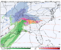
6z AI...been rock solid for places west of NC...for Raleigh the writing on the wall.
View attachment 161224View attachment 161225
Though you could argue the AI is folding towards the NWP models to some degree, verbatim that’s a 100 county Murphy to Manteo snowstorm in NC with widespread 2-4”+ across the state, which would honestly be relatively remarkable in its own right (last storm like that was maybe 2014 or 2010?).
Snowflowxxl
Member
People think they want this more amped, prepare to cry when temps are your issue come go time
beanskip
Member
Complete tunover to rain in northern Mississippi by 15z Friday on 12z NAM -- definite warming trend there.
EDIT: Could be partially due to crappy graphics, though, as surface freezing line didn't retreat as much as it looked like it would.
EDIT: Could be partially due to crappy graphics, though, as surface freezing line didn't retreat as much as it looked like it would.
Carolina folks are about to get screwed by that warm nose on this run too I’m afraid


