• Hello, please take a minute to check out our awesome content, contributed by the wonderful members of our community. We hope you'll add your own thoughts and opinions by making a free account!

Wintry 1/9-12 Winter Potential Great Dane or Yorkie

These model trends are looking awesome for North Alabama. When do they normally start looking at putting out watches?

On a side note, I want to personally thank the peeps that put the time and effort posting the models, the evaluations of those models, and the ones that take time to fulfill the IMBY requests. You guys are the real heroes!
 
See what you are saying there. So many of us want the trough to tilt positive overall, but sharpen to neutral at the base
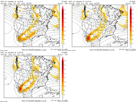
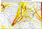
here's where i've landed- we want a mix of both- positive tilt on the southern half and more negative on the northern half. we want the entire trough to look like a bow
1736269602287.png
when the entire feature is more neutrally tilted we get more height rises out ahead of it, which nobody wants, even puts me at risk. however when that entire feature is too positively tilted we get a strung out mess and we're squeezing qpf out of a stone

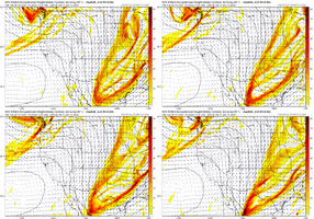
when the southern half is more positively tilted, it leaves that vort appendage in in baja. I think we want this. GFS and other have been trending this way. adios. i like this trend a lot because when we detach this piece it allows for a cleaner vort down the line. like pruning a crepe myrtle
gfs_z500_vort_wus_fh78_trend.gif

meanwhile a more neutrally tilted northern piece has an easier time digging, advancing eastward and allows for a healthier storm track for everyone in my opinion. this is why i still think we can still trend colder and snowier.

(it took me like 8 attempts to finally write this in a way that made sense, starting from last night lol)

and yeah, i have an ulterior motive. i'm praying for some coastal enhancement. thats how my event goes from good to great. but i think that can be achieved without sacrificing amounts for the rest of the board

moderately encouraged by trends today from my perspective, we're chiseling away more outer ranges and have a healthier consensus
 
These model trends are looking awesome for North Alabama. When do they normally start looking at putting out watches?

On a side note, I want to personally thank the peeps that put the time and effort posting the models, the evaluations of those models, and the ones that take time to fulfill the IMBY requests. You guys are the real heroes!
I expect a WS Watch by Wed morning and a warning by Thursday morning
 

That storm was an unmitigated disaster for central NC, so please not. 😂 One of the worst storms in living memory out here as the storm and cold literally fell moving east, after crushing you guys. Fortunately, it was two weeks steer the Christmas 2010 storm, so it was fine. But if it happened now, oh boy…

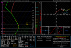
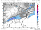
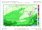
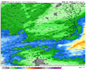
Yeah some of the precip maps on pivotal aren't aligning with soundings, could be rate issues but the snow maps solid 2-4
Example: map showing rain with this sounding, borderline bl but below freezing through the column

View attachment 160866

Yeah, that’s easily a snow sounding. Doesn’t even seem close.

EDIT: Wasn't thinking about the dendritic growth zone, could be it. That can be a problem at times, although it’s almost always associated with very light precip, it seems like.

I’m thinking a general 1-3” / 2-4” type event for central NC looks likely at this point. Probably erring on the lower side of those predictions. Best bet is to err on the side of there being more sleet than expected, since it seems like that always happens in situations where the temperature is marginal somewhere in the column.

Seems like the 12z modeling has been mixed. Don’t love the Canadian going the wrong way.
 
I have not looked close... But is it possible to that the type maps are showing rain because the dendritic growth region is not adequately saturated?.....

Things to look at for sure
I'm trying to figure with the Canadian and UKmet solutions, how much of the 1st initial northern stream shortwave interacted initially vs what the NAM and GFS did (along with the ICON to some extent) keeping it separated more.
 
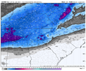
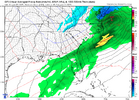
Hmmm: UKIE's 12Z has FAY in rain Sat. morning, but model soundings are all snow. Sensing some shenanigans. Wait for the ensemble before burning any Team UKIE jerseys. View attachment 160871
This is something I’ve noticed. I think on its depiction on Pivotal, it automatically shows anything below the 540 line as rain, but as some mets on here have pointed out in the past, the 540 line was often doesn’t match with the R/S line in this region. The track of the low was roughly the same
 
I'm trying to figure with the Canadian and UKmet solutions, how much of the 1st initial northern stream shortwave interacted initially vs what the NAM and GFS did (along with the ICON to some extent) keeping it separated more.
The loop of the 12z Ukie, looked like it transferred to GA coast from central GA? weird, instead of just a straight route from point A. (Pensacola) to point B. (Ga/SC coast)
 
My thoughts on the storm for NC rn

I think the CLT metro area is far enough west that we should stay all frozen, plus I still think the CAD element is being downplayed. We won't have the classic 1040 High but modelling does show a weak high initially in a good placement that later slides east and I think others have pointed out yesterday the potential of a meso high. Despite ppls opinions on him, I think ------------- as a good handle on this event for this region. This may well be a classic I-85 split. I think Statesville up through GSO might be the big winners here.

The RDU/Triangle area is more precarious. Areas east of I-95 have the biggest chance of switching to rain while from I-95 west up to I-74 is honestly too unpredictable for me to make a comfortable call lol. If CAD is stronger than modeled/the low is more to the east then RDU might be a similar position to CLT but if the low tracks further west and the CAD is scoured our faster then rain might become a bigger issue.
 
This is another sleet sounding per gfs. Says it at the bottom and has pink on the clown. To the naked eyeball it should be snow as everything stays left of the freezing line on the way down. But I think if you kiss this line, its enough to melt the flake some or give you icey flake, not pure powder one.

1736271115436.png
 
Hmmm: UKIE's 12Z has FAY in rain Sat. morning, but model soundings are all snow. Sensing some shenanigans. Wait for the ensemble before burning any Team UKIE jerseys. View attachment 160871
it's not the mid levels it's sniffing out, it's surface temps i think. another issue the skimpier wave solutions bring is 2m temps. i know "rates overcome all" is basically a meme but surface temps are meh and heavier precip will stabilize it. the gfs actually has mixing/surface temp issues for me in richmond on saturday. i wouldn't overlook this as a risk of the flatter solutions
1736271186014.png
 
I'm trying to figure with the Canadian and UKmet solutions, how much of the 1st initial northern stream shortwave interacted initially vs what the NAM and GFS did (along with the ICON to some extent) keeping it separated more.
Canadian injected more energy into the Baja Low with the 1st northern stream s/w... Way more than the GFS/ICON did
 
So we've got the NAM + ICON + GFS all a bit better and the RGEM + CMC + UK all a bit worse. Wonder which way the tiebreaker heartbreaker will go?

I think we should be prepared for a few worse runs over the coming days. It's just not possible for everything to trend colder and snowier from here on in.

We just have to hope for minor adjustments and not some major trend change at the 11th hour.

The lack of a cold air feed always concerns me. But this pattern has afforded us some wiggle room in this area. This is one of the reasons I'm always enthusiastic about well-positioned, strongly blocking. Even with less than ideal conditions, you can still find more ways to score.
 
My thoughts on the storm for NC rn

I think the CLT metro area is far enough west that we should stay all frozen, plus I still think the CAD element is being downplayed. We won't have the classic 1040 High but modelling does show a weak high initially in a good placement that later slides east and I think others have pointed out yesterday the potential of a meso high. Despite ppls opinions on him, I think ------------- as a good handle on this event for this region. This may well be a classic I-85 split. I think Statesville up through GSO might be the big winners here.

The RDU/Triangle area is more precarious. Areas east of I-95 have the biggest chance of switching to rain while from I-95 west up to I-74 is honestly too unpredictable for me to make a comfortable call lol. If CAD is stronger than modeled/the low is more to the east then RDU might be a similar position to CLT but if the low tracks further west and the CAD is scoured our faster then rain might become a bigger issue.
I think that is a good analysis of the situation as it stands. The strength of the CAD is going to be crucial to determining the precipitation type for folks from RDU south and east. I wish there was a reinforcing high pressure to the north of this system but no such luck. Hopefully that low will track more east and give folks here a better chance of seeing all snow.
 
The loop of the 12z Ukie, looked like it transferred to GA coast from central GA? weird, instead of just a straight route from point A. (Pensacola) to point B. (Ga/SC coast)
Both the Canadian, and UKMET did a transfer. The GFS/ICON didn't or kept the primary low far enough south, the energy transfer was barely noticed. The Canadian still infused a little bit of the 1st northern stream energy, actually literally came down from due north of the Baja Low back on hour24, where the GFS/ICON/NAM didn't do so.
 
Back
Top