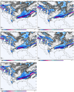
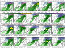
Yup. It was never gonna crash in one run. But that was a nice step. Excited to look at it in more detail laterLooks like RDU stays below freezing for the whole event now. For me that was the benchmark to get to with the GFS today.
-
Hello, please take a minute to check out our awesome content, contributed by the wonderful members of our community. We hope you'll add your own thoughts and opinions by making a free account!
You are using an out of date browser. It may not display this or other websites correctly.
You should upgrade or use an alternative browser.
You should upgrade or use an alternative browser.
Wintry 1/9-12 Winter Potential Great Dane or Yorkie
- Thread starter SD
- Start date
Going to continue, playing catch upI am sure the NWS offices are a bunch of busy bees over these past 24 hours of model runs.... Who knows when it will slow down it keeps trending better and better
Cary_Snow95
Member
See what you are saying there. So many of us want the trough to tilt positive overall, but sharpen to neutral at the basesmall detail but love the trough orientation becoming more negative over the plains, talked about this last night
Good to see the GFS correct slightly east. The model loves to plow into wedges.
bud006
Member
The GFS verbatim would be the biggest snowfall for my location since December 2017. Wow.
—30—
—30—
Bigedd09
Member
Brad P thinking 1-3 in CLT but a bust lower is more likely than a bust higher. He thinks mixing will be an issue.
Same here, stayed at or below freezing entire time. It was close but that's improvement, again need it shift south/east another 100 miles or so to feel comfortableLooks like RDU stays below freezing for the whole event now. For me that was the benchmark to get to with the GFS today.
It almost always is. I think we should be skeptical of all snow solutions until more models jump on board with thatBrad P thinking 1-3 in CLT but a bust lower is more likely than a bust higher. He thinks mixing will be an issue.
Benholio
Member
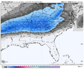
The snowfall maps don't account for melting/show actual accumulations, right? Like the GFS shows 4-5"+ swath of snowfall around ATL metro but the snow depth map from TT shows ~3". How accurate is this? I just want to temper expectations on the "snowfall" maps that we always see if they are significantly different than actual accumulations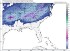

Why are we wasting time watching trends on all these model runs when the Euro AI is like “where you guys been all week?”
Bigedd09
Member
Did it show texas getting shafted this whole time?Why are we wasting time watching trends on all these model runs when the Euro AI is like “where you guys been all week?”
Benholio
Member
The consistency on the Euro AI has been pretty incredibleWhy are we wasting time watching trends on all these model runs when the Euro AI is like “where you guys been all week?”
Tokenfreak
Member
I hope so as we need snow here in the lowcountryA couple more trends like this by the GFS and it will be an all snow event for many in the Carolina's
rburrel2
Member
Texas hasn't gotten shafted yet.Did it show texas getting shafted this whole time?
Don’t know but we could probably find out (may not want to know that answer though lol)Did it show texas getting shafted this whole time?
Stormsfury
Member
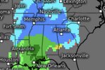
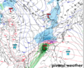
More separation from the 1st n/s s/w and the Baja Low a tick south.NAM is a complete crash and burn for Texas and Oklahoma. Wow. 6 to 12 inches fantasy runs to... nothing?
View attachment 160805
Basically cut and paste for Charlotte, especially if you’re south/east of LKN.If you’re in/near Atlanta, specifically south of 20, this will be easier on yourself if you accept now that there will very likely be mixing issues at some point. It’s going to come down to that front end thump for the city and how much we can lay down before temps above start to warm and there’s a flip to IP/ZR. Root hard for the front end thump
Is all snow on the table? For sure. But is it likely? Probably not. Still a ways to go. We’re still in the “…but it’s the long range NAM/RGEM” phase of the game. You’d certainly rather be where we are today than where we were 2-3 days ago, but the story on this one has not been written.
iGRXY
Member
ChattaVOL
Member
I go to school at UTC (UT at chattanooga) and I'm feeling great rn! I appreciate reading all of your guys' posts
In Chattanooga as well… holding my breathe and hoping we can nail this.
Sent from my iPhone using Tapatalk
LukeBarrette
im north of 90% of people on here so yeah
Meteorology Student
Member
2024 Supporter
2017-2023 Supporter
This a fairly accurate look here. Ratios farther south might not be the greatest. Dealt with the problem up here in Roanoke with the storm a couple days ago.The snowfall maps don't account for melting/show actual accumulations, right? Like the GFS shows 4-5"+ swath of snowfall around ATL metro but the snow depth map from TT shows ~3". How accurate is this? I just want to temper expectations on the "snowfall" maps that we always see if they are significantly different than actual accumulationsView attachment 160847
Bigedd09
Member
Canadian Mixed Bag for many. Not even much of a front end thump
beanskip
Member
Meanwhile, the 12z Canadian still has it 13F in Charlotte at 7 a.m. Friday morning.
But, what's 15 degrees among friends (AIFS 28F at the same time)?
But, what's 15 degrees among friends (AIFS 28F at the same time)?
Bring it home to Frosty Land, Jimmy Jam. I seem to be in the minimum on just about every output. So need little help pal. They should be locked in by 00z tomorrow night.
Sent from my iPhone using Tapatalk
Snowflowxxl
Member
CMC has consistently been a pinger fest here
RTRwx
Member
Canadian is colder at the surface for some (what else is new?) but it has a weird 700 mb inversion not shown by other models thats making sleet the predominant p-type where other models have snow.
NorthGaWinter4
Member
Only concern at the moment is how the RGEM and CMC about have the same look.
beanskip
Member
Pretty big jump north with the surface low from the Canadian. 0z had it at the Alabama/Ga./FL line - 12z up to Columbus. It doesn't make much difference in the sensible weather because of the CMC's crazy cold temp profiles (see, 13F in Charlotte Friday morning), but if I were trying not to let my expectations get out of whack, I would take note of this sizeable shift. A low that cuts too far west seems like the main (only?) way this thing can crash.
D
Deleted member 609
Guest
Tale as old as time. Frosty on the northern fringe. Boom, gets a foot.Bring it home to Frosty Land, Jimmy Jam. I seem to be in the minimum on just about every output. So need little help pal. They should be locked in by 00z tomorrow night.
Sent from my iPhone using Tapatalk
Bigedd09
Member
A lot of mets seem to think the warm nose is a major concern, Maybe the canadian is onto something? It's short range model also shows sleet. But they are the outliers as of nowCanadian is colder at the surface for some (what else is new?) but it has a weird 700 mb inversion not shown by other models thats making sleet the predominant p-type where other models have snow.
John1122
Member
The Canadian/RGEM is more amped and has a 725mb or so warm nose. The DGZ is also very elevated as upper level temps are warmer than normal. That's why it's showing sleet.
CNCsnwfan1210
Member

I-85 N and W try to stay all snow, but southeast of there it’s a changeover to an icy mess in NC
Sent from my iPhone using Tapatalk
D
Deleted member 609
Guest
It may end up being a sleet fest for many on the board. But be happy we are about to have a winter storm for first time in a good while, let’s enjoy whatever we get.
Sent from my iPhone using Tapatalk
Sent from my iPhone using Tapatalk

