• Hello, please take a minute to check out our awesome content, contributed by the wonderful members of our community. We hope you'll add your own thoughts and opinions by making a free account!

Wintry 1/9-12 Winter Potential Great Dane or Yorkie

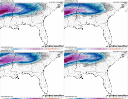
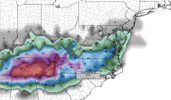
It's not terrible but definitely ticked north. It's not a trend if it's just one run! But a good reminder to keep expectations in check
View attachment 160892

Im not sure it’s worth mentioning, but what are the chances the surface low strengthens off the Carolina coast? I’m sure it depends on if the trough can tilt negative a bit. I was noticing the snow increase off the VA tidewater, or is that a sign the LP will be further north? I know it was only one trend north, just curious.


Sent from my iPhone using Tapatalk
 
I am not making any predictions at this point but if you throw out the RGEM, do so at your own risk. I will wait for the NAM3km before I go either way on a prediction. Globals are pretty mixed but that is normal this far out, plus they do not do a good of a job in close like the RGEM, NAM3km and to some extent the EPS does
 
I call BS on this.
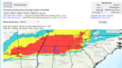
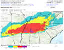
it’s the probability of exceeding warning quality snowfall. I’m sure the percentages will increase through time near Atlanta but off the top of my head I think winter storm warning criteria is 2 inches here? So it’ll take them getting more confident

I’m just sharing the data lol I don’t necessarily agree with it
 
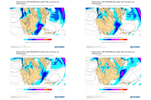
For Clemson, SC Here's a break down of Ensemble mean snowfalls:

Euro Ens: 2.9 down from 3.2 at 06z
GEFS: 4.4 up from 3.9 at 06z
CMCE: 3.7 up from 2.6 at 00z

So, overall, not a bad cycle for the upstate.

Yeah, the Euro Ens is the one I'm worrying about. It ticked down, but my further concern is that the individual members are all pretty weak storms. Very few big dogs. Lots of hits, but small ones. Euro suite is just seeing a weak storm in the Carolinas right now IMO.
 
Yeah, the Euro Ens is the one I'm worrying about. It ticked down, but my further concern is that the individual members are all pretty weak storms. Very few big dogs. Lots of hits, but small ones. Euro suite is just seeing a weak storm in the Carolinas right now IMO.
I would prefer that right now that a bunch of misses or overamped storms honestly
 
While not a trend amongst the current models, I think everyone has grown accustom to expecting a N/NW trend with these setups, in the final days. So yes, while it is just one run, it also falls in line with expectations.

It also wouldn’t be the first to tease us with a good trend and then rip it away for good.
 
I'm baffled why surface temps aren't being modeled colder for this storm. yesterday globals were showing anywhere from 27 to 33 during the height of the storm for me... They've actually warmed a bit today and the range is 29-32.. if you take out the cmc they are all showing 31-32.

I just find that hard to buy when looking at the temps as the fronto band arrives... I feel like we should be dropping to 27-28 at least. Curious to see if the NAM does that this afternoon since it'll finally be in range.
 
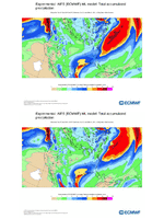
12z AIFS and EC-GraphCast both shifted warmer. Matches the trends we have started to see and the trends that are expected at this range (NW Trend). That WPC map of warning exceedance is actually looking really good IMO.
View attachment 160914
Yes I agree. Brutal trend in the modeling today. Luckily we still have 3 days to trend it in the right direction
 
Back
Top