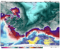
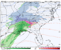
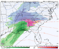
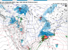
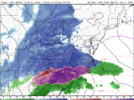
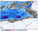
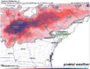
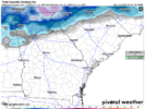
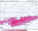
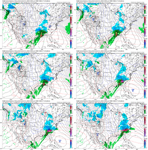
I’m pretty worried about temps here the rest of the run. The 500mb look is slightly warmer and we were already on a razor edge. Maybe I’ll be wrong! Hope so
-
Hello, please take a minute to check out our awesome content, contributed by the wonderful members of our community. We hope you'll add your own thoughts and opinions by making a free account!
You are using an out of date browser. It may not display this or other websites correctly.
You should upgrade or use an alternative browser.
You should upgrade or use an alternative browser.
Wintry 1/9-12 Winter Potential Great Dane or Yorkie
- Thread starter SD
- Start date
iGRXY
Member
packfan98
Moderator
There’s a fine line between getting enough energy to beef up the precip and getting too much to screw up the track of the low. Thread the needle event every time.
Stormsfury
Member
No, the first northern stream shortwave is stronger (552mb closed contour) over the 4 Corners already beginning to phase into the Baja Low .. gets amped up early, likely driving a bump up ridge downstream... Likely to be warmer downstream and also more precip type issues and modes. ...Looks like there's nothing there. Does it miss the phase?
ForsythSnow
Moderator
18Z is a lot like 6Z on the NAM. Looks to be a big hit.
Nam height field looks in line with 06z
ForsythSnow
Moderator
Seeing that now, warm air coming in too intense. Need to tone it down some.Nope. Not going to work for I-20. Too amped already
View attachment 160936
packfan98
Moderator
I-85 diving line it looks like for the all snow vs mix. Typical.
Needs to track east from here. I'm sure it will
LukeBarrette
im north of 90% of people on here so yeah
Meteorology Student
Member
2024 Supporter
2017-2023 Supporter
Downeastnc
Member
Needs to track east from here. I'm sure it will
You beat me to it....ENE would be epic for NC.
Looked to me the sfc low was sliding a bit more east than the gfs has it doing so.
Snowlover34
Member
Also here in Hazel green near the Tennessee state line here in Alabama getting smokedIce. Tennessee going to get smoked
View attachment 160937
BufordWX
Member
18z NAM would lead to serious problems for Atlanta. Major ice storm.
Cold air mass doing work. I really can't imagine there's going to be that much zr with a Miller A, unless it's reforming.
beanskip
Member
Captain Obvious checking in to say: You really can't compare surface temps vs. prior runs without taking into account where precip has fallen (or not) -- have to kind of triangulate with DPs (unless there is a site that measures wet bulbs which would be amazing, but I don't think exists).
I think more of a sleet than FRZ rain in ATL. I was complaining about the 12z but I rather that then this. lol
CMC & the NAM are full send on a huge ice storm.
Snowflowxxl
Member
That’s a lot of sleet for metro ATL
iGRXY
Member
Looking at the soundings at least in the central and southern upstate, it's ZR.Cold air mass doing work. I really can't imagine there's going to be that much zr with a Miller A, unless it's reforming.
LukeBarrette
im north of 90% of people on here so yeah
Meteorology Student
Member
2024 Supporter
2017-2023 Supporter
Long range NAM will have huge shifts next several runs just fyi.
ITUSETOSNOW
Member
That is a crippling ice storm for ATL and most of GA...
- Joined
- Jan 5, 2017
- Messages
- 3,773
- Reaction score
- 5,983
Not believing the accretion maps at all. Only has me at 30-32 degrees. Unless it's very light precipitation and heavy overcast or at night, you're not going to get that much ice to form with marginal surface temps. It's just a very cold rain for me. The coldest rain possible.
Temps are very marginal for ZR accrual throughout North Georgia. Like it's 30-32 across most of the region. I'm not super worried. If it was in the 20's I'd be concerned.
Euro AI - SV "Snow" output, last 4 runs (could be mix on the southern edge)


ITUSETOSNOW
Member
Atlanta had 5 inches of sleet in February, 1978That’s a lot of sleet for metro ATL
- Joined
- Jan 23, 2021
- Messages
- 4,602
- Reaction score
- 15,197
- Location
- Lebanon Township, Durham County NC
One thing you might want to consider is how cold the ground will be. You’re gonna see ice in places you normally don’t see it during an ice storm.Temps are very marginal for ZR accrual throughout North Georgia. Like it's 30-32 across most of the region. I'm not super worried. If it was in the 20's I'd be concerned.
Snow fall totals I would divide by 3/4.I’m going to place my bet, the NAM just nailed that storm. Looks like exactly what’s going to happen.
albertwilsonjr
Member
Sent from my iPhone using Tapatalk
I think that is possible, particularly the way the CMC shows, as it does an A/B thing. The Nam doesn't look like it's doing that, so it should be more r/s. But I don't have access to the good stuff yet, so maybe I'm missing something.CMC & the NAM are full send on a huge ice storm.
Either way, it's hard to believe a half inch of ice is going to accrue in a non-reinforcrd, shallow CAD.
My forecast thoughts (1/7 Update) - staying the course for now:


Sent from my iPhone using Tapatalk
Not to get too off topic but I was watching TWC yesterday afternoon and they were saying 8-12” for most of east Texas and now those poor people are fighting for their lives

