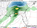
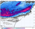
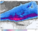
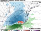
Lots of people have 3 straight nights in the 20s coming up. If you can get under some good returns it’s gonna pile up quick
-
Hello, please take a minute to check out our awesome content, contributed by the wonderful members of our community. We hope you'll add your own thoughts and opinions by making a free account!
You are using an out of date browser. It may not display this or other websites correctly.
You should upgrade or use an alternative browser.
You should upgrade or use an alternative browser.
Wintry 1/9-12 Winter Potential Great Dane or Yorkie
- Thread starter SD
- Start date
A fickle lesson in we all should be cautious even 48 hours out!NAM is a complete crash and burn for Texas and Oklahoma. Wow. 6 to 12 inches fantasy runs to... nothing?
View attachment 160805
Jan88
Member
Is that because the northern stream energy phases later?NAM is a complete crash and burn for Texas and Oklahoma. Wow. 6 to 12 inches fantasy runs to... nothing?
View attachment 160805
ITUSETOSNOW
Member
Yes, the low in ATL Fri morning is 22.Lots of people have 3 straight nights in the 20s coming up. If you can get under some good returns it’s gonna pile up quick
iGRXY
Member
Confluence is really trending stronger and further west by the run. The ICON is also showing it stronger
LovingGulfLows
Member
- Joined
- Jan 5, 2017
- Messages
- 1,499
- Reaction score
- 4,100
If this does indeed become a Miller A event, every foot of elevation will help.
If I were in Alpharetta or Canton, I'd be feeling pretty good...they do pretty well in these setups relative to the southern metro areas.
I do have concerns here in river city for sure with this amping up so quickly and what is waiting beyond that 84hr range currentlyLot of moving parts, no doubt. A perfect-timed phase and many of us may score bigly. But we've already seen what happens if we get too much. Northern and western parts of the board are in great shape to see something wintry no doubt, but that CLT to RDU and east corridor in NC are really toeing the line.
Cary_Snow95
Member
For the Central and Eastern NC peeps, the timing is about ideal as it gets. Precip works its way into our area around 7PM with the height occurring in the overnight hours.
To me, it really seems like both of our cold air sources are trending better for the Southeast.Confluence is really trending stronger and further west by the run. The ICON is also showing it stronger
RTRwx
Member
Icon looking like the NAM in TX (in terms of precip/temps)
bud006
Member
This might be banter - if so, please move it mods - but it feels like forever since we’ve had this type of setup and consensus. I almost get chills looking at what realistically could be evolving into a classic Miller A setup for North Georgia with a significant thump I-20 north, preceded by multiple days of cold.
Long way to go, but confidence is increasing. Thanks to all those far more knowledgeable in this than I for your guidance and perspectives so far. Keep ‘em coming!
—30—
Long way to go, but confidence is increasing. Thanks to all those far more knowledgeable in this than I for your guidance and perspectives so far. Keep ‘em coming!
—30—
Psalm 148:8
Member
- Joined
- Dec 25, 2016
- Messages
- 344
- Reaction score
- 789
We’ll need help. I’m south of Atlanta.. headed for Hiawasee, GA. Planned to leave Friday morning. I know precip type is still up in the air.. but can anyone give advice to timing as to whether I should leave Thursday night instead? I do NOT want to chance slip sliding through Atlanta with those crazy drivers!!! Welcome advice please!!! But do it through a board message as to not clutter up the thread. I’d rather pay for an extra night than chance driving Atlanta with ANYTHING frozen on the ground!!!
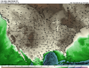
This is the airmass you want in place first, where's @Rain Cold , tell'em brother, get the cold air first then worry about precip..... that's a solid cold/dry airmass right there

iGRXY
Member
ICON will hold serve in the east.
ITUSETOSNOW
Member
I would leave on Thursday evening...We’ll need help. I’m south of Atlanta.. headed for Hiawasee, GA. Planned to leave Friday morning. I know precip type is still up in the air.. but can anyone give advice to timing as to whether I should leave Thursday night instead? I do NOT want to chance slip sliding through Atlanta with those crazy drivers!!! Welcome advice please!!! But do it through a board message as to not clutter up the thread. I’d rather pay for an extra night than chance driving Atlanta with ANYTHING frozen on the ground!!!
- Joined
- Jan 2, 2017
- Messages
- 1,566
- Reaction score
- 4,279
Nam good at Cad thermal profiles..take snow totals and cut in half and it's still a banger
Trust me this isn't banter, have you seen some of the other comments? But I'm going to use your post as an example and reminder (not directed at you at all) but if you are posting banter we will not be moving those comments, it's too time consuming, we will just be deleting. And if you say "I know this is banter" then post it in banter.... again this one really wasn't just using it to set the tone.This might be banter - if so, please move it mods - but it feels like forever since we’ve had this type of setup and consensus. I almost get chills looking at what realistically could be evolving into a classic Miller A setup for North Georgia with a significant thump I-20 north, preceded by multiple days of cold.
Long way to go, but confidence is increasing. Thanks to all those far more knowledgeable in this than I for your guidance and perspectives so far. Keep ‘em coming!
—30—
Thanks
This is the airmass you want in place first, where's @Rain Cold , tell'em brother, get the cold air first then worry about precip..... that's a solid cold/dry airmass right there
View attachment 160806
Cold first. Always.
Snowflowxxl
Member
Friday morning is going to be snowpocalypse ITP. These things always show up a couple hours earlier than modeledWe’ll need help. I’m south of Atlanta.. headed for Hiawasee, GA. Planned to leave Friday morning. I know precip type is still up in the air.. but can anyone give advice to timing as to whether I should leave Thursday night instead? I do NOT want to chance slip sliding through Atlanta with those crazy drivers!!! Welcome advice please!!! But do it through a board message as to not clutter up the thread. I’d rather pay for an extra night than chance driving Atlanta with ANYTHING frozen on the ground!!!
iGRXY
Member
Bigedd09
Member
Upstate SC may be the BIG winner in this storm.
iGRXY
Member
Mahomeless
Member
I20 north paste job in ALView attachment 160807A true Miller A look
Well we all know how you don’t wanna be the big winner this far out. I’m thinking Asheville NC and north-east up the east coast.Upstate SC may be the BIG winner in this storm.
Holy crap the ICON is almost perfect, keep sliding the LP off the coast a little south each time and many of us will stress less
ooooof that is nasty work for CAE lmaoo now that is a traditional Carolina Winter storm.
Mahomeless
Member
ICON warm bias in full play right now....biggest Miller A we've seen in a VERY long time is on its way across MS/AL/GA
SnowwxAtl
Member
Is that 3.4 for the ATL airport? Exactly where I am. I would be happy and run with itICON is a North Georgia hammer job View attachment 160809
Ron Burgundy
Member
Holy cow it really moved that bullseye further southICON is a North Georgia hammer job View attachment 160809
If you’re in/near Atlanta, specifically south of 20, this will be easier on yourself if you accept now that there will very likely be mixing issues at some point. It’s going to come down to that front end thump for the city and how much we can lay down before temps above start to warm and there’s a flip to IP/ZR. Root hard for the front end thump 

ForsythSnow
Moderator
9 to 10 inches across Forsyth is just a weenie dream, I'm hugging. That FGen band would be as epic as 2017.ICON is a North Georgia hammer job View attachment 160809
View attachment 160808We keep increasing each run
Pretty consistent. I keep thinking there's absolutely no way we keep seeing the same general looks run after run, and yet.
Still, it's hard to shake the unease that lingers in the back of my mind.
As long as that confluence holds....
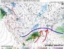
From a synoptic standpoint this is my biggest fear for snow lovers in the Carolinas. All the cold air we are working with is pretty stagnant with no high pressure to the north locking it in. Snow pack to the north will absolutely help AT THE SURFACE. However 800mb warm air advection doesn't care about your surface snow pack.
This is why ice still remains a legit concern IMO. So many soundings look a lot more like a wintry mix instead of pure snow.
This is why ice still remains a legit concern IMO. So many soundings look a lot more like a wintry mix instead of pure snow.

Looks like CAE is on the line as alwaysooooof that is nasty work for CAE lmaoo now that is a traditional Carolina Winter storm.
packfan98
Moderator
This is the 6z.View attachment 160808We keep increasing each run
In the absence of UL forcing to drive the low inland, an elongated + tilted trough axis, climo is for the SLP to follow the natural baroclinic zone off the SE coast.
packfan98
Moderator
the 12z RGEM has much more of a mixed bag at the end of its run.


