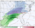
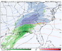
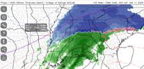
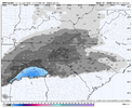
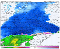
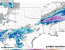
I don’t wanna step on anyone’s toes but the ZR threat with this storm is nowhere near impactful as our last storm was in Kentucky and Virginia. Temps aren’t there for accumulations over 0.1” accrual unless you live in the mountains.  This storm is largely just using the initial conditions to form snow and loses the snow growth to sleet then cold rain. There will be some narrow ZR but I can’t see it being noteworthy given temps rising or near 32.
-
Hello, please take a minute to check out our awesome content, contributed by the wonderful members of our community. We hope you'll add your own thoughts and opinions by making a free account!
You are using an out of date browser. It may not display this or other websites correctly.
You should upgrade or use an alternative browser.
You should upgrade or use an alternative browser.
Wintry 1/9-12 Winter Potential Great Dane or Yorkie
- Thread starter SD
- Start date
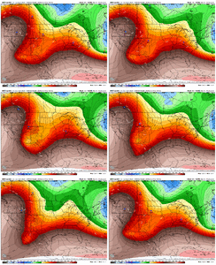
Northern stream driving in hard this run. No one wants to hear it, but this one can still go boom boom and douse all of the fantasy model runs. Northern stream / phasing events like this are notorious for bigger shifts in the home stretch, largely because the northern stream energy doesn't get sampled as well because of where it's coming in from.
Winter Storm Watches are now out for Louisiana and Arkansas. Moving east. 
SnowwxAtl
Member
Is that bad news?View attachment 160795
Northern stream driving in hard this run. No one wants to hear it, but this one can still go boom boom and douse all of the fantasy model runs. Northern stream / phasing events like this are notorious for bigger shifts in the home stretch, largely because the northern stream energy doesn't get sampled as well because of where it's coming in from.
Stormsfury
Member
First n/s s/w was weaker at 21hr, more separation from the Baja Low. I don't have it out past 21 on TT. But looked better on a map posted later in the run.Yeah definitely warmer
CNCsnwfan1210
Member
View attachment 160795
Northern stream driving in hard this run. No one wants to hear it, but this one can still go boom boom and douse all of the fantasy model runs. Northern stream / phasing events like this are notorious for bigger shifts in the home stretch, largely because the northern stream energy doesn't get sampled as well because of where it's coming in from.
I like the trend in SE Canada though with the 50-50 nosing in westward
Sent from my iPhone using Tapatalk
For your location maybe not so muchIs that bad news?
- Joined
- Jan 23, 2021
- Messages
- 4,602
- Reaction score
- 15,197
- Location
- Lebanon Township, Durham County NC
NAM looking solid with the track.
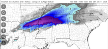
12z NAM going boom with more snow even down to Birmingham and points just south
iGRXY
Member
NAM looked good for the onset of it here.
I’d say that is a good take. The thing that keeps me hopeful is I believe the thing that is hurting them right now is the thing that is helping us. Flatter setup instead of a nuke to our west sucking all of the available cold air into it and onto the wrong side of the mountains.Trends in Texas are nasty work. Could happen to us, still a long way to go!
This run def showing the point RAH made about it being mostly just rain or snow.
Also, yeah the end looks good but you just gotta remember that we’ve got a ways to go and small ticks back toward our less snowy solutions from Sunday can certainly happen
- Joined
- Jan 23, 2021
- Messages
- 4,602
- Reaction score
- 15,197
- Location
- Lebanon Township, Durham County NC
Some really heavy snow totals showing up at 84 for areas of Alabama and MS along 22. More than likely would've topped out around 8" in alot of areas.
ForsythSnow
Moderator
As expected, the NAM does go boom. Looks to me like the axis is shifting eastward and could be trending towards a flatter Miller A type system.
- Joined
- Jan 23, 2021
- Messages
- 4,602
- Reaction score
- 15,197
- Location
- Lebanon Township, Durham County NC
That last frame is basically rain or snow, a true hallmark of a miller A
rburrel2
Member
The nam was gonna drop over a foot in the upstate...the low was about to start cranking, but the northern stream press and phase in has pushed 600-800mb temps well south of other guidance, perfect run for us.
Yes largely snow or cold rain. Don’t see a big ice storm for anyone. There will be sleet in betweenThat last frame is basically rain or snow, a true hallmark of a miller A
ForsythSnow
Moderator
If you check the 500 vort, you'll see the tilt going neutral and really pulling in the moisture and pushing the cold in too. If extrapolated I'd bet we would see someone hitting high totals and a huge streak from GA into NC
WxBlue
Meteorologist
Man... talking about a gut punch with my area maybe getting first snow in 3 years while I'm on a weekend trip to Savannah  Ensembles look amazing for us who are so snow starved. Seems like even us in eastern Wake County will score. That NAM run really did put a dot on the exclamation mark!
I mean we should pay attention to out West and the trends for the Southern plains sure, but I wouldn't put a ton of stock in the bad trends for them & compare it to us. If that N/S gets out in front and phases a little later, it's going to obviously suck more for them and probably help us out more. Someone will take an L with this while someone else takes a W IMO.
- Joined
- Jan 23, 2021
- Messages
- 4,602
- Reaction score
- 15,197
- Location
- Lebanon Township, Durham County NC
The only potential limiting factor I can see for north alabama is the majority falls during the day with temps just at 32-35.
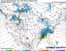
The surface low now showing up near the Great Lakes is eye raising. Shows a very strong northern stream push…
I think that will end up being too warm. I think those areas will be okay honestly unless something changes.The only potential limiting factor I can see for north alabama is the majority falls during the day with temps just at 32-35.
I can’t remember ever getting this many good runs in a row. Enjoy this one because this is not normal
ITUSETOSNOW
Member
That rain line is still too close for my liking..
SnowwxAtl
Member
Rain and snow line is too close to my house. I mean I am in the snow but I need it alittle more south of me to feel comfortable.
It really has been awhile since we have something that in that 4-5 day window basically had all the models trending into 1 general distilled direction and sure their are variants in all the models but the overall theme is the same and that lately hasn't been something you see till maybe at most 48 to 56 hours out.I can’t remember ever getting this many good runs in a row. Enjoy this one because this is not normal
If we could push the southern extent of the rain snow line to just below Shelby county then I’d be feeling better. Current depiction could have it snowing in my backyard and raining in the front. Colder trends continue!
If this does indeed become a Miller A event, every foot of elevation will help.Rain and snow line is too close to my house. I mean I am in the snow but I need it alittle more south of me to feel comfortable.
Lot of moving parts, no doubt. A perfect-timed phase and many of us may score bigly. But we've already seen what happens if we get too much. Northern and western parts of the board are in great shape to see something wintry no doubt, but that CLT to RDU and east corridor in NC are really toeing the line.I like the trend in SE Canada though with the 50-50 nosing in westward
Sent from my iPhone using Tapatalk
WxBlue
Meteorologist
I’m not sure, but I feel like the NAM really nailed this setup. It’s possible we see it trend a little colder in future runs, but I don’t think it’s going to get significantly better than what the NAM is showing right now.
That’s perfect for instant sticking. Not like we won’t get accumulations regardless but not wasting a half inch to melting is always nice. Low sun angle will work in our favor, too.

