• Hello, please take a minute to check out our awesome content, contributed by the wonderful members of our community. We hope you'll add your own thoughts and opinions by making a free account!

Wintry 1/9-12 Winter Potential Great Dane or Yorkie

It would be nice to get cloud cover to come in early in the day. Not late afternoon. I don't think it would matter too much once precip started but it would be great to have the "coldest" conditions before the precip moves in. **this something else for us to track leading up to the storm.
I think usually that would matter but we might actually be okay considering how cold the ground already is
 
It would be nice to get cloud cover to come in early in the day. Not late afternoon. I don't think it would matter too much once precip started but it would be great to have the "coldest" conditions before the precip moves in. **this something else for us to track leading up to the storm.
while i agree and hate it when excess diurnal heating makes its way in, this is putting the cart before the horse a little
 
Not saying we shouldn’t discuss the NAM but it was so bad for the event this past couple of days.
 
Not saying we shouldn’t discuss the NAM but it was so bad for the event this past couple of days.
Yeah, I tend to agree, but I do like to at least look at it inside 36 hours. Because it runs first, sometimes it can give us some things to look for in the rest of the 12z suite. Also, used to be known to sniff out CAD temp profiles better than the globals.
 
crazy how hard it is for atl to get an all snow system! i have long felt that georgia is overdue for a proper system and not getting sloppy seconds from a blairsville special
Agree but for most of us it’s been 7 years so we are going to celebrate our slop like we just won a championship
 
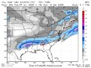
Gut feeling says this red area where the snow fall is trending up with each run is sleet.

View attachment 160791

The soundings show snow starting around 1 am and then switching to mostly sleet by noon. It's all going to be sleet and snow with the temps soooo close in the thermal profile.
 
crazy how hard it is for atl to get an all snow system! i have long felt that georgia is overdue for a proper system and not getting sloppy seconds from a blairsville special
We got all snow in the late January 2014 storm. Also, in January 1982. They are exceedingly rare, but do occur.
 
It would be nice to get cloud cover to come in early in the day. Not late afternoon. I don't think it would matter too much once precip started but it would be great to have the "coldest" conditions before the precip moves in. **this something else for us to track leading up to the storm.
I don't think that will be an issue at all this time around, plus I was sunny with a high of 45 Sunday before clouds rolled in around 2:30 and by 5 pm I had ip/sn and that was a light fgen band with a airmass not nearly as cold as this.
 
I don't think that will be an issue at all this time around, plus I was sunny with a high of 45 Sunday before clouds rolled in around 2:30 and by 5 pm I had ip/sn and that was a light fgen band with a airmass not nearly as cold as this.
Yeah, we dropped from 43 on Sunday to having a covering of sleet in two hours.
 
I don't think that will be an issue at all this time around, plus I was sunny with a high of 45 Sunday before clouds rolled in around 2:30 and by 5 pm I had ip/sn and that was a light fgen band with a airmass not nearly as cold as this.
I looked at simulated IR on the 06z GFS cycle and saw that by 09z it was already cloudy in Southeast SC so don't think that aspect will be a problem.
 
Not saying we shouldn’t discuss the NAM but it was so bad for the event this past couple of days.
Another thing to remember is the old "E-E rule," named by a very good (and very volatile) met who used to frequent some of the old weather boards.

The EE rule is that when the Euro and the NAM (formerly the ETA) are in agreement, you can take it to the bank, even if other models are showing a different solution.

Still too early to know on that, but something to watch for this week.
 
Will this be sticking or staying around near atl or is it probably gonna melt within in a few hours?
 
I don't think that will be an issue at all this time around, plus I was sunny with a high of 45 Sunday before clouds rolled in around 2:30 and by 5 pm I had ip/sn and that was a light fgen band with a airmass not nearly as cold as this.
One of the craziest storms I’ve seen with this was the last major snow I experienced. February 25, 2015 (6.4” at GSO, I think around the same where I live now too). It was a sunny day with temperatures reaching the mid 50s and then by mid-evening it was below freezing and snowy. Obviously, from a sticking perspective, especially if you care about road stickage, not having sunshine or warmer temps in the hours before a storm is helpful, but the weather is certainly capable of changing quickly and heavy rates will stick to anything (although you obviously lose some to melting if it’s warmer before).

In this case, we should have ground temps about as good as we ever do, so that’s a positive.
 
Last edited:
Another thing to remember is the old "E-E rule," named by a very good (and very volatile) met who used to frequent some of the old weather boards.

The EE rule is that when the Euro and the NAM (formerly the ETA) are in agreement, you can take it to the bank, even if other models are showing a different solution.

Still too early to know on that, but something to watch for this week.
Are the euro and nam in agreement for the upcoming 84hrs right now?
 
The soundings show snow starting around 1 am and then switching to mostly sleet by noon. It's all going to be sleet and snow with the temps soooo close in the thermal profile.
I'm hoping it's mostly sleet and not much zr. 850's will tell the tale. I just bought and filled a freezer, and I'm headed out to load up on gas, but I'd prefer not to use the generator much, lol. We are so close here though. We get more precip closer to the storm, but p types can sure be an issue. I have a good feeling for you and me, Psalm and Senoia with this one. As long as we land in the two or three county band that's ip/sn.
 
Are the euro and nam in agreement for the upcoming 84hrs right now?
Well, I'm not even going to look because back when the EE rule was first articulated, the ETA (NAM) only went out, I think, to 48 hours. So, it's definitely a short-term tactic. You'd be surprised, however, how many times the Euro and ETA were off on an island vs. the GFS (then the AVN) and others -- even just 48 hours out -- and would almost always score the coup.
 
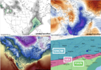
Screenshot 2025-01-07 at 9.20.40 AM.pngAnother Round of Analysis: The Cold Pattern Continues to Dominate

As I’ve been saying for days now, the models have been underestimating the cold air and the potential for a suppressed storm track—and the latest runs are proving that point yet again. While the GFS and Euro continue to act as outliers, models like the UKMET, NAM, GEFS, and Euro AI are showing a much clearer picture of the cold, wintery potential we’ve been tracking. This is exactly the trend I’ve been highlighting, and it’s exciting to see the consensus growing around the colder solution. Let’s dive into the details.


Key Observations

  1. GFS and Euro Outliers
    • The GFS and Euro continue to struggle with the proper handling of the cold air and storm dynamics, showing a warmer, more progressive solution. These models have consistently failed to capture the full extent of the cold air damming (CAD) and its ability to suppress Gulf moisture southward.
    • While these solutions cannot be dismissed entirely, their divergence from other models raises questions about their reliability in this particular setup.
  2. UKMET, NAM, GEFS, and Euro AI Leading the Pack
    • These models have shown much better agreement on the critical factors: stronger CAD, a more suppressed Gulf flow, and a colder storm track. This alignment gives more confidence in their solutions, which favor significant snowfall farther south into the Southeast and Mid-Atlantic.
    • The UKMET and GEFS, in particular, have consistently trended colder, reflecting the influence of persistent Arctic air and the snowpack across the Midwest.
  3. Model Agreement Growing
    • With the UKMET, NAM, GEFS, and Euro AI largely on the same page, we are seeing a clear trend toward a colder, more amplified solution. This growing model agreement increases confidence in a suppressed storm track that maximizes winter weather potential.
  4. Colder Ground and Snowpack Impact
    • One major factor driving this colder trend is the preexisting snowpack and colder ground temperatures across the Midwest and Plains. These elements enhance the CAD and prevent warm Gulf air from overwhelming the pattern, creating a more favorable setup for snow and wintry precipitation.

What to Expect Moving Forward

  1. Continued Trends Toward Suppression
    • With the stronger CAD and blocking in place, it’s likely that models will continue to suppress the storm track, pushing the snow/mix line farther south. This trend aligns well with the solutions from the UKMET, NAM, GEFS, and Euro AI.
  2. Snow Zone Expansion
    • As models come into better agreement, we may see the snow zone expand farther south into parts of northern Alabama, Georgia, and South Carolina. The suppressed track ensures that these areas remain under colder air, increasing their chances of significant snowfall.
  3. GFS and Euro Adjustments
    • While the GFS and Euro remain outliers for now, there is still time for them to adjust toward the consensus. Historically, both models have been slower to catch onto these types of setups, especially when CAD and suppressed storm tracks are involved.

Final Thoughts

The UKMET, NAM, GEFS, and Euro AI are clearly leading the way in capturing the correct pattern for this storm. Their solutions align with the colder trends we’ve been seeing and paint a much more accurate picture of the winter weather potential. The GFS and Euro, on the other hand, are lagging behind and appear to be outliers at this stage.

If these trends continue, we’re looking at a significant winter storm for the Southeast and Mid-Atlantic, with colder air, suppressed Gulf moisture, and an expanding snow zone. As always, the next few model runs will be crucial, but for now, the colder, snowier solution is gaining momentum—and that’s great news for winter weather enthusiasts!
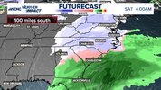
Image 112.jpeg
 
I think the biggest boom/bust potential for this event is along and north of 85 from Gainesville to Charlotte-ish. If QPF is going overperform anywhere, it'll likely be that area. The bust part comes in with temps but I am leaning more boom than bust rn.

Secondary boom area with lower odds is probably NENC if the ICON depiction is to be believed
 
I know a lot of people live in Atlanta so I will give a first guess. Temps are very marginal…snow/sleet to cold rain. I’m not sure if freezing rain is really in store there tbh. It’s more of a 1 day storm there in terms of impacts as temps rise. Considering the timing and heavy traffic, it’s mostly gonna stick to cars and the grass. Temps initially all above freezing too will still make it to 32 imo but that’s not enough to warrant much ice on the tree tops until you go 1 county north some of the roads there may be more slushy. 1”snow mix sleet. Any ZR is just a glaze on the tree. Bridges will likely be slick at times if enough sleet and snow fall there..I would say 30% chance of 2”. But most likely outcome is up to 1”.
 
Are the euro and nam in agreement for the upcoming 84hrs right now?
Although, it doesn't have to mean 48 hours out to the end result -- if the NAM and Euro are aligned for the next 36-48 hours (which it looks like they are, somewhat) that should be good. Of course the arrival of the AIFS may mean the end of the EE rule. Anyway, enough about that!
 
12z NAM is a much smaller precip shield and warmer so far. Screwed Texas, might screw here in a few minutes.
 
For the I-20 corridor, your proposed line would be nice. I like that basically all the models are trending south, but it will likely be a nail biter for us I-20 folks like always.
Theres going to be a sharp cutoff. A lot of these "simulated" maps we see with heavy blue returns over us will be wasted to dry air for us.

We are going to probably end up less snowy while everyone else cashes in north of Lake Murray.
 
Back
Top