-
Hello, please take a minute to check out our awesome content, contributed by the wonderful members of our community. We hope you'll add your own thoughts and opinions by making a free account!
You are using an out of date browser. It may not display this or other websites correctly.
You should upgrade or use an alternative browser.
You should upgrade or use an alternative browser.
Wintry 1/9-12 Winter Potential Great Dane or Yorkie
- Thread starter SD
- Start date
RDUHeatIsland
Member
CNCsnwfan1210
Member
This pretty much falls in line with its ensemble members
Sent from my iPhone using Tapatalk
iGRXY
Member
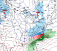
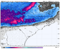
Solid winter storm. Several good trends today. 0% chance the Euro is going to make anyone happy tonight.
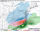
CMC/ICON bring it south: yay!
now can we get the gfs to do more than tilt a bit more + tomorrow?
Also, I assume CMC cold bias applies at this range
now can we get the gfs to do more than tilt a bit more + tomorrow?
Also, I assume CMC cold bias applies at this range
That’s what I was trying to figure out. Where is the cold source? And with a lakes low? Someone smarter than me (which shouldn’t be too hardHard to take the Canadian seriously when it has Charlotte at 13F Friday morning (GFS -- 29F; ICON -- 24F; NAM -- 29F).
1.64 back in Miss. Ouch
Xlhunter3
Member
Likely by the snow pack up north, but its way too aggressive. CMC has a cold bias.That’s what I was trying to figure out. Where is the cold source? And with a lakes low? Someone smarter than me (which shouldn’t be too hard) can maybe explain it.
This did end up being a better GFS run than the previous one. Shift that low just east of Wilmington another fifty miles east and give me a cold air feed from New England and I set for some snow.
rburrel2
Member
ForsythSnow
Moderator
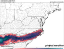
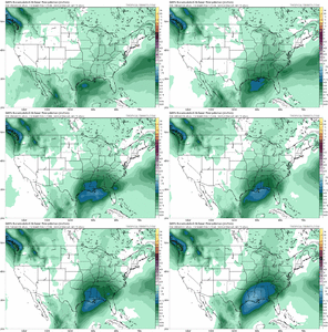
GEFS looks to be coming in higher. One member has a streak through MS/AL with inch/hr rates
Its the track angle guys. Goes from Ga Fl line to south of Wilm.
Gfs goes to Macon, midlands. Why gfs is warmer
Gfs goes to Macon, midlands. Why gfs is warmer
that won't veriify these are garbage maps
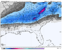
I know the models often overestimate ice accrual but even half of that would cause problems for many folks throughout the southeast.
The low needs to track across the panhandle/Valdosta and not Macon. GA gets screwed with tthis setupThis did end up being a better GFS run than the previous one. Shift that low just east of Wilmington another fifty miles east and give me a cold air feed from New England and I set for some snow.
Last edited:
That’s what I was trying to figure out. Where is the cold source? And with a lakes low? Someone smarter than me (which shouldn’t be too hard) can maybe explain it.
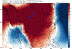
reminder that the airmass coming in is a textbook cold high and yeah, it will moderate some and weaken but not a ton, it's still early january
Attachments
It's the CMC so of course it is way too cold but there is a solid 50/50 low, with a H up over WV and a solid snowpack to our north so these things don't hurtThat’s what I was trying to figure out. Where is the cold source? And with a lakes low? Someone smarter than me (which shouldn’t be too hard) can maybe explain it.
For my central/southern midlands of SC friends.
You want the low to track across North Central Florida and off into the Atlantic for a big snow deal. It's likely not happening, and will come too far North from there, but who knows.
You want the low to track across North Central Florida and off into the Atlantic for a big snow deal. It's likely not happening, and will come too far North from there, but who knows.
Forevertothee
Member
Chris Justice WYFF NBC has posted a graphic and wording on Facebook indicating that he is going with 2-4 inches 85 N to NC line. 1-2 South of 85 with mixing with more ice. Has mountains 4-8+. Has Clemson to Greenville to Spartanburg labeled as mainly Snow icy mix at times. South of 85 labeled Icy Mix, Some Snow. Heavy Snow labeled WNC. Of course, he says subject to change.
Yeah and if it tracks more towards the panhandle everyone is in, it's a boardwide snow party for the most part. A bunch of folks in GA and SC are gonna get hosed with cold rain while dealing with the NC folks drunk on their first snow in years.
Hello rduwx, good to see you on here!! I would say there's 2 components to it: 1) High Pressure to the north, and 2) The airmass in place over E Canada / NE / M Atl. Ideally, we have a big high, in strong damming, with a big pool of cold air to the NW, N, and NE of us. In this case, we don't have the high pressure, but we have a good (not great), cold airmass over us and to the north as the storm is moving in. So, negatives are that we don't have the high pressure, and we don't have a super cold airmass. Positives are that the airmass is pretty solid and it's in place...it's not fighting to get across the mountains. But we should always, always question temperatures along the line from Raleigh to GSPThat’s what I was trying to figure out. Where is the cold source? And with a lakes low? Someone smarter than me (which shouldn’t be too hard) can maybe explain it.
UNCSC
Member
Seems very bold to put that out on a Monday night when this is a Friday night event. He may regret thatChris Justice WYFF NBC has posted a graphic and wording on Facebook indicating that he is going with 2-4 inches 85 N to NC line. 1-2 South of 85 with mixing with more ice. Has mountains 4-8+. Has Clemson to Greenville to Spartanburg labeled as mainly Snow icy mix at times. South of 85 labeled Icy Mix, Some Snow. Heavy Snow labeled WNC. Of course, he says subject to change.
iGRXY
Member
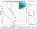
If you’re under heavy rates, that’s snow
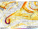
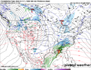
Uh oh, looks like UKMET might be a little more amped then it's 12z run, going more neg too early but let's see where it goes. I'm horrible at projections lol
Looks like those of us SE of RDU are really going to be sweating this one out, as usual. Probably snow, sleet, and mostly freezing rain. Anything from nothing on the GFS to 5 inches on the nutjob Canadian. The thought of tree limbs and power lines snapping does not excite me in the least. We need that track about 50 to 75 miles further SE.
Nope, still positive tilt so should help it slide east, also a touch stronger
CNCsnwfan1210
Member
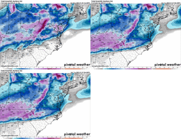
GEFS is basically a hold from 18zView attachment 160668
Trends getting worse for Dallas, better trends for the midsouth
Sent from my iPhone using Tapatalk
Still very euro-y for the ukie
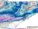
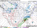
Meh lighter amounts, solid 1-3 across NC but this is a much weaker system then the ICON/CMC/GFSNope, still positive tilt so should help it slide east, also a touch stronger

