We can work with this


 We are starting to get a nice swath 3-7" along the 85 corridor this suite
That’s what I was trying to figure out. Where is the cold source? And with a lakes low? Someone smarter than me (which shouldn’t be too hardHard to take the Canadian seriously when it has Charlotte at 13F Friday morning (GFS -- 29F; ICON -- 24F; NAM -- 29F).
 ) can maybe explain it.
Likely by the snow pack up north, but its way too aggressive. CMC has a cold bias.That’s what I was trying to figure out. Where is the cold source? And with a lakes low? Someone smarter than me (which shouldn’t be too hard

that won't veriify these are garbage maps
I know the models often overestimate ice accrual but even half of that would cause problems for many folks throughout the southeast.
The low needs to track across the panhandle/Valdosta and not Macon. GA gets screwed with tthis setupThis did end up being a better GFS run than the previous one. Shift that low just east of Wilmington another fifty miles east and give me a cold air feed from New England and I set for some snow.
That’s what I was trying to figure out. Where is the cold source? And with a lakes low? Someone smarter than me (which shouldn’t be too hard

It's the CMC so of course it is way too cold but there is a solid 50/50 low, with a H up over WV and a solid snowpack to our north so these things don't hurtThat’s what I was trying to figure out. Where is the cold source? And with a lakes low? Someone smarter than me (which shouldn’t be too hard

Hello rduwx, good to see you on here!! I would say there's 2 components to it: 1) High Pressure to the north, and 2) The airmass in place over E Canada / NE / M Atl. Ideally, we have a big high, in strong damming, with a big pool of cold air to the NW, N, and NE of us. In this case, we don't have the high pressure, but we have a good (not great), cold airmass over us and to the north as the storm is moving in. So, negatives are that we don't have the high pressure, and we don't have a super cold airmass. Positives are that the airmass is pretty solid and it's in place...it's not fighting to get across the mountains. But we should always, always question temperatures along the line from Raleigh to GSPThat’s what I was trying to figure out. Where is the cold source? And with a lakes low? Someone smarter than me (which shouldn’t be too hard
Seems very bold to put that out on a Monday night when this is a Friday night event. He may regret thatChris Justice WYFF NBC has posted a graphic and wording on Facebook indicating that he is going with 2-4 inches 85 N to NC line. 1-2 South of 85 with mixing with more ice. Has mountains 4-8+. Has Clemson to Greenville to Spartanburg labeled as mainly Snow icy mix at times. South of 85 labeled Icy Mix, Some Snow. Heavy Snow labeled WNC. Of course, he says subject to change.
If you’re under heavy rates, that’s snow


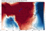
GEFS is basically a hold from 18zView attachment 160668

Meh lighter amounts, solid 1-3 across NC but this is a much weaker system then the ICON/CMC/GFSNope, still positive tilt so should help it slide east, also a touch stronger


.gif")

