NBAcentel
Member
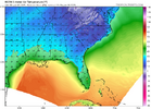
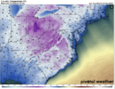
Yeah, those 2m temps on 00z RGEM are beyond insanely ridiculous.Wait until you weenies get a load of Canuck. IDK where this model comes up with these temps, but LOL if it's even close. The RGEM is a few hours slower, but man, it's be worth the wait!
View attachment 160610
View attachment 160612
View attachment 160613

You aren’t joking - definitely wouldn’t have to worry about anything not being frozen hahaWait until you weenies get a load of Canuck. IDK where this model comes up with these temps, but LOL if it's even close. The RGEM is a few hours slower, but man, it's be worth the wait!
View attachment 160610
View attachment 160612
View attachment 160613


Look at that 1032 in WV!End of the NAM. Not too shabby!
View attachment 160570
Still expecting this thing to wind up tighter? LP at 995 over the marine base on my map is a bit close for what happens in Wake countyImagine when the northwest trend kicks in.
For anyone new to the board, Canadian models are always too cold at the surface.You aren’t joking - definitely wouldn’t have to worry about anything not being frozen haha
View attachment 160619
View attachment 160622
that 850 stays at or below zero!!! We have a chance here in the western Triangle!!!!Man, so close to greatness
View attachment 160602
That's got to be a misprint. The QA was pretty shoddy on this run.You aren’t joking - definitely wouldn’t have to worry about anything not being frozen haha
View attachment 160619
View attachment 160622
Thats where everyone upstate- east should focus now. Key to whats gonna happen p type.That trackView attachment 160615
We need it to trend south from here until 12 hours before the event.Imagine when the northwest trend kicks in.
I would still like to see another run of the Pangu because it was hitting home runs too. The model verification scores for the last 3 winters were GFS Graphcast & Euro AI, then down a level to Pangu & Euro, then down a level to UKMetEuro AI will gain legendary status if we get a board wide snow here. We will be talking about how it nailed this storm in the 2030s lol
No doubt about it - something was definitely offThat's got to be a misprint. The QA was pretty shoddy on this run.
When you are on the line at RDU 4 days out, I think we all know how it ends.We need it to trend south from here until 12 hours before the event.
I think we are looking at a True Miller A.View attachment 160601TELL GOD TO STOP THE COUNT. 9" at my house.
Hopefully at the mouth of the Delmarva as it pivots.Imagine when the northwest trend kicks in.
You'd think so, and I'm sure it's way too cold. But, the CMC has been 5-10 degrees colder than other models for several runs now too.That's got to be a misprint. The QA was pretty shoddy on this run.
1018 HP on top of metwannabe’s house might do itNevermind!
View attachment 160597
Temps are crazy, but the pattern (ICON, GEFS, EURO AI) isn’t and models are starting to agree. IMOWait until you weenies get a load of Canuck. IDK where this model comes up with these temps, but LOL if it's even close. The RGEM is a few hours slower, but man, it's be worth the wait!
View attachment 160610
View attachment 160612
View attachment 160613
Except 36 hrs ago.For anyone new to the board, Canadian models are always too cold at the surface.
The benchmark is Friday at 15z. Want to see the height lines running from Wyoming to Arizona, not Wyoming to New Mexico. Different model sites have different number of contours. It's not the number of contours, just the angle of the lines.Is this what you mean grit? re: less lines (contours) from WY to NM but better for WY to AZ?

I’m only little over an hour from you west
I’m right there with you. Let’s drop that drop off about 60 miles further south between now and Thursday evening before the you know what trend. After February 2015, January 2017, and December 2018 and the snowless last 3 years, us Union County folks deserve this one.Icon looked great here but that sharp drop off 40 miles south makes me want to vomit.

