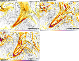
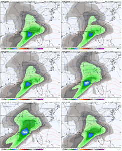
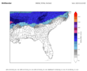
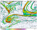
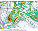
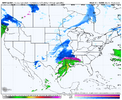
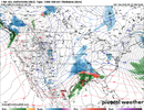
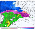
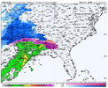
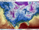
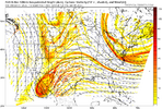
How do we know these trends wouldn't have take place if that storm was still ongoing?Maybe we truly did need to get that system out of the way yesterday and today. These trends are absolute magical for the I-20 crowd. Absolutely crazy to see these trends. We’ve got a cold cold week ahead and it won’t take long to get things accumulating. Let’s keep it rolling!
-
Hello, please take a minute to check out our awesome content, contributed by the wonderful members of our community. We hope you'll add your own thoughts and opinions by making a free account!
You are using an out of date browser. It may not display this or other websites correctly.
You should upgrade or use an alternative browser.
You should upgrade or use an alternative browser.
Wintry 1/9-12 Winter Potential Great Dane or Yorkie
- Thread starter SD
- Start date
Imo, that’s a mixed bag to rain for my fellow RDU folks just based of the position of the low off the coast. We would need a trend SE of that if we stand a chance. Still lots of time. This is just based of the latest Ai run.
As much as I love my ATL family, it’s been my experience that if Atl north see snow, it’s a struggle for RDU. That’s why it’s so hard for everyone to get in on one storm. Little changes in the track have major impacts for different parts of the SE. Trust me, I wish I could go through one of those storms where everyone got in on the action. 17 years on the weather boards and still waiting. Lol!
As much as I love my ATL family, it’s been my experience that if Atl north see snow, it’s a struggle for RDU. That’s why it’s so hard for everyone to get in on one storm. Little changes in the track have major impacts for different parts of the SE. Trust me, I wish I could go through one of those storms where everyone got in on the action. 17 years on the weather boards and still waiting. Lol!
Can I put in a dinner order for the latest Pangu?It's the best model we have right now. State of the art.
How do we know these trends wouldn't have take place if that storm was still ongoing?
We don’t know, but maybe it’s just coincidence. Let’s see if it keeps up.
RollTide18
Member
NWS Mobile has a 50% chance of a wintry mix in my forecast for Thursday Night, then a chance of freezing rain Friday Morning
ForsythSnow
Moderator
6 inches for all of ATL makes me skeptical as does a foot in northern Louisiana, but I'm not complaining if it happens. That or we see something amazing.
NBAcentel
Member
Chattownsnow
Member
A foot in northern Louisiana? I don’t know lol
Shinrin
Member
I've been lurking here for the past week or so checking to see how this pans out, I'm loving the trends here and hope they pan out. I'd rather get snow than Ice or a Cold rain.
beanskip
Member
Pretty significant trend southwest from prior two runs with the Baja low from the 0z NAM at just 30 hours out. Yes, it's the NAM ...
Iceagewhereartthou
Member
Would love to see some pinks and purples in the Carolinas!
is this the latest?
Looks like the bottom text has all the things. 18z big models. 12z graphcast.
Mahomeless
Member
SL….are you right at the state line?is this the latest?
Stormlover
Member
15 miles from TennesseeSL….are you right at the state line?
iGRXY
Member
accu35
Member
I’m only little over an hour from you westNWS Mobile has a 50% chance of a wintry mix in my forecast for Thursday Night, then a chance of freezing rain Friday Morning
Snowlover34
Member
I’m liking the trends here in Hazel Green near the tennessee state line
PARSONBROWN
Member
agree. think strong cutoff as normal from huntsville to cullmanI’m liking the trends here in Hazel Green near the tennessee state line
CNCsnwfan1210
Member
Northern stream wave. This needs to stay ahead of the Baja low to keep the storm track flatter
Sent from my iPhone using Tapatalk
Sent from my iPhone using Tapatalk
albertwilsonjr
Member
Northern stream wave. This needs to stay ahead of the Baja low to keep the storm track flatter
Sent from my iPhone using Tapatalk
Looks like it is on the nam
Sent from my iPhone using Tapatalk
accu35
Member

Nam!! come get me!!
I think anyone north of the Tennessee River in Bama are sitting pretty. Anyone north of I20 will do ok but messy. South of I20 cross your fingers, toes, and anything else you can think of and pray the south trend continues. Just my 2 cents probable worth lessI’m liking the trends here in Hazel Green near the tennessee state line
Iceagewhereartthou
Member
Good response from Jimmy but thought I'd chime in. You're probably in a pretty good spot actually, just looking at the map. But we all need a stronger northern jet stream press (not too strong, don't want too much supression) while keeping the low tracking in the gulf, not over land. We want the low to track more east than NE and stay relatively weak. It would really help if there were a better H pressure to our north to provide a better cold feed; we need ongoing cold air advection feeding in throughout the storm to help cancel out the affects of warm air advection, but we usually see a lot of weakening and retreating highs in these setups. Mixing is hard to avoid but is possible if the cold feed can outlast the WAA. You may actually do a bit better being West of the Apps, those mountains are beautiful but tend to complcate weather.What do we need to see happen to keep this thing from changing back to rain?
iGRXY
Member
iGRXY
Member
iGRXY
Member
Depends on your location tbh. Means a more amped LP.Not good right?
NBAcentel
Member
SnowwxAtl
Member
In Atlanta...probably not...more ice than snow but the NAM can't be trust that far out.Depends on your location tbh. Means a more amped LP.
Stormlover
Member
iGRXY
Member
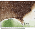
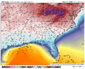
Yeah fro I was just about to post them DPs, that's a stout CAD look on the NAMA winter storm is coming boysView attachment 160567View attachment 160568
CAD there will be a moisture issue closer you get to Mount Airy.Yeah fro I was just about to post them DPs, that's a stout CAD look on the NAM
Snowlover34
Member
I wonder what it would take for this to be a slow moving system?
ForsythSnow
Moderator
Iceagewhereartthou
Member
Man that looks juiced! Normally I would take that look every time. However, I think the NAM tends to over juice and over amp, in its long range. I'd like to see that ice line another 50 miles south, but it's hard not to like that for many of us.View attachment 160566Oh yeah we were going to get NAM'd if this kept going

