-
Hello, please take a minute to check out our awesome content, contributed by the wonderful members of our community. We hope you'll add your own thoughts and opinions by making a free account!
You are using an out of date browser. It may not display this or other websites correctly.
You should upgrade or use an alternative browser.
You should upgrade or use an alternative browser.
Wintry 1/9-12 Winter Potential Great Dane or Yorkie
- Thread starter SD
- Start date
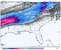
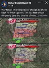
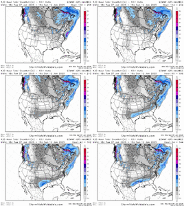
Still a lot of variability. Some bombs but also a lot of whiffs
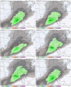
View attachment 160508
Very much appreciate both of your contributions to to this forum for our area, I think I speak for everyone.At just a few less bombs than whiffs and mostly acceptable hits, I think there's a pretty good sitting for N GA on this. P24 and 12 and 15 I'd have to wonder how that would happen
NoSnowATL
Member
Euro catching up late to the party like always.Now that is cray!
euro late to the party? Doesn't happen that muchEuro catching up late to the party like always.
NBAcentel
Member
So UKMET and EURO on board for North Alabama Winter Wonderland, now were talking. Time to find some big enough cardboard boxes to use for a sled 
NBAcentel
Member
Darklordsuperstorm
Member
NBAcentel
Member
Blue_Ridge_Escarpment
Member
You love to see models catching up
albertwilsonjr
Member
You love to see models catching up
Is this good for South Carolina
Sent from my iPhone using Tapatalk
More precip and not warmer. Not something you see very often. Hope it continues.
Bigedd09
Member
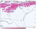
My favorite part about this is the precip is increasing and the temperatures are not. lfgEuro is probably late to the party. QPF slowly increasing across the Carolina’s View attachment 160517
Bet eps ens lp tracks are 90 miles futher right tha gfs op. Prob pos tilt longer before phase. Thats the rubber meets road cage match for NC .
Downeastnc
Member
Baby steps is the way....this is still 4 days out for us here in eastern NC plenty of time to reel it in.Need the trend with the Euro/Ukie cluster of slp well off the coast to keep up.
Bigedd09
Member
Sorry I copied you here. Didn't see your post until after I replied. I agree though! Great trends today for EVERYONE. Let's keep it upMore precip and not warmer. Not something you see very often. Hope it continues.
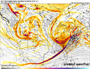
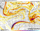
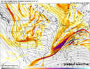
Funny how we're coming back to this topic, but at hr 93, you can see the difference between the GFS and Euro. May have been mentioned earlier, but the ridge thru Montana has rolled over to the right more on the Euro (more anticyclonic wave break). This slows the ejection of the baja wave on the Euro compared to the GFS. It also allows the central plains trough to drop in farther west on the GFS. In addition, the 50/50 low on the Euro hasn't escaped as much and is extending farther south. All of these act to lessen the amount of ridging along the east coast and allow the GFS to phase more cleanly into a stronger storm with more amplitude on its east side...so it's warmer storm, with a more expansive precip shield to the NW.
This is the type of thing I would not want to bet against the Euro on, but it's probably not 100% correct either. Maybe give it 70% Euro / 30% GFS blend

This is the type of thing I would not want to bet against the Euro on, but it's probably not 100% correct either. Maybe give it 70% Euro / 30% GFS blend

I think the GFS storm track over central North Carolina in the latest run is highly unlikely. I think it will eventually fold and move more southeast in line with most of the other models. On the other hand it may be on to something with the rapid erosion of the CAD. What worries me with this system is that there is not a high pressure system to lock in and reinforce the CAD during the storm. Temperatures have been trending colder but they have a ways to go before I can be confident that this will be primarily a winter weather event in the RDU area.
ForsythSnow
Moderator
I can almost see this trending more towards 5 or 6 inches across N al and N GA if this keeps going but I'm not going to be greedy at 3. Logical is 2 to 4 wishcast is 6+
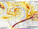
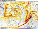
Here is the resulting difference between the GFS and Euro at hr 108


Tokenfreak
Member
Depends on location, but for the lowcountry it just means more rainIs this good for South Carolina
Sent from my iPhone using Tapatalk
Is this good for South Carolina
Sent from my iPhone using Tapatalk
Bigedd09
Member
Ya'll these models other than the GFS are starting to look more and more like the EURO AI
That's a sharp difference between where the 540 line is in the GFS and Euro model frames at that point.Here is the resulting difference between the GFS and Euro at hr 108

BHS1975
Member
Much rather have the Euro on our side though like we have now.I think the GFS storm track over central North Carolina in the latest run is highly unlikely. I think it will eventually fold and move more southeast in line with most of the other models. On the other hand it may be on to something with the rapid erosion of the CAD. What worries me with this system is that there is not a high pressure system to lock in and reinforce the CAD during the storm. Temperatures have been trending colder but they have a ways to go before I can be confident that this will be primarily a winter weather event in the RDU area.
NBAcentel
Member
carolinachaos
Member
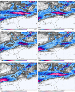
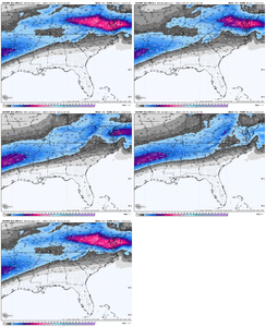
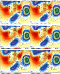
EPS is trending to more Atlantic confluence as well View attachment 160526
Can you explain what that means to the novices on the board? More warm air off the ocean?
Sent from my iPhone using Tapatalk
Cary_Snow95
Member
Means heights will be lower in the east = colderCan you explain what that means to the novices on the board? More warm air off the ocean?
Sent from my iPhone using Tapatalk
I think there is a good deal of merit to the point made by others upthread about the nature of this non-reinforcing, shallow CAD. An amped up system would, in fact, scour it out pretty effectively.I think the GFS storm track over central North Carolina in the latest run is highly unlikely. I think it will eventually fold and move more southeast in line with most of the other models. On the other hand it may be on to something with the rapid erosion of the CAD. What worries me with this system is that there is not a high pressure system to lock in and reinforce the CAD during the storm. Temperatures have been trending colder but they have a ways to go before I can be confident that this will be primarily a winter weather event in the RDU area.
That said, I have seen models do what the GFS is attempting, only to correct south and east as we close in. It may be that the CAD trends a little stronger in time. That is not uncommon, even when there is no reinforcing HP. It may be that the system does really wind up.
It is possible, even likely, that such a system would run inland. That scenario is certainly not something to take off the table. However, I feel that the GFS, trying track the storm between GSO and RDU, is out to lunch. Up through the coastal plain? Yeah, ok, I'll bite on that.
Confluence suppresses and/or shreds storms and can locks in high pressure. Nothing is 100% in weather except that it doesn't snow at Rain Cold's house. But confluence to our north/northeast is good for increasing wintry weather chances for us down here, unless it's overwhelming (cold and dry). That's the bottom line.Can you explain what that means to the novices on the board? More warm air off the ocean?
Sent from my iPhone using Tapatalk
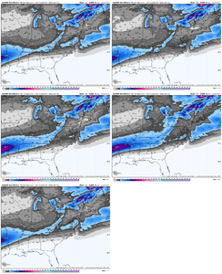
I think the trends are easy to see,Past 11 EPS numbers…fairly easy to see a major winter event for large portion of the SE is coming.
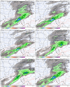
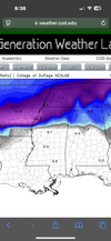
View attachment 160525
The same thing happened downstream
In ArkLaTexas, Miss & Tenn.
I'd imagine those blues will be filling in further east with later modeling unless the atmosphere changes from this point.
Which is still a possibility but I think the chances are growing for a Miller A storm with a great track and some very good totals in the sweet spots for this storm on the NW side of that track.
I'm feeling really good where I'm at!
Xlhunter3
Member
Looks like the areas to the north of us are getting an extra 1-3 inches of snow. Backside of system one is more amplified than models showed. Hopefully that enhances the cold air further from the snow pack.
For those in NC/SC (and even GA), I'll say we have a long ways to go. Tempting to zero in on the details and hyperfocus on slight shifts--even favoring whatever model(s) delivers the best outcome in our MBY. But these exact details likely won't resolve until 24-48 hours before onset. (especially in CAD events)
Would also strongly caution against reading too much into freezing rain/snow amounts modeled in CAD areas for reasons others have alluded to. (snow can also include other ptypes at this stage, and frz rain almost always overdepicted)
Regardless, my current forecast for RDU is at least 2 inches of predominantly concrete. I love snow, but I'll trade it for pingers if there's a good chance it gets washed away by cold rain.
JLL1973
Member
Hey man you can keep them snow shields in Raleigh. Don't bring that mojo to my neck of the woodsConfluence suppresses and/or shreds storms and can locks in high pressure. Nothing is 100% in weather except that it doesn't snow at Rain Cold's house. But confluence to our north/northeast is good for increasing wintry weather chances for us down here, unless it's overwhelming (cold and dry). That's the bottom line.

