Tarheelwx
Member
Maybe for Alabama, but not necessarily for NC Cad areas. Sure a nice parent high is much more preferable, but certainly not a requirement here in NC CAD. TWIt absolutely is a requirement when you have a gulf low pumping WAA
Maybe for Alabama, but not necessarily for NC Cad areas. Sure a nice parent high is much more preferable, but certainly not a requirement here in NC CAD. TWIt absolutely is a requirement when you have a gulf low pumping WAA
I mean the GFS is crappy with CAD.That's hilarious, I just said the same thing on X. The eastern edge of the CAD would have to erode very quickly. Anything is possible, but my guess is that the GFS is being a bit too hasty in doing so. If we can maintain the general trends of the day through the night, I'll feel much better about a widespread major winter storm.
This is fun again.
Gfs with a ton of precip. Legit major winter storm no matter the precip type
That mean gonna skyrocketView attachment 160493
18z GEFS with many more members further south with frozen precip
Are you serious? I think he's on to something View attachment 160497
Woah! GEFS big increase for I-20. Still rolling so areas further east may have more left to go
View attachment 160499
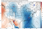
this is not name brand cad. it's great value. Not even in the 1020sIdk how the Low would plow that far inland. Ain’t no way.


I'll say this just from experience, either that lp runs the apps, miller B's or runs up the coast, it's not going up central Carolina's like that...no way no howThis is at 9z:
View attachment 160478
I feel like it can. Like Ross just said, where’s the big high over top giving legit CAD? GFS camp is def getting more isolated tho and I think we need to keep rooting against its solutionI'll say this just from experience, either that lp runs the apps, miller B's or runs up the coast, it's not going up central Carolina's like that...no way no how
I guess my point is this, if the CAD is that weak or almost non-existent, then the low is going further inland. The reason the GFS sends up that track is because there is CAD in place and we've seen a gazillion times over the years, CAD just don't erode that quicky. So if CAD it's east of that or no CAD with an amped system going west..... jmhoI feel like it can. Like Ross just said, where’s the big high over top giving legit CAD? GFS camp is def getting more isolated tho and I think we need to keep rooting against its solution
looks a lot like euro AI
That's hilarious, I just said the same thing on X. The eastern edge of the CAD would have to erode very quickly. Anything is possible, but my guess is that the GFS is being a bit too hasty in doing so. If we can maintain the general trends of the day through the night, I'll feel much better about a widespread major winter storm.
This is fun again.

this is not name brand cad. it's great value. Not even in the 1020s
View attachment 160498
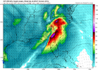
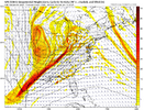
cad erodes when the turbulent interface of screaming upper level winds erode into the dome. unfortunately this dome is weak and these winds are strong:
View attachment 160500
so i could totally see something more inland here.
the good news is that i think this run takes both the worse attributes of the gfs and euro to get this solution. the vort max this run gets strung out over texas which means the shortwave coming from the midwest can't really dig further. because of that it gets negative tilt at a higher latitude and jolts everything north. the euro and others don't have that particular diving shortwave feature which is why their precip is "slidier" for lack of a better term
View attachment 160502
so warmer run but no need to burn it all down to me

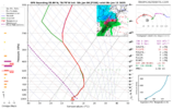
Normally, I'm totally in agreement with the wedging, even in-situ winning. However, the GFS 850mb winds depicted screaming from the SSW in spits over 65kts, will wreck a wedge faster than a dog discovering a steak the first time. Provided the GFS verbatim is correct.I guess my point is this, if the CAD is that weak or almost non-existent, then the low is going further inland. The reason the GFS sends up that track is because there is CAD in place and we've seen a gazillion times over the years, CAD just don't erode that quicky. So if CAD it's east of that or no CAD with an amped system going west..... jmho
i really wouldn't be on the ledge, i think a lot of solutions are still in play. This is just typical southern snow forecasting. DC always gets a treat or two. Unfortunately I don't think any suite is going to be particularly revelatory, instead we're just going to narrow the range of outcomes by like 8%. just be patientThanks for pointing that out. Many North Carolina members are on the ledge this evening.

Could the wedge get stronger with future model runsNormally, I'm totally in agreement with the wedging, even in-situ winning. However, the GFS 850mb winds depicted screaming from the SSW in spits over 65kts, will wreck a wedge faster than a dog discovering a steak the first time. Provided the GFS verbatim is correct.
Today, it was no problem getting strong southerly flow to warm it in the Lowcountry of SC due to the SFC low being well NW of us.
My gut is mixed on our next system if the wedge breaks this far south (probably still warm enough to not be an ice issue down here), but what kind of in-situ lays out and IF some sort of s/w sfc mesohigh pops up say in VA/NC in response of evaporation cooling forces... just enough, with more solid precip trying to hold Temps at the SFC down, despite WAA ducting over the top. That's where I'm mixed with this system of if it can, or can't. I simply don't know yet.
Edit: just thought of this. I wonder if the GFS is trying to develop the Piedmont mesolow that we sometimes see in Carolina severe situations at times or even on some overperforming clippers.
It’s been so long since I tracked a storm I forgot how good at this you are.Normally, I'm totally in agreement with the wedging, even in-situ winning. However, the GFS 850mb winds depicted screaming from the SSW in spits over 65kts, will wreck a wedge faster than a dog discovering a steak the first time. Provided the GFS verbatim is correct.
Today, it was no problem getting strong southerly flow to warm it in the Lowcountry of SC due to the SFC low being well NW of us.
My gut is mixed on our next system if the wedge breaks this far south (probably still warm enough to not be an ice issue down here), but what kind of in-situ lays out and IF some sort of s/w sfc mesohigh pops up say in VA/NC in response of evaporation cooling forces... just enough, with more solid precip trying to hold Temps at the SFC down, despite WAA ducting over the top. That's where I'm mixed with this system of if it can, or can't. I simply don't know yet.
Edit: just thought of this. I wonder if the GFS is trying to develop the Piedmont mesolow that we sometimes see in Carolina severe situations at times or even on some overperforming clippers.
Absolutely... these airmasses can be stubborn as hell to shove out, especially with what I laid out as possible. But it's also quite possible, the modeled upper wind fields by the GFS could be correct, and pretty much rain/dampen the parade. We're still going to need some more time to be a lot more confidentCould the wedge get stronger with future model runs
At just a few less bombs than whiffs and mostly acceptable hits, I think there's a pretty good sitting for N GA on this. P24 and 12 and 15 I'd have to wonder how that would happenStill a lot of variability. Some bombs but also a lot of whiffs
View attachment 160508
Absolutely and not saying it hasn't happened or won't happen but that track verbatim is uncommon. I'm just thinking if it really amps and CAD is that weak it's going more west than that. If it's trying to develop the mesolow this will indeed be a dynamic system with some strong storms in the warm sector, still lots to work out obviouslyNormally, I'm totally in agreement with the wedging, even in-situ winning. However, the GFS 850mb winds depicted screaming from the SSW in spits over 65kts, will wreck a wedge faster than a dog discovering a steak the first time. Provided the GFS verbatim is correct.
Today, it was no problem getting strong southerly flow to warm it in the Lowcountry of SC due to the SFC low being well NW of us.
My gut is mixed on our next system if the wedge breaks this far south (probably still warm enough to not be an ice issue down here), but what kind of in-situ lays out and IF some sort of s/w sfc mesohigh pops up say in VA/NC in response of evaporation cooling forces... just enough, with more solid precip trying to hold Temps at the SFC down, despite WAA ducting over the top. That's where I'm mixed with this system of if it can, or can't. I simply don't know yet.
Edit: just thought of this. I wonder if the GFS is trying to develop the Piedmont mesolow that we sometimes see in Carolina severe situations at times or even on some overperforming clippers.
