• Hello, please take a minute to check out our awesome content, contributed by the wonderful members of our community. We hope you'll add your own thoughts and opinions by making a free account!

Wintry 1/5-7 Winter Weather

Not sure how many times people have to learn this lesson…

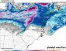
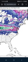
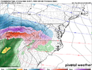
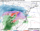
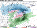
When your storm is largely getting forced by warm advection aloft, there’s no cold high to the north, and the snow pack is paltry, play it north of where you think it’ll be. Seen this kind of thing happen so many times over the years and it’s why I was pessimistic on this system for the last week or so. Setup wasn’t really there for us and it’s been funny, but not that surprising to see it keep shifting northward.

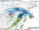
View attachment 158532

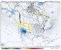
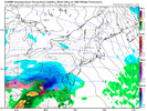
View attachment 158533
I don’t understand people’s optimism with this system. Others talking about “players on the field” “we have a signal” . Yeah, your signal is a LP moving to your west (never good) and your players ARENT on the field. Where’s your HP to funnel cold air? WAA will just obliterate the cold air, and no, it’s not in place it will retreat like a roach seeing raid.
 
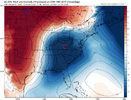
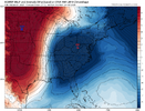
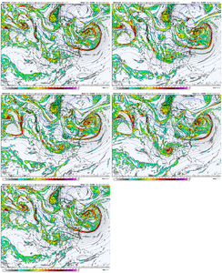
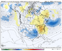
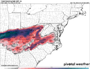
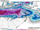
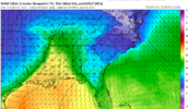
I haven't been following this one as of late, but pretty large difference in temperatures between the regular Euro and the Euro AI. The AI is colder. The timestamps are different here, but I used the images when the storm was in a similar location (Reg Euro is a little faster with it). Any known model biases??

49GQiLf.gif
AI’s got a more compact low and ever so slightly more HP over top, which I imagine both help to feed in some more cold air around the top of the low? Small difference, could be something else
IMG_0496.pngIMG_0497.png
 
I don’t understand people’s optimism with this system. Others talking about “players on the field” “we have a signal” . Yeah, your signal is a LP moving to your west (never good) and your players ARENT on the field. Where’s your HP to funnel cold air? WAA will just obliterate the cold air, and no, it’s not in place it will retreat like a roach seeing raid.

Yeah you need to have sufficient cold air already in place here as the system comes up from the W-SW. The lack of a good cold high (1030 hPa or higher) in front of this over say Southern Quebec, Ontario, &/or the NE US concerned me. Warm advection aloft and sensible heat flux from precipitation falling into the in-situ cad dome will steadily erode the low-level cold air mass.
 
Northwest piedmont might still get something out of this event.

From RAH:
Sunday/Monday: A cold and dry sfc high is expected to retreat to our
north Sunday ahead of a sfc low and associated moisture expected to
lift through the TN valley Sunday night. Run to run consistency
amongst guidance continues to be lacking with respect to the path of
the sfc low, and consequently if central NC will experience any
ptype concerns with this system. However, it`s worth noting that
the 00Z GFS and 00Z ECMWF both did take the sfc low a bit further
south, with the GFS in particular simulating thicknesses/thermal
profiles potentially conducive for a rain/freezing rain mix late
Sunday night/early Monday morning in the Triad area. Ensemble mean
sfc wet bulb temperatures during the 06Z to 12Z Monday period hover
around freezing in the Triad (the GEPS is the outlier, simulating
upper 20s; and consequently more freezing rain potential). However,
by 12Z, the freezing sfc wet bulb contours arc back north and out of
central NC suggesting any freezing rain early Monday morning would
quickly change to all rain by early to mid-morning Monday.

As of now, can`t rule out flurries (maybe some light snow showers)
in the Triad area late Sunday evening that may transition to a light
freezing rain/liquid rain mix between ~06 and 12Z Monday morning
.
It`ll be worth watching to see if a southward trend of the sfc low
develops or not over the next few days, but as of now, this looks
like a pretty inconsequential event for us.


Tuesday/Wednesday: After Monday`s system moves east of our area,
central NC gets largely stuck under zonal flow aloft Tuesday and
Wednesday. Cold air associated with a high over the Central US will
ooze eastward during this period. However, highs in the upper 30s
and lows in the upper teens are currently expected, which is a bit
warmer than the really cold temperatures the ensembles were hinting
at just a few days ago.
 
RNK, has taken snow only out thus far, but I expect it to be a cold rain maybe a few sleet pellets at the start. But who knows right!
SUNDAY
Partly sunny in the morning, then mostly cloudy with a chance of rain in the afternoon. Highs in the upper 30s. Chance of rain 40 percent.

SUNDAY NIGHT
Sleet, snow, freezing rain likely with a chance of rain in the evening, then freezing rain and sleet after midnight. Light snow accumulation. Cold. Near steady temperature in the lower 30s. Chance of precipitation 80 percent.

MONDAY
Mostly cloudy in the morning, then becoming partly sunny. Sleet and freezing rain in the morning. A chance of rain. Little or no additional sleet accumulation. Highs around 40. Chance of precipitation 80 percent.
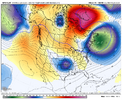
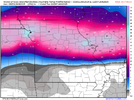
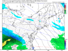
I'm bored this morning, so I'm looking at the differences in the short-range models (NAM & RDPS) and the operational GFS. It looks to me that the short-range models have a (slightly) stronger pressure press from the high in the northern plains. For us northern NC folks, any small adjustment in that high (location, strength, pressure extent), could be the difference in getting just rain or seeing some wintery precip.
 
I'm bored this morning, so I'm looking at the differences in the short-range models (NAM & RDPS) and the operational GFS. It looks to me that the short-range models have a (slightly) stronger pressure press from the high in the northern plains. For us northern NC folks, any small adjustment in that high (location, strength, pressure extent), could be the difference in getting just rain or seeing some wintery precip.
Wouldn't take much, depends on what DP's are when precip starts and see whether we can WB below 32 degrees for a while. I mean the ground/roads is going to be plenty cold leading up to the event. Need some teens to low 20s DP's when it gets underway. That may be wishcasting a bit. lol
 
Wouldn't take much, depends on what DP's are when precip starts and see whether we can WB below 32 degrees for a while.
Yep. Dew points on the Canadian are really low. These types of setups can work best for your area. By the time the warm can win out, a lot of your precip is over. For my area (north central/east NC), we need to a constant cold air feed (real CAD). This is not the setup.
 
Courtesy of Raysweather

A potent low forms in Oklahoma Sunday. It will be in Kentucky Monday before transferring energy to a coastal low late Monday. Temperatures look tricky, but we look "just out of the money." Overrunning moisture may arrive in time to produce a period of mixed precipitation (light rain and snow) on Sunday afternoon. The heaviest precipitation comes Sunday night. Dynamic coolling at the beginning of the heaviest rain may cool the atmosphere to give us a mix of rain and snow, but temperatures will warm aloft producing just rain later Sunday night into early Monday.

A front moves through Monday, and much colder air arrives. Precipitation changes to snow showers and flurries, ending Monday evening. Like so many before, this NW flow event will favor west over east for light accumulations of snow.

Tuesday will be cold with more sun. But the coldest air of the season may accompany a secondary front arriving late Wednesday. Again a few snow showers or flurries may follow the front Wednesday night.

Cold weather will be with us for the first two weeks of January, but currently, there's no real candidate for a significant snow.
Mountains get theirs even in the worst of winters!
 
Back
Top