-
Hello, please take a minute to check out our awesome content, contributed by the wonderful members of our community. We hope you'll add your own thoughts and opinions by making a free account!
You are using an out of date browser. It may not display this or other websites correctly.
You should upgrade or use an alternative browser.
You should upgrade or use an alternative browser.
Wintry 1/5-7 Winter Weather
- Thread starter SD
- Start date
WEATHERBOYROY
Member
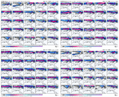
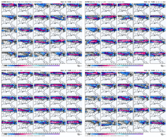
Maybe not? can't figure things out in this craziness!You can go ahead and expect this same trend with our Jan 10 window View attachment 158412
RDUHeatIsland
Member
iGRXY
Member
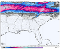
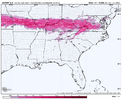
The extreme northern counties of NC on the VA border likely get some ice here but yeah this is pretty much dead in the water at this point. Biggest thing to look at with this storm is how much snow can we put down to our north and how does it strengthen as it moves to the 50/50 region for wave 2 behind it.EPS has stuck a fork in this one. Would be a colossal bust for it to shift southward at this point with no remaining southern solution members left. Feels like we made it right to the goal line and will once gain not get the ball into the end zone.
View attachment 158470
View attachment 158472
I love it for the mid Atlantic honestly hopefully it sets the stage for the next one
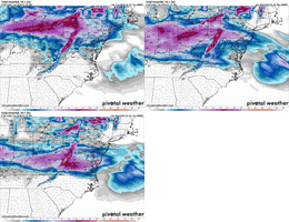
It’s fairly clear someone in the south east will get snow from this. We already had a little event in parts for Dec and now middle Atlantic getting a big one on Sunday…it wants to snow this winter. Buy shovels.Here’s where all three major models sit right now View attachment 158480View attachment 158481View attachment 158482
Webberweather53
Meteorologist
I’ve always felt like this was more likely to be a table setter event for something to come down after it in the 2nd week of January. Not too surprised about where things are rn in the model world, although we still can’t rule out a more southern solution
Sorry folks this is my storm
This is why it’s always better to keep expectations in check. Especially for the first winter storm of the season. The pattern still looks cold and having the snow pack to y’all’s north will help with future events. Plenty of cold later to form more storms. Best chance for that southern snow will be storm #2.
I’ll be here in southern Illinois getting a messy ice storm with some back end snow. Will be sure to provide photos of what’s to come in the future once I’m done covering it on TV!
First winter storm as a broadcast meteorologist for me so I’m excited to get out there in the elements!
I’ll be here in southern Illinois getting a messy ice storm with some back end snow. Will be sure to provide photos of what’s to come in the future once I’m done covering it on TV!
First winter storm as a broadcast meteorologist for me so I’m excited to get out there in the elements!
Congrats man! I can not wait sir!This is why it’s always better to keep expectations in check. Especially for the first winter storm of the season. The pattern still looks cold and having the snow pack to y’all’s north will help with future events. Plenty of cold later to form more storms. Best chance for that southern snow will be storm #2.
I’ll be here in southern Illinois getting a messy ice storm with some back end snow. Will be sure to provide photos of what’s to come in the future once I’m done covering it on TV!
First winter storm as a broadcast meteorologist for me so I’m excited to get out there in the elements!
What station are you on? I’ll pull up the live stream of your coverageThis is why it’s always better to keep expectations in check. Especially for the first winter storm of the season. The pattern still looks cold and having the snow pack to y’all’s north will help with future events. Plenty of cold later to form more storms. Best chance for that southern snow will be storm #2.
I’ll be here in southern Illinois getting a messy ice storm with some back end snow. Will be sure to provide photos of what’s to come in the future once I’m done covering it on TV!
First winter storm as a broadcast meteorologist for me so I’m excited to get out there in the elements!
This is why it’s always better to keep expectations in check. Especially for the first winter storm of the season. The pattern still looks cold and having the snow pack to y’all’s north will help with future events. Plenty of cold later to form more storms. Best chance for that southern snow will be storm #2.
I’ll be here in southern Illinois getting a messy ice storm with some back end snow. Will be sure to provide photos of what’s to come in the future once I’m done covering it on TV!
First winter storm as a broadcast meteorologist for me so I’m excited to get out there in the elements!
LukeBarrette
im north of 90% of people on here so yeah
Meteorology Student
Member
2024 Supporter
2017-2023 Supporter
StoneColdHeel
Member
Better than rain or cutting like it has been showing.View attachment 158513
Live and die by the front end thump
NBAcentel
Member
Over performing that fgen band drastically changes the eventDefinitely gonna at least be some non accumulating front end sleet/snow reports though even pretty far south. But along - north of I-40 still wouldn’t sleep on this being impactful View attachment 158515
NBAcentel
Member
Yeah there’s a noticeable trend in this system dealing with more confluence but less cold air damming today, if we go that way more and squash it some more then things get interesting, if we stay in between those looks then things kinda suck. The more confluence the further south the front end thump could beOver performing that fgen band drastically changes the event
LukeBarrette
im north of 90% of people on here so yeah
Meteorology Student
Member
2024 Supporter
2017-2023 Supporter
Aggressive especially for VA
Blacksburg, dang didn't expect this from them, But I will sure take it. It'll change many times before Sunday I'm well aware of that.
SUNDAY
Mostly sunny. A chance of rain in the afternoon. Highs in the lower 40s. Chance of rain 30 percent.
SUNDAY NIGHT
A chance of snow in the evening, then snow after midnight. Cold with lows in the upper 20s. Chance of snow 80 percent.
MONDAY
Snow likely in the morning, then a chance of snow and rain in the afternoon. Highs around 40. Chance of precipitation 70 percent.
MONDAY NIGHT
Mostly cloudy. A chance of snow in the evening. Cold with lows in the lower 20s. Chance of snow 50 percent.
Unfortunately they don’t have permission to forecast sleet/zr vs snow at certain time lengths. Certainly wouldn’t read into that forecast for a place like Mount Airy..will be warm nose city there.Blacksburg, dang didn't expect this from them, But I will sure take it. It'll change many times before Sunday I'm well aware of that.
SUNDAY
Mostly sunny. A chance of rain in the afternoon. Highs in the lower 40s. Chance of rain 30 percent.
SUNDAY NIGHT
A chance of snow in the evening, then snow after midnight. Cold with lows in the upper 20s. Chance of snow 80 percent.
MONDAY
Snow likely in the morning, then a chance of snow and rain in the afternoon. Highs around 40. Chance of precipitation 70 percent.
MONDAY NIGHT
Mostly cloudy. A chance of snow in the evening. Cold with lows in the lower 20s. Chance of snow 50 percent.
No doubt, that's why I said it'll change many times before SundayUnfortunately they don’t have permission to forecast sleet/zr vs snow at certain time lengths. Certainly wouldn’t read into that forecast for a place like Mount Airy..will be warm nose city there.
if anyone gets a surprise with this one it’s likely the foothills&mtns with 1-2” snow followed by <1” sleet and .2” ZR. That would be my high end of the forecast for any location that can wetbulb before 3 am Monday. Odds probably down to 30% currently
Webberweather53
Meteorologist
Lol even DC struggling to snow on this euro run.
Color me shocked. Not
Color me shocked. Not
LukeBarrette
im north of 90% of people on here so yeah
Meteorology Student
Member
2024 Supporter
2017-2023 Supporter
How does it look for Blacksburg area?Lol even DC struggling to snow on this euro run.
Color me shocked. Not
Webberweather53
Meteorologist
How does it look for Blacksburg area?
Ice ice baby
We got 5 days just need the usual cooling trends to seal the deal on some sleet/ip mix which is a win esp for non mountain areas down in the hills.
LukeBarrette
im north of 90% of people on here so yeah
Meteorology Student
Member
2024 Supporter
2017-2023 Supporter
Yeah just saw the trend. Hopefully it reversesIce ice baby
JP152
Member
Yeah, they're getting nervous. Still has IAD at 10 inches, but who knows if the North trend continues.Lol even DC struggling to snow on this euro run.
Color me shocked. Not
Webberweather53
Meteorologist
Yeah, they're getting nervous. Still has IAD at 10 inches, but who knows if the North trend continues.
Not sure how many times people have to learn this lesson…
When your storm is largely getting forced by warm advection aloft, there’s no cold high to the north, and the snow pack is paltry, play it north of where you think it’ll be. Seen this kind of thing happen so many times over the years and it’s why I was pessimistic on this system for the last week or so. Setup wasn’t really there for us and it’s been funny, but not that surprising to see it keep shifting northward.
SnowmanVol99
Member
-NAO blocking and or 50-50 doesn’t seem to be keeping first storm from cutting. Maybe a snowpack to our north will help the second system hit the mid-south and even the Carolinas more. That second system may stay in Deep South but I could see it pulling more north and being a mid-south-Ohio valley storm to Carolina storm.
To use Webb's vernacular---different background states preceding each of these storm set-ups-NAO blocking and or 50-50 doesn’t seem to be keeping first storm from cutting. Maybe a snowpack to our north will help the second system hit the mid-south and even the Carolinas more. That second system may stay in Deep South but I could see it pulling more north and being a mid-south-Ohio valley storm to Carolina storm.
wow
Member
It's not an app runner.. the Greenland block does do its thing and transfers to a secondary low but it's too far north. But when you have a primary low running up to TN/KY - even when its dying and a secondary is forming off the coast.. there's always precip type issues. Always.-NAO blocking and or 50-50 doesn’t seem to be keeping first storm from cutting. Maybe a snowpack to our north will help the second system hit the mid-south and even the Carolinas more. That second system may stay in Deep South but I could see it pulling more north and being a mid-south-Ohio valley storm to Carolina storm.
- Joined
- Jan 2, 2017
- Messages
- 1,566
- Reaction score
- 4,279
Question
Is this wave on shore yet? Still time for a trend good or worse.
Is this wave on shore yet? Still time for a trend good or worse.
SnowmanVol99
Member
I agree I am from northwest middle Tennessee. What Carolina needs and us is too different things lots of times. First time post under new handle. I should have worded differently. Long time lurker and listen to Webb a lot. I think the 2nd system has more potential for my area and North Carolina. Once this first system gets past the 2nd should start becoming more clear.To use Webb's vernacular---different background states preceding each of these storm set-ups
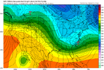
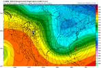
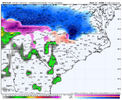
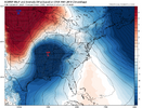
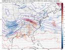
I haven't been following this one as of late, but pretty large difference in temperatures between the regular Euro and the Euro AI. The AI is colder. The timestamps are different here, but I used the images when the storm was in a similar location (Reg Euro is a little faster with it). Any known model biases??


