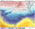
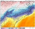
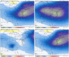
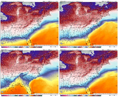
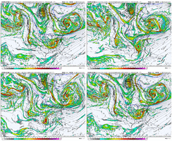
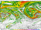
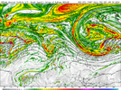
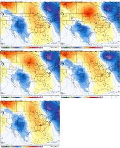
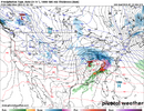
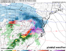
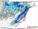
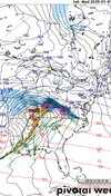
Icon will atleast ice. If that 1040 hp over dakotas can get out in front, we will get a nice event. Neck an neck right now
-
Hello, please take a minute to check out our awesome content, contributed by the wonderful members of our community. We hope you'll add your own thoughts and opinions by making a free account!
You are using an out of date browser. It may not display this or other websites correctly.
You should upgrade or use an alternative browser.
You should upgrade or use an alternative browser.
Wintry 1/5-7 Winter Weather
- Thread starter SD
- Start date
iGRXY
Member
Avalanche
Member
Temps are better, but still marginal outside the frontrange. Continues to be an eekie situation
- Joined
- Jan 23, 2021
- Messages
- 4,602
- Reaction score
- 15,197
- Location
- Lebanon Township, Durham County NC
it will not look anything like AI but it did go south
iGRXY
Member
This thing is only making it to east TN before traversing to the coast already. If this continues we will quickly walk ourselves into an Ice storm.
I’ll take a southern trend regardless. We continue to see models other than the gfs bringing it south and we’re in businessit will not look anything like AI but it did go south
iGRXY
Member
It's significantly better vs 12z. You're hardly ever going to get a clean flip in the medium range. Just has to keep trending better each run.Temps are better, but still marginal outside the frontrange. Continues to be an eekie situation
NBAcentel
Member
Im millineters away from glory on that. Needed a little stronger confluence from NE or HP in southern canada to get out front more, work in tandem. Wave took its sweet time ejecting but was south. Does a ne hook, slight cut move at the end.
That icon run was probably a big sleet storm on the south side of that snow band
wow
Member
Crap german models
- Joined
- Jan 23, 2021
- Messages
- 4,602
- Reaction score
- 15,197
- Location
- Lebanon Township, Durham County NC
Actually yeah that was my first thought. Probably the whole kitchen sink here before going to rn.That icon run was probably a big sleet storm on the south side of that snow band
Webberweather53
Meteorologist
Even more digging on this gfs run
Showmeyourtds
Member
Question for clarity, Atlanta is not in this storm correct for wintry precip right?
Correct- based on current modeling Atlanta and just about all of North and Central Georgia wouldn’t see much, if any wintry precipitation from this storm.
Last edited:
Energy coming on shore CA, notch slower an futher south
NBAcentel
Member
wow
Member
6z was a bit further south than thisEnergy coming on shore CA, notch slower an futher south
NBAcentel
Member
I don't like it at all. Going to be a big fail.
Well that’s a jump northwest!
NBAcentel
Member
Probably gonna be an ice fest run. Still a stout wedge starting to show up
Yeah nc gets it good with ice hereProbably gonna be an ice fest run. Still a stout wedge starting to show up
StoneColdHeel
Member
Webberweather53
Meteorologist
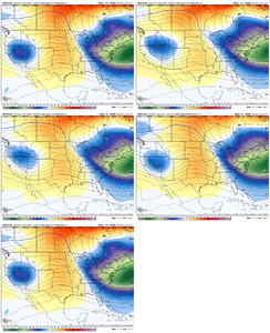
I like it but idk if I do, not sure if I like the bubble ridge in the C US being stronger, but it’s more of a response to the S/W being a lower latitude. the snowiest run was weaker with this feature View attachment 158310
This is starting to get a more classic CAD look at 500mb w/ greater stream separation & the southern stream wave digging into the Southern Plains.
Problem is, the parent surface high isn't as strong as I'd like it to be, but this can still work.
StoneColdHeel
Member
7mb stronger and 50 miles futher north,plus 3 hours latter on arrival. We need the 12z weaker 7mb and 100 miles futher south
- Joined
- Jan 23, 2021
- Messages
- 4,602
- Reaction score
- 15,197
- Location
- Lebanon Township, Durham County NC
This event will live or die with whatever we can squeeze out of the initial FGEN band. This run is more paltry.
Blue_Ridge_Escarpment
Member
I’m not sure I totally buy the surface output on the GFS that run. 500 mb pretty much in lock step with previous run, tilt a little more neutral
NBAcentel
Member
It’s worth noting the CMC looks more south due to slighlty more confluence, probably gonna be slightly better then 12z
Thinking we need wave to scoot a notch quicker, slower aint gonna get us more HP in front it looks like. You think it would. A little quicker maybe the blocking confluence in ne can help us with better thermals
Webberweather53
Meteorologist
0z GFS run seems more realistic generally speaking
NBAcentel
Member
Eh the cmc is weaker/slightly more squashed with the system but has less cad
Canadian transfers from wva to senc. Miller bish
CAD is there at the surface east of the mtns. Timing favors more snow/sleet if precip is here 18z Sunday to 6z Monday. Last run precip arrived too late and led to more mixing with warm air. However, we gonna wetbulb regardless at some point leading to a winter storm along i77 minimum, due to cold dry air. Models won’t be able to truely see these cold pockets.This is starting to get a more classic CAD look at 500mb w/ greater stream separation & the southern stream wave digging into the Southern Plains.
Problem is, the parent surface high isn't as strong as I'd like it to be, but this can still work.
Looks awesome!! Unreal we can't have a bit of luck with winter weather. I don't think it can snow here period.....................................
Looks like we can fire up the severe thread

