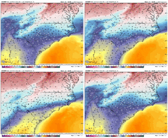
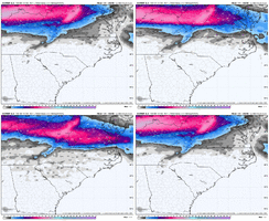
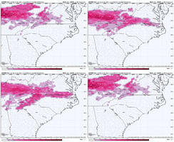
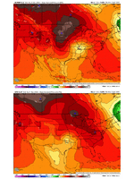
-
Hello, please take a minute to check out our awesome content, contributed by the wonderful members of our community. We hope you'll add your own thoughts and opinions by making a free account!
You are using an out of date browser. It may not display this or other websites correctly.
You should upgrade or use an alternative browser.
You should upgrade or use an alternative browser.
Wintry 1/5-7 Winter Weather
- Thread starter SD
- Start date
NBAcentel
Member
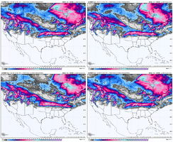
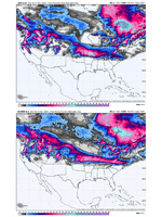
I mean… that’s a tick to the gfs
wow
Member
That is an encouraging trend with the Euro.. Someone is getting whacked.
Roxboro should finally be on the board after this one which is good for the rest of us probably
euro and gfs complementing each other with trends. This is why we don’t share specific model output on social media because the truth all along was/is likely to be a compromise which greatly impacts the location/amount/ptype. The compromise imo will be less snowy for sure even in Virginia. Winter Storms are not always snow or ice. Likely to be all types with cold rain at some point too
Twister
Member
Uh oh EURO starting to Cave.
iGRXY
Member
We're seeing what -NAO do in the short to medium range.
Exactly. It’s why pattern recognition >>> just taking model output verbatim 10 days out. Even if it doesn’t work out, no doubt this one has a suppressed-leaning tendency and was absolutely worth continuing to track.We're seeing what -NAO do in the short to medium range.
Expect further south trends as long as heights up north hold or continue to press
Hopefully we continue the trends which looks hopeful if we continue to flex the -NAO and shifting the HP into place faster. Who knows maybe we get a new years surprise on the 00z runs tonight 

NBAcentel
Member
and this is why a -NAO is the most prevalent teleconnection for NC winter storms outside of the mountainsExpect further south trends as long as heights up north hold or continue to press
- Joined
- Jan 2, 2017
- Messages
- 1,566
- Reaction score
- 4,279
I'm liking an over performing over running sleet paste job in the northern upstate and extreme ne ga! Like it was said above..some of us have seen this movie before. Cad building in and is usually under modeled this far out.
It’s been so long folks have forgotten or weren’t even really into this yet when we last really had a strong one.and this is why a -NAO is the most prevalent teleconnection for NC winter storms outside of the mountains
Euro was south with the wave with more positive tilt - both help with temperatures


packfan98
Moderator
Looks like similar trends on the 18z eps too.
NBAcentel
Member
Biggest concern is we trend into something between the euro and GFS which would be a nasty frzr event
Blue_Ridge_Escarpment
Member
Mine too. I’m afraid it may be the likeliest.Biggest concern is we trend into something between the euro and GFS which would be a nasty frzr event
Aaaannnd we are still 6 days out. Also, even if models work out the primary track of the low there will be a lot of details that will not come into focus for us east of the Apps until maybe 24-48 hours out.Exactly. It’s why pattern recognition >>> just taking model output verbatim 10 days out. Even if it doesn’t work out, no doubt this one has a suppressed-leaning tendency and was absolutely worth continuing to track.
Twister
Member
Yep I agree it's happen way to many times. Northern upstate will be a Mixed messI'm liking an over performing over running sleet paste job in the northern upstate and extreme ne ga! Like it was said above..some of us have seen this movie before. Cad building in and is usually under modeled this far out.
Yeah. Especially when you factor in that neither one of those models do well with temps in CAD at this range.Biggest concern is we trend into something between the euro and GFS which would be a nasty frzr event
MichaelJ
Member
If I have to rely on the GFS to get some snow, just need me some xanax,. I don't see a parent high pressure that is going to get in place in time to have it precip into the cold air. We are trending towards a place that nobody gets much pf nothing, and only the King can save us
LONG TERM /FRIDAY THROUGH TUESDAY/...
As of 310 PM Tuesday...
Two systems to watch in this time window, one late Friday and the
likely stronger system arriving Sun night-Monday. Temps will be
below normal, at times significantly so.
Fri-Sat night: Models agree fairly well that a broad mid level
shortwave trough and PV max will sweep through the Carolinas Fri,
primarily in the afternoon, accompanied by an Arctic cold front that
will usher in a well-advertised cold snap as large/strong Yukon-
source high pressure pours in from the NW heading into the weekend.
The GFS shows the 2 PVU surface getting down to 600 mb with steep
low level lapse rates (around 8 C/km) and fairly high moisture
content through a deep layer noted on forecast soundings as the
trough passes by, and recent runs of deterministic models have
favored low pops with very light amounts across the N, so have
included an isolated pop for light showers or sprinkles Fri
afternoon there, with amounts tempered by the limited moisture near
the ground. Expect highs in the mid 40s to low 50s Fri, with more
clouds than sun through the day, esp N. The colder air will arrive
Fri night, persisting through Sat night with deep NW flow and steady
CAA. Lows will be in the 20s Fri night with clearing skies, then
we`ll see fair skies Sat/Sat night with temps about 8-10 deg F below
normal, upper 30s to mid 40s for highs and around 20 to 25 for lows
Sat night. We may see borderline concerning fire weather conditions
Sat given afternoon wind gusts and RH values bottoming out at 25-30%
in some areas, although this risk will be mitigated a bit by the
cold temps.
Sun-Tue: Attention then turns to a storm system crossing our region
Sun evening through early Tue, a mid level shortwave trough still
currently well out over the open Pacific. Confidence is fairly high
that cold air will remain in place, as the Arctic high will still be
extending into the CWA from the NW Sun, and the shortwave trough
should be fairly robust with a track through the mid Miss Valley
and, ultimately, culminating in a likely Miller-B type surface
cyclogenesis pattern. What is uncertain, however, is the timing,
with about 12-18 hours difference among deterministic models and a
high spread in heights aloft among the LREF and NBM members, as well
as the track of the primary and triple-point/secondary surface lows,
which will affect how much any cold air gets locked in and/or how
much warm air exists just aloft. For now, given that this system
should be able to tap into some moisture, will keep chance pops,
starting Sun night, peaking at good chances Mon morning, then
trending down and out W to E Mon night. The potential for some
wintry precip, either exclusively or mixed with rain, will be across
the far N, from the Triad across the near Roanoke Rapids late Sun
night through Mon morning, with a lesser but non-zero chance of a
period of wintry precip or mixture from Badin Lake across the
Triangle area to Rocky Mount-Wilson. Again, though, major timing and
track differences continue to bring uncertainty. It`s far too early
to talk about specific amounts, with broad ranges among multiple
models and ensemble system members. Any precip should be exiting by
Tue morning, with clearing skies. Expect highs generally in the 40s
Sun and Tue with 40s to lower 50s Mon. Lows in the mid 20s to low-
mid 30s. -GIH
Right now, KRDU seems to be leaning towards the Euro solution for the January 6th event with the best chances for winter precipitation along the northern border of North Carolina. They do note the uncertainity of what will transpire though and as we all know nothing is written in stone yet.
wow
Member
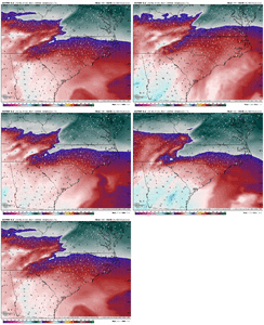
I know no one wants to hear it but the warm nose will be there. Hopefully it won't be a huge factor but there will be a screw zone.
When’s it not? Almost always gonna be an issue. I think most of us would take sleet at this ptI know no one wants to hear it but the warm nose will be there. Hopefully it won't be a huge factor but there will be a screw zone.
Blue_Ridge_Escarpment
Member
Talk about something sticking around a while, sleet with those temps after would be like concrete.When’s it not? Almost always gonna be an issue. I think most of us would take sleet at this pt
Twister
Member
And that's probably what biggest part of it will be, I'm speaking across my area of the Northern upstateWhen’s it not? Almost always gonna be an issue. I think most of us would take sleet at this pt
Warm nose forecasting. slush or crunch below 900ft for a large swath of Piedmont counties of the Carolina’s. “white looking but still heavy mix” above 900ft . And rain above 5,500ft. Gonna be hard to convey this storm given the “snow” maps
iGRXY
Member
I feel like some in here that the most likely outcome for a winter storm is going to be ZR and sleet south of I40. The upstate and southern CAD areas below US74 could get a nasty ice storm in this setup. We maybe able to squeak out some FGEN front end magic with WAA being prevalent.
Upstate is always gonna fight warm nose on a setup like this. I’m sure you’ve seen it too, right up against the mtns will get much more than 85 corridorAnd that's probably what biggest part of it will be, I'm speaking across my area of the Northern upstate
iGRXY
Member
The Northern upstate could get that FGEN front end thump like Jan 2022. Just depends on how long it could hold out.Upstate is always gonna fight warm nose on a setup like this. I’m sure you’ve seen it too, right up against the mtns will get much more than 85 corridor
Webberweather53
Meteorologist
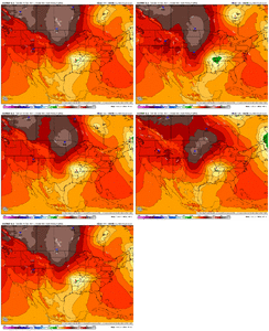
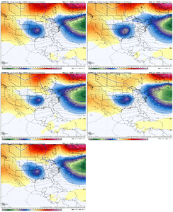
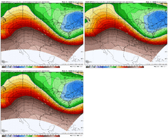
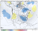
The tighter spacing between the shortwave and the rather fat 50-50 low as well as the broad wavelength of the 50-50 low (which makes it harder to get synoptic subsidence in its wake that forces pressure rises) is probably what’s been giving me fits here. Tbh, that’s why we’re having a harder time getting the surface high in the right spot for a CAD event.
I’d love to see the southern stream wave slow/dig a bit more to let the high come in, but also the closer we move this wave to the 50-50 low, the more the storm track gets squashed like a bug with the confluence over the NE US. Double edged sword ig
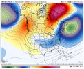
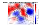
I’d love to see the southern stream wave slow/dig a bit more to let the high come in, but also the closer we move this wave to the 50-50 low, the more the storm track gets squashed like a bug with the confluence over the NE US. Double edged sword ig


iGRXY
Member
Twister
Member
Oh yeah seen it way to many times. This will definitely be a North of 85 event for upstate. I'm like 5 miles South of Hwy 11 above Keowee. This could be a nasty ice storm for usUpstate is always gonna fight warm nose on a setup like this. I’m sure you’ve seen it too, right up against the mtns will get much more than 85 corridor
JB, says the Spire model may have the best solution with this storm. IDK He says should know by Thursday, so many players on the field but models should have it figured out by then....

