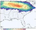
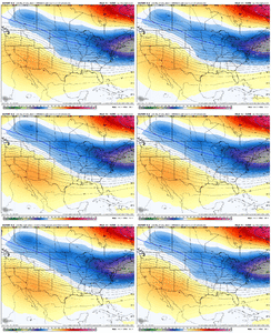
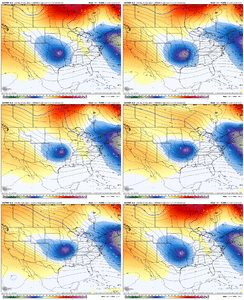
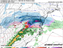
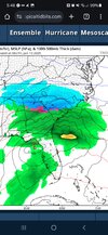
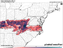
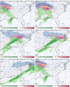
Yea we need more press from the NE, not less. We have no other mechanisim to fix our temp issues with this one. Eitheir its got to get here 6 hours sooner, preferably futher south. Or the Block has to be a nudge stronger, futher sw. Id really like to see white ground while having frigid temps fior 2 straight weeks.Looks awesome!! Unreal we can't have a bit of luck with winter weather. I don't think it can snow here period.....................................
-
Hello, please take a minute to check out our awesome content, contributed by the wonderful members of our community. We hope you'll add your own thoughts and opinions by making a free account!
You are using an out of date browser. It may not display this or other websites correctly.
You should upgrade or use an alternative browser.
You should upgrade or use an alternative browser.
Wintry 1/5-7 Winter Weather
- Thread starter SD
- Start date
- Joined
- Jan 23, 2021
- Messages
- 4,602
- Reaction score
- 15,197
- Location
- Lebanon Township, Durham County NC
Man, I remember when those were like 80% the other day. Hopefully we can get back to that.
It would be nice but I'm not holding my breath. Also not expecting any change for the better but the ECMWF is running I honestly expect it to be similar to the Ukmet as usual.Man, I remember when those were like 80% the other day. Hopefully we can get back to that.
Edit: Definitely not UKMet like. Much further South then the UKMet.
Last edited:
NBAcentel
Member
NBAcentel
Member
Systems tend to arrive quicker than modeled…our last severe weather event did. This would certainly help lay down more snow than advertised and set the stage for sleet or ZR to accumulate. Timing could really help for north GA, upstate SC and some of NC but largely west of Greensboro proper.
Maybe we can get a 5 minute onset sleet pellet to go with all this frost coming the next 2 weeks
That was my thought too. I doubt the severe cold shows up as advertised, It will be cold but I doubt the crazy cold they been showing UNLESS we can manage to get a decent snow cover.Maybe we can get a 5 minute onset sleet pellet to go with all this frost coming the next 2 weeks
StoneColdHeel
Member
StoneColdHeel
Member
StoneColdHeel
Member
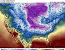
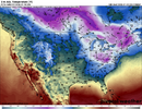
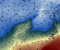
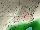
lol. Better wrap them pipes going to get down in the mid 20s. Maybe?Big change in Temperatures behind the system also between the 2 runs. First photo is 12Z. 2nd is 00Z.View attachment 158349View attachment 158350
I guess I have not learned anything? I thought if this system did indeed cut it would set up a better 50/50 and all of that jazz. So now this is bad? I understand for those wanting to cash in sooner but I thought in the long run this may allow a southern slider (Miller A) type setup?
- Joined
- Jan 2, 2017
- Messages
- 1,566
- Reaction score
- 4,279
06z GFS says first system is a Ukie soln, ice in NC mountains.
2nd system is a paste job!
2nd system is a paste job!
- Joined
- Jan 2, 2017
- Messages
- 1,566
- Reaction score
- 4,279
CNCsnwfan1210
Member

GFS still wants to bring front end mix/ice to northern NC very late Sunday night/Mon morning
Sent from my iPhone using Tapatalk
This is a classical Miller B track. Primary gets up into eastern KY,WVA and transfers to the coast.
We usually have a HP in the NE and thats our cold feed mechanisim. Not this time
Also this is how we really get screwed east of apps with the Classical Carolina Split. As the energy transfers from the primary to the coast, we get dryslotted east of the apps and receive about 75% less qpf than is getting advertised by models heading into an event.
Back when we use to have normal winters, I hated Miller B storms. We always had mixing issues and dry slots screwing with us everytime.
But in todays desperado winter wx starved world, a slop fest, dry slot Miller B,that only produces 1-2 hours onset excitement, is like a Filletmengion, as Metwannabe put it the other day.
Webberweather53
Meteorologist
Most of the concerns I've had about this system for the better part of the last week are starting to rear their head w/ this morning's model suites. Even though significant wintry weather will probably occur somewhere in NC, it's pretty unlikely we're in the core of this system & the predominant precipitation types will probably be ice &/or cold rain for those east of the mountains.
My concerns still are the lack of snow cover to the north to squash the baroclinic zone & lock the low-level cold in place w/ this in-situ type CAD and the lack of a strong surface high in the right position for a good, classic CAD event. We need to have an absolutely perfect look in the mid-levels to complement the lack of help we're getting in the low-levels. Even then, we still leave the door open for this to shift north as it pleases.
This is the kind of system we need to see near the tail end of an arctic outbreak, when the cold & snow pack is already very well established & locked in place. If this showed up for example in the 2nd week of January after our big cold shot, we would likely have a very different & more favorable outcome.
Nomanslandva
Member
Agree, same thing happens here. This is starting to look like an I64 north system that I have seen so many times. Weird how nice some of the 18Z solutions looked to have everything go bad overnight. Hoping for a south shift today. Getting a little to close to show time to expect huge changes beyond that.This is a classical Miller B track. Primary gets up into eastern KY,WVA and transfers to the coast.
We usually have a HP in the NE and thats our cold feed mechanisim. Not this time
Also this is how we really get screwed east of apps with the Classical Carolina Split. As the energy transfers from the primary to the coast, we get dryslotted east of the apps and receive about 75% less qpf than is getting advertised by models heading into an event.
Back when we use to have normal winters, I hated Miller B storms. We always had mixing issues and dry slots screwing with us everytime.
But in todays desperado winter wx starved world, a slop fest, dry slot Miller B,that only produces 1-2 hours onset excitement, is like a Filletmengion, as Metwannabe put it the other day.
Good luck and Happy New Year!
Agree with Webber, I called insitu wedge the other day. Just a reminder, not all winter storms are snow. It will be a race for i77 corridor to lock in a white ground before ice and cold rain overwhelms us all even Virginia imo. Certainly a moderate chance it looks white for Sparta, Mount Airy, West Jefferson, Boone and maybe Wilkesboro.
It would be nice to get a band of fgen precip well ahead of the parent low to lock in the insitu cad dome and potentially shove the miller B transfer south. Unfortunately as a whole that initial band is still leaking north and there are a lot of E to SE winds feeding toward the parent this leads to a race between retreating cold and incoming moisture. I would feel good if I was in the climo favored areas Roxboro, South Hill, just north of GSO and obviously Va but those of us to the south we need help
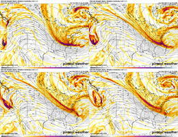
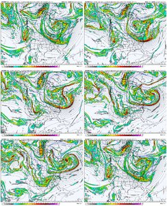
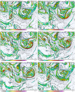
I think there is still time for changes with this one for a couple of reasons: 1) the energy still has about 60 or so hours before it moves onshore. We've seen even some off the wall runs such as from the ICON that dramatically change the entry point of it, which would certainly have downstream implications. 2) Even now, NWP are not uniform in how the wave is handled once it moves onshore. Quite a bit of energy is moving around, and if the wave were to stay positive tilt / more strung out for longer, that could result in a further south track. On the other hand, if it is able to get even more wound up, it would likely track even further north. So changes that may occur could be good or bad.


Blue_Ridge_Escarpment
Member
ICON a little more wedgey this run for NC CAD areas. Icon usually a little warm at 2m, so noteworthy.
It was a little faster with the low as well. Still a nice Virgina storm at this point.Kind a hard to take ICON seriously with it's run to run changes...well unless it snows hard at 12z.
View attachment 158400
It was a little faster with the low as well. Still a nice Virgina storm at this point.
You have to be really close on all the globals...what like 20 miles from 2-3"?
Right now it looks like areas east of the mountains and south of the NC/VA line are going to be shut out for the most part with this winter event. We will have to wait and see if any changes occur when the energy from the Pacific comes onshore and the models can sample that. This would be strike one if conditions do not change for many of us but with the cold air pouring in next week and threats on the horizon we will get more chances to knock that hanging curve ball into the deep seats.
LukeBarrette
im north of 90% of people on here so yeah
Meteorology Student
Member
2024 Supporter
2017-2023 Supporter
I feel like I’m solidly in 1-3 range here in Roanoke. One slight shift north and i’m out of it and one slight slight south and I’m in 4-8. Really curious how this storm trends as confluence tends to trend stronger right at the last second.
We need the wave to get here faster and stay weaker to have a better menu choice of items than currently listed.
Last nights runs, all Globals at 0z ,our vort was close to 10 mb+ stronger as it rolled through TN,KY. As someone said above post,that will just yank a SE wind off the ATL even more before transfer occurs.
Ill take whatever we can scrap out here. This is a Free Play Storm. So nothing to lose. The Jan8-10 deal is the big fish. You eitheir get nailed and remember what you love about winter or get zilch and start looking for the panic button on getting skunked again.
Ill take option 1 for $1000.We need the wave to get here faster and stay weaker to have a better menu choice of items than currently listed.
Last nights runs, all Globals at 0z ,our vort was close to 10 mb+ stronger as it rolled through TN,KY. As someone said above post,that will just yank a SE wind off the ATL even more before transfer occurs.
Ill take whatever we can scrap out here. This is a Free Play Storm. So nothing to lose. The Jan8-10 deal is the big fish. You eitheir get nailed and remember what you love about winter or get zilch and start looking for the panic button on getting skunked again.
Your in a great spot ( minus gurantee to stay all snow p type ,possibly).I feel like I’m solidly in 1-3 range here in Roanoke. One slight shift north and i’m out of it and one slight slight south and I’m in 4-8. Really curious how this storm trends as confluence tends to trend stronger right at the last second.
Frosty needs just a good 35 mile shift and he can do ok, still mix. I need 60-80 miles.
The 540 line on todays 12z GFs compared to yesterdays fabolous 12z run is a 100 miles futher north.
12z GFS was a little bit faster and farther north (than 6z) with the ptypes. Still shows some ice for northerns sections.

