LukeBarrette
im north of 90% of people on here so yeah
Meteorology Student
Member
2024 Supporter
2017-2023 Supporter
That’s a massive shift, perhaps it has some samples data…
That’s a massive shift, perhaps it has some samples data…
Yeah okay I’m not buying it entirely but that’s impressive
I mean, pretty similar? The weak little bubble High that developed wasn't really ever shown on the global models at this lead time.
View attachment 158748View attachment 158749
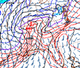
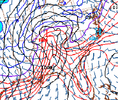
Yeah, the surface low is flirting with the idea of sliding under and around the mountains instead of the miller B'ish idea with a dry slot. Trending much colder at all levels too. One more jog south and the CAD regions and northern tier of NC counties are in the game to see some winter weather.Pesky little chunk of the 50-50 low over Quebec making things interesting again
This would break the streak for a lot of folks, so it shouldn't be shrugged off.6z euro said yes 40N View attachment 158976
Getting inside hi res range today so hopefully start seeing some consistency and positive consistency at thatLittle bit more of this pleaseView attachment 158978
I'm a little more into this than I want to be. Really want to see how the models start to resolve the leading fgen band I do think there's enough consistency that I'm probably out on a front end mixed hit but I think you look OK with that. If nothing else I'd take a front end rain to lock in the residual CAD dome and try to push the transfer farther south so that if the mid level features keep inching south I'm not trying to go from 60 to mid 30sGetting inside hi res range today so hopefully start seeing some consistency and positive consistency at that
It sure would be nice to have snow on the ground after not having any the past couple of years, no matter how little it is.6z euro said yes 40N View attachment 158976
Yeah, keeps getting a little better each run. Here the NAM for the last two runs. A little more CAD signature. We need the primary low to get squeezed south some.DPs keep trending down on the NAM as precip arrives which at very least bodes well for some onset ip/zr
View attachment 158993


What an awesome storm for the DC to PHL area...10-12"...NYC to BOS has to be pulling their hair out. We get some heavy rains for us...not all bad, with nice cold temps to follow.
View attachment 159005
View attachment 159004
Consolation prize, laying down snow pack up northI don't hate the mid-atlantic is getting a good hit. It's been a while for them too, so I'm glad somebody's getting a storm somewhat nearby on the east coast. At least we know it's still possible...lol.
This one is slowly sneaking back up on us. I thought we could write this one off for good. I guess it warrants some more tracking. Let's see if we can get a CAD event out of this.
This one is slowly sneaking back up on us. I thought we could write this one off for good. I guess it warrants some more tracking. Let's see if we can get a CAD event out of this.
If cad is involved there is usually a chance it out performs the models right up to when it starts falling, and often after that with a 4am cad surprise.This one is slowly sneaking back up on us. I thought we could write this one off for good. I guess it warrants some more tracking. Let's see if we can get a CAD event out of this.
