• Hello, please take a minute to check out our awesome content, contributed by the wonderful members of our community. We hope you'll add your own thoughts and opinions by making a free account!

Wintry 1/5-7 Winter Weather

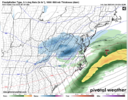
Rule of thumb when I make snow maps I heavily reduce accums by 80% from the southern edge of the dark blue hues and 3 counties north. Yes this is depressing but ip mixing and snow aloft melting often skews things so bad these models struggle with it in their output.
 
News being very eh here considering the hype... Mostly under 10 inches. Someone is gonna be wrong 🤣

Also I'm not driving to St Joseph anymore I'm just gonna stay by the international airport on the north side. I don't see the point in more driving when the roads aren't gonna clear up for awhile. It's already gonna be bad enough and whatever happens with mixing happens theres still gonna be a big heavy snow round whiteout conditions at some point during daylight Sunday. That's good enough
 
👀 👀 👀 The potential for blizzard conditions will increase Sunday morning
as colder air builds into the area, leading to higher/ drier snow
ratios and stronger winds. The HREF has fairly high probabilities
(~75%) of wind gusts exceeding 35 mph and visibility a quarter mile
or less. It`s quite possible an upgrade of the winter storm warning
to a blizzard warning will be needed as confidence in blizzard
conditions increases.
 
Models have trended worse up this way, except they still show a shot of a backside band as it moves out. Of note and strange to me, ABC11 in house model this morning was actually bullish up this way, front end and back end 🤷‍♂️
 
Models have trended worse up this way, except they still show a shot of a backside band as it moves out. Of note and strange to me, ABC11 in house model this morning was actually bullish up this way, front end and back end 🤷‍♂️
Yeah not buying it...
1000003239.jpg
 
I think the back end is gonna be our best shot. Major doubts about anything more than some novelty IP/RN mix here, chances always a bit better up your way
Agree, backside best chance not sure what local in-house models are seeing
 
.WINTER WEATHER ADVISORY REMAINS IN EFFECT FROM 7 AM SUNDAY TO 7 PM EST MONDAY...

TODAY
Sunny. Highs in the upper 30s. Northwest winds 5 to 10 mph. Gusts up to 35 mph, decreasing to 25 mph this afternoon.

TONIGHT
Mostly clear. Cold with lows in the lower 20s. West winds around 5 mph.

SUNDAY
Mostly sunny in the morning, then mostly cloudy with a chance of snow, rain, sleet and freezing rain in the afternoon. Little or no snow and sleet accumulation. Ice accumulation around a trace. Highs around 40. Light and variable winds, becoming south around 5 mph in the afternoon. Chance of precipitation 50 percent.

SUNDAY NIGHT
Freezing rain and rain likely in the evening, then freezing rain after midnight. Cold with lows in the upper 20s. Southeast winds around 5 mph. Chance of precipitation 90 percent.

MONDAY
Rain and freezing rain likely in the morning, then partly sunny with a chance of rain and snow in the afternoon. Little or no snow accumulation. Highs in the mid 40s. East winds around 5 mph, becoming west with gusts up to 30 mph in the afternoon. Chance of precipitation 70 percent.
 
Also looked like the 3k nam at end of it's run was about to get a nice little deform band going on the backside.
 
NAM vs HRRR at Richmond is worlds apart. @ILMRoss might be busy with this one.
my current occupation is not in operational forecasting these days, which thank goodness, because i would be working 12 hour shifts with this thing... one of these days i might start a blog/substack because i think the people yearn for a voice that's not wxrisk

but yeah, there's like 5 fail points, the southern shift in the models smells just a little fishy but at the same time the eps mean demands respect. verifying what's happening upstream will be critical. the opening frontogen band looks to clock us some but that will likely be narrow and mercurial in behavior. 0 to a quick 4 is in play with that. Most models have a complete grab bag insofar as both dry slot and thermals go for us, i've seen some like the hrrr give us a crack at all snow, while others authoritatively flip to rain. the only common thing seems to be backside snow showers which may be worth a half inch of fluff on the slop. i'm on richmond's northside so i feel pretty solid about my location, wheres places like downtown/the fan/manchester will be closer to the transition line

fortunately any bands of zr/sleet will probably be narrow, maybe only a county wide, and they will shift. not having a strong antecedent high pressure in place and no real cad i think helps keep the ptype forecast, less complicated than you think it should be.
 
Back
Top