-
Hello, please take a minute to check out our awesome content, contributed by the wonderful members of our community. We hope you'll add your own thoughts and opinions by making a free account!
You are using an out of date browser. It may not display this or other websites correctly.
You should upgrade or use an alternative browser.
You should upgrade or use an alternative browser.
Wintry 1/5-7 Winter Weather
- Thread starter SD
- Start date
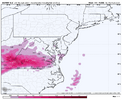
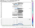
Maybe RDU will get some token flakes on the backside of this. It is better than getting totally shut out I guess. With the disappointing model trends today for the January 9-12 storm this would be a win for me.45/50 members with something on the back side
SWVAwxfan
Member
Boy. This is getting really interesting. We've even had some serious snow squalls here today. Put down a quick dusting.
LukeBarrette
im north of 90% of people on here so yeah
Meteorology Student
Member
2024 Supporter
2017-2023 Supporter
I wouldn’t get your hopes up here. Need the NAM onboard.Boy. This is getting really interesting. We've even had some serious snow squalls here today. Put down a quick dusting.
SWVAwxfan
Member
Not too concerned about the NAM atm
LukeBarrette
im north of 90% of people on here so yeah
Meteorology Student
Member
2024 Supporter
2017-2023 Supporter
I would be, it always nails WAANot too concerned about the NAM atm
SWVAwxfan
Member
I know it's pretty good sniffing out warm noses. A few more south shift would put that out of play.
rburrel2
Member
it's also always over-amped in the 60+hr range.I would be, it always nails WAA
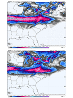
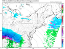
It don't much matter because you and I are NOT going to get in the snow.... #suxtothemaxLets see who wins...the GFS is 175-200 miles further north with the heaviest snow axis v/s the Euro at 60 hours out.
View attachment 159136
Bigedd09
Member
Brad P said storm could start out as sleet in piedmont
We live vicariously through model runs during the winter.It don't much matter because you and I are NOT going to get in the snow.... #suxtothemax
Nomanslandva
Member
NAM and GFS vs the others. Icon shifted a bit south at 18Z with qpf axis. I looked at it on Pivital. Roa gets 1.8 total qpf and only 2.8 is snow (kuchera). I hope the rest is sleet or some rain if that is even close to right. EC and CMC are lighter in total qpf but still higher than the NAM/GFS totals.
Ill make sure and run the generator a bit tomorrow!
Ill make sure and run the generator a bit tomorrow!
Nomanslandva
Member
That one band missed just to my SW. Bet that freaked some people out on I81.Boy. This is getting really interesting. We've even had some serious snow squalls here today. Put down a quick dusting.
LukeBarrette
im north of 90% of people on here so yeah
Meteorology Student
Member
2024 Supporter
2017-2023 Supporter
I purposely took US Route 11 back to Roanoke from Blacksburg to avoid what was probably a few accidents.That one band missed just to my SW. Bet that freaked some people out on I81.
These models are trying hard to develop a deform band as the LP departs and scrape N NC with it as it exits. I'll take my chances, since I'm missing all the sn/graupel showers this evening
Winter Storm Watches out near the Virginia-North Carolina state line northward. Likely be some sleet or something fun in places like Mount Airy just not the lions share 
packfan98
Moderator

JP152
Member
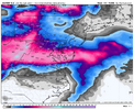
12-15 in Richmond would be awesome, and the rest of the Commonwealth does really well too. Should stick on the ground for a while too.Pretty crazy difference between gfs and euro. Here’s the new 18z euro. I know what our VA folks are rooting for.
It’s not a downgrade to go from Winter Storm Watch to winter weather advisory. Looks like that’s the route they are expanding on tomorrow due to Monday everyone going back to school and work.
SimeonNC
Member
Do you have access to ice maps from the 18z Euro?Pretty crazy difference between gfs and euro. Here’s the new 18z euro. I know what our VA folks are rooting for.
some arguing at the NWS level but I believe it’s prudent to alert young drivers and treat roads just in case. I know most snow weenies get heart broken when that watch gets issued then it goes to a trace of ice advisory. Lol
it’s not up and it’s not sideways. What else would you call it?It’s not a downgrade to go from Winter Storm Watch to winter weather advisory. Looks like that’s the route they are expanding on tomorrow due to Monday everyone going back to school and work.
technically it’s considered an upgrade at the NWS level. But in the public it confuses everyone. And tv Mets confuse the issue further by saying downgrade occasionallyit’s not up and it’s not sideways. What else would you call it?
LukeBarrette
im north of 90% of people on here so yeah
Meteorology Student
Member
2024 Supporter
2017-2023 Supporter
Don’t think this will happen but man that would be awesomePretty crazy difference between gfs and euro. Here’s the new 18z euro. I know what our VA folks are rooting for.
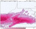
Also not sure the site you are using resolves multiple precip types well because these images do not sync up. 1 inch of freezing rain would also be catastrophic
Last edited:
packfan98
Moderator
Brent
Member
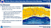
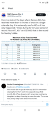
Good luck up there!Im in Kansas City and it's questionable when I'll be able to go homeView attachment 159178
Drizzle Snizzle
Member
Are you near downtown ?Im in Kansas City and it's questionable when I'll be able to go homeView attachment 159178
Brent
Member
Are you near downtown ?
Nah I'm just passing through the west side tonight to go St Joseph tomorrow
Drizzle Snizzle
Member
When's the last time you experienced a foot of snowfall outside of the mountains ?Nah I'm just passing through the west side tonight to go St Joseph tomorrow
Brent
Member
When's the last time you experienced a foot of snowfall outside of the mountains ?
Never?
I don't even think 93 was that bad where we were
- Joined
- Jan 23, 2021
- Messages
- 4,602
- Reaction score
- 15,197
- Location
- Lebanon Township, Durham County NC
Xlhunter3
Member
LukeBarrette
im north of 90% of people on here so yeah
Meteorology Student
Member
2024 Supporter
2017-2023 Supporter
Nomanslandva
Member
Yea, I am just saying I do not like that ZR crap!
SimeonNC
Member
Brent
Member
- Joined
- Jan 23, 2021
- Messages
- 4,602
- Reaction score
- 15,197
- Location
- Lebanon Township, Durham County NC
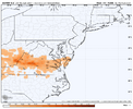
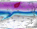
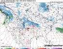
Welcome aboard. What part of town are you in? I know we have folks on the south side and I believe someone off Latta/Snow Hill. We’re over between Umstead and st MarysFirst post here. Yay! Anyways, it definitely looks more interesting on Monday with potential back snow here in Durham and the Northern counties of NC from what the Euro/EPS is showing. Wondering if more models will start to show it.
View attachment 159193

