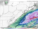
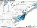
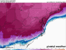
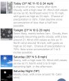
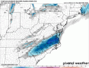
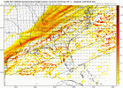
Allan Huffman’s final forecast:
-
Hello, please take a minute to check out our awesome content, contributed by the wonderful members of our community. We hope you'll add your own thoughts and opinions by making a free account!
You are using an out of date browser. It may not display this or other websites correctly.
You should upgrade or use an alternative browser.
You should upgrade or use an alternative browser.
Wintry 1/20 - 1/23 Winter Storm
- Thread starter packfan98
- Start date
Yeah, hopefully as with a lot of similar setups, the models underdo the NW side of the precip and we have more wiggle room than the models suggest. But someone’s going to be on the wrong side of that line, regardless.Very sharp cutoff, w/nw, going to be somebody that can smell the snow and get nothing.... very little wiggle room
packfan98
Moderator
You guys in Wake county must be living right. You jackpot on the run right before game time! Here's the 3k NAM.


Allan Huffman’s final forecast:
I know this may be weenie but I just don’t see how after 8+ hours of snowing in the mid 20s .. especially after the small returns giving us that snow last night we’re impressive .. that we end up with 2 inches … this is screaming over preformed but we will see
Another thing to keep in mind is how many times do you get forecasted a quarter inch of rain and instead you get a half inch? Well, that’s the difference between 2-3” of snow and 5-6” of snow with a snowstorm, where a normally small and irrelevant difference suddenly is a big deal. Of course, it also often goes the other way where a half inch of rain forecasted ends up being a quarter inch…This is what makes forecasting snow hard. These differences don’t really matter with rainfall.
Much rather be in the jackpot 12 hours out and by a hires model .. I remember when it showed 0 for us yesterday or two days agoYou guys in Wake county must be living right. You jackpot on the run right before game time! Here's the 3k NAM.

3k don't let me down now haha. Really nice increase on that run, it's almost nowcast time, I feel really good about where we are. Again look at WV, look at downstream obs/radar, etc, things are on schedule and a touch better than modeled.


Going to be honest the one thing I've been kind of meh on with this storm is rates, half inch an hour for 8 hours for 4 inches feels really sane and reasonable. I think the biggest area for a bust is definitely when the precip starts... if flakes start in the triangle at 2 or something by some miracle then time to readjustI know this may be weenie but I just don’t see how after 8+ hours of snowing in the mid 20s .. especially after the small returns giving us that snow last night we’re impressive .. that we end up with 2 inches … this is screaming over preformed but we will see
Allan Huffman’s final forecast:
How 'bout that F zone? That's a trick to draw. On the worry some side zone E looks bad for power hits.
packfan98
Moderator
Hypsometric
Member
RAH with a 12 hour window of opportunity
weatherfide
Member
- Joined
- Jan 5, 2017
- Messages
- 3,212
- Reaction score
- 4,774
It's the coldest drizzle ever here. 33 degrees.
Latest hrrr looking great
I just feel like some more mesoscale banding could show up and bring enhancements to some of those rates … i dont know i Just feel like we can produce more than 2-4 in areas that see those banding featuresGoing to be honest the one thing I've been kind of meh on with this storm is rates, half inch an hour for 8 hours for 4 inches feels really sane and reasonable. I think the biggest area for a bust is definitely when the precip starts... if flakes start in the triangle at 2 or something by some miracle then time to readjust
packfan98
Moderator
The indicator for a good winter storm is to make sure the grass clippings are all covered by the end of it! That’s my benchmark3k don't let me down now haha. Really nice increase on that run, it's almost nowcast time, I feel really good about where we are. Again look at WV, look at downstream obs/radar, etc, things are on schedule and a touch better than modeled.

Hypsometric
Member
I really think the ratios are not being considered enough west of 95. If that zone gets .4 QPF, that should equate to 5-6" of snow.I just feel like some more mesoscale banding could show up and bring enhancements to some of those rates … i dont know i Just feel like we can produce more than 2-4 in areas that see those banding features
