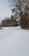
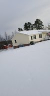
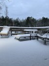
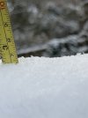
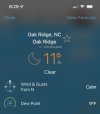
Re measured 2 on the dot on a flat surface
-
Hello, please take a minute to check out our awesome content, contributed by the wonderful members of our community. We hope you'll add your own thoughts and opinions by making a free account!
You are using an out of date browser. It may not display this or other websites correctly.
You should upgrade or use an alternative browser.
You should upgrade or use an alternative browser.
Wintry 1/20 - 1/23 Winter Storm
- Thread starter packfan98
- Start date
When was the last time you had this much snow?
2018 before that 2015When was the last time you had this much snow?
WinterWishes
Member
Scooter
Member
Finished with 1” in northern Davidson County just south of High Point. Second time grounds been covered in a week! Let’s do it again next weekend
Shaggy
Member
We've been at32 or below now since the 12:15am obs on the 21st so pushing 36 hours at or bow freezing and we will struggle to break 32 today.
Oh total snow measurement was 3.3
Yogi803
Member
Fountainguy97
Member
For 2-3 hrs last night between say 1-4am it absolutely dumped....we just need to learn how to do that for more than a few hrs every storm again.....looks like a general 4-5" total, powdery dry snow so it drifted a bit even so a few places 6-8" deep....
Warms my East NC heart seeing all the snow pictures on my Facebook feed
We haven't had a nice stalling system in forever it feels like. Everything is so progressive the best you can do is 6-8hrs of decent snow. Even here the systems themselves are lightning quick. It's just the NW flow that prolongs things.
pcbjr
Member
BelmontWX79
Member
Anyone else here Cocorahs members? Had 1.8in of snow out of .12 liquid. Made for a decent 15:1 ratio.
Downeastnc
Member
We haven't had a nice stalling system in forever it feels like. Everything is so progressive the best you can do is 6-8hrs of decent snow. Even here the systems themselves are lightning quick. It's just the NW flow that prolongs things.
Yeah I was loving the band we were in but had to keep zooming in to keep that western edge off my phone screen so I wouldnt get so sad by how fast it was coming......
Blane20181990
Member
NBAcentel
Member
Blane20181990
Member
I've been a lurker for awhile! Awesome site thanks for all the info and forecasting during these storms fellas!
My measurements showed an average snow depth of 3.6 inches in my front yard and 2.8 on the cement driveway and sidewalk. This storm did not disappoint as others have in recent memory. This would be a good snow for skiing, it is the classic powder that they make at the resorts.
The temperature is 22.3 degrees.
The temperature is 22.3 degrees.
Shaggy
Member
Cloud cover rolling back In is gonna preserve this snow and prevent too much warming today. Might not break 30
Congratulations to all that got snow, beautiful pictures!!!
I got just a light dusting last night but temp dropped to 13.6 this morning.
Sent from my iPhone using Tapatalk
I got just a light dusting last night but temp dropped to 13.6 this morning.
Sent from my iPhone using Tapatalk
PDubRDU
Member
BHS1975
Member
4" of pure powder here 
Sent from my iPhone using Tapatalk

Sent from my iPhone using Tapatalk
I hope so if you never hear from me again it was the power plant melting down and not snowWait, what's this? That isn't legit is it lolView attachment 109631
Oh yeah that's close to Shearon Harris isn't it? Oh boyI hope so if you never hear from me again it was the power plant melting down and not snow
norcarolinian
Member
How'd you get your cat to walk on the ceiling?!Maybe an inch and a half in Greensboro proper, Lindley Park area. Beautiful and cold this morning! Pic from last night. It’s Quattro season. Max was not happy this morning.
View attachment 109625
View attachment 109626
tazaroo
Member
Wonder how long these glorious sun blocking snow preserving clouds will be around
snowlover91
Member
5" here in the Elm City area, submitted report to the NWS. Drifts 12-15" up around the house and cars. Impressive storm with snow from 6pm Friday till about 5am today.
You’re in East Durham, right? Sounds like a solid differential across the city east-to-west!Averaged just under 4" in a bunch of spots in the yard. This was a fleeting moment that we got the dog to sit still.
View attachment 109585
VegasEagle
Member
Is that a Carolina dog?Averaged just under 4" in a bunch of spots in the yard. This was a fleeting moment that we got the dog to sit still.
View attachment 109585
Clear skies here so incomingWonder how long these glorious sun blocking snow preserving clouds will be around


